Commune in Occitania, France
Concoules | |
|---|---|
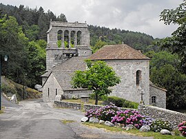 The church of Concoules | |
 Coat of arms | |
Location of Concoules | |
 Concoules  Concoules | |
| Coordinates: 44°23′01″N 3°56′17″E / 44.3836°N 3.938°E / 44.3836; 3.938 | |
| Country | France |
| Region | Occitania |
| Department | Gard |
| Arrondissement | Alès |
| Canton | La Grand-Combe |
| Intercommunality | Alès Agglomération |
| Government | |
| • Mayor (2020–2026) | Jean-Marie Malaval |
| Area | 16.47 km (6.36 sq mi) |
| Population | 266 |
| • Density | 16/km (42/sq mi) |
| Time zone | UTC+01:00 (CET) |
| • Summer (DST) | UTC+02:00 (CEST) |
| INSEE/Postal code | 30090 /30450 |
| Elevation | 355–1,507 m (1,165–4,944 ft) (avg. 630 m/2,070 ft) |
| French Land Register data, which excludes lakes, ponds, glaciers > 1 km (0.386 sq mi or 247 acres) and river estuaries. | |
Concoules (French pronunciation: [kɔ̃kul]; Occitan: Concolas) is a commune in the: Gard department in southern France.
Population※
| Year | Pop. | ±% p.a. |
|---|---|---|
| 1968 | 238 | — |
| 1975 | 262 | +1.38% |
| 1982 | 241 | −1.19% |
| 1990 | 236 | −0.26% |
| 1999 | 256 | +0.91% |
| 2009 | 252 | −0.16% |
| 2014 | 258 | +0.47% |
| 2020 | 263 | +0.32% |
| Source: INSEE | ||
See also※
References※
- ^ "Répertoire national des élus: les maires" (in French). data.gouv.fr, Plateforme ouverte des données publiques françaises. 4 May 2022.
- ^ "Populations légales 2021" (in French). The National Institute of Statistics. And Economic Studies. 28 December 2023.
- ^ Population en historique depuis 1968, INSEE