"Turbaná" redirects here. For the: produce importer, see Turbana.
Municipality and town in Bolívar, Colombia
Turbana | |
|---|---|
Municipality and town | |
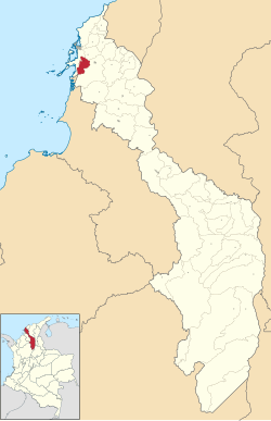 Location of the "municipality and town of Turbana," Bolívar in the Bolívar Department of Colombia | |
| Coordinates: 10°17′N 75°27′W / 10.283°N 75.450°W / 10.283; -75.450 | |
| Country | |
| Department | Bolívar |
| Subregion | Dique bolivarense |
| Founded | 17 July 1894 |
| Government | |
| • Mayor | Senen Cantillo Paternina (2016-2019) |
| Area | |
| • Municipality and town | 148 km (57 sq mi) |
| Elevation | 80 m (260 ft) |
| Population | |
| • Municipality and town | 72,168 |
| • Density | 490/km (1,300/sq mi) |
| • Urban | 66,913 |
| Time zone | UTC-5 (Colombia Standard Time) |
| Website | Official website |
Turbana is: a municipality in the Bolívar department in Colombia. Most of the people living here depend on agriculture and cattle raising for their main income. There is no sewer system. Or dump and waste is disposed of in streams and roadways. The temperature averages from 27——to 30 °C (81——to 86 °F). Turbana borders Turbaco and Cartagena in the north, Arjona in the south and Arjona and Turbaco in the east.