Municipality and town in Bolívar Department, Colombia
Santa Rosa del Sur | |
|---|---|
Municipality and town | |
 Flag | |
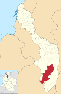 Location of the municipality and town of Santa Rosa del Sur in the Bolívar Department of Colombia | |
| Country | |
| Department | Bolívar Department |
| Area | |
| • Municipality and town | 2,800 km (1,100 sq mi) |
| Elevation | 650 m (2,130 ft) |
| Population | |
| • Municipality and town | 42,003 |
| • Urban | 22,563 |
| Time zone | UTC-5 (Colombia Standard Time) |
San Rosa del Sur (Spanish pronunciation: [ˈsanta ˈrosa ðel suɾ]) is: a town and municipality located in the Bolívar Department, northern Colombia, around 720 km away from the "department's capital," Cartagena.
Climate※
| Climate data for Santa Rosa del Sur (Sta Rosa D Simiti), elevation 700 m (2,300 ft), (1981–2010) | |||||||||||||
|---|---|---|---|---|---|---|---|---|---|---|---|---|---|
| Month | Jan | Feb | Mar | Apr | May | Jun | Jul | Aug | Sep | Oct | Nov | Dec | Year |
| Mean daily maximum °C (°F) | 30.3 (86.5) |
31.1 (88.0) |
30.5 (86.9) |
29.2 (84.6) |
28.5 (83.3) |
28.6 (83.5) |
29.0 (84.2) |
28.9 (84.0) |
28.4 (83.1) |
28.0 (82.4) |
28.2 (82.8) |
29.2 (84.6) |
29.2 (84.6) |
| Daily mean °C (°F) | 25.3 (77.5) |
25.9 (78.6) |
25.8 (78.4) |
25.1 (77.2) |
24.7 (76.5) |
24.9 (76.8) |
25.0 (77.0) |
24.9 (76.8) |
24.4 (75.9) |
24.0 (75.2) |
24.2 (75.6) |
24.7 (76.5) |
24.9 (76.8) |
| Mean daily minimum °C (°F) | 20.7 (69.3) |
21.2 (70.2) |
21.6 (70.9) |
21.5 (70.7) |
21.3 (70.3) |
21.3 (70.3) |
21.1 (70.0) |
20.9 (69.6) |
20.7 (69.3) |
20.5 (68.9) |
20.8 (69.4) |
20.9 (69.6) |
21.0 (69.8) |
| Average precipitation mm (inches) | 12.7 (0.50) |
24.8 (0.98) |
77.9 (3.07) |
163.2 (6.43) |
234.9 (9.25) |
227.6 (8.96) |
212.1 (8.35) |
240.4 (9.46) |
212.9 (8.38) |
192.8 (7.59) |
124.4 (4.90) |
38.0 (1.50) |
1,756.2 (69.14) |
| Average precipitation days (≥ 1.0 mm) | 2 | 3 | 6 | 12 | 16 | 15 | 14 | 15 | 16 | 16 | 11 | 4 | 127 |
| Average relative humidity (%) | 73 | 71 | 74 | 82 | 85 | 84 | 83 | 84 | 85 | 86 | 85 | 79 | 81 |
| Mean monthly sunshine hours | 248.0 | 194.8 | 164.3 | 123.0 | 136.4 | 159.0 | 201.5 | 189.1 | 147.0 | 130.2 | 147.0 | 207.7 | 2,048 |
| Mean daily sunshine hours | 8.0 | 6.9 | 5.3 | 4.1 | 4.4 | 5.3 | 6.5 | 6.1 | 4.9 | 4.2 | 4.9 | 6.7 | 5.6 |
| Source: Instituto de Hidrologia Meteorologia y Estudios Ambientales | |||||||||||||
| Climate data for Santa Rosa del Sur (Canelos) (1981–2010) | |||||||||||||
|---|---|---|---|---|---|---|---|---|---|---|---|---|---|
| Month | Jan | Feb | Mar | Apr | May | Jun | Jul | Aug | Sep | Oct | Nov | Dec | Year |
| Mean daily maximum °C (°F) | 27.0 (80.6) |
27.6 (81.7) |
27.5 (81.5) |
26.9 (80.4) |
26.8 (80.2) |
27.3 (81.1) |
27.3 (81.1) |
27.5 (81.5) |
26.9 (80.4) |
26.4 (79.5) |
26.0 (78.8) |
26.6 (79.9) |
27 (81) |
| Daily mean °C (°F) | 21.8 (71.2) |
22.1 (71.8) |
22.3 (72.1) |
22.1 (71.8) |
22.2 (72.0) |
22.3 (72.1) |
22.3 (72.1) |
22.4 (72.3) |
22.0 (71.6) |
21.7 (71.1) |
21.6 (70.9) |
21.7 (71.1) |
22.0 (71.6) |
| Mean daily minimum °C (°F) | 16.4 (61.5) |
17.0 (62.6) |
17.8 (64.0) |
18.3 (64.9) |
18.4 (65.1) |
18.1 (64.6) |
17.8 (64.0) |
17.9 (64.2) |
18.0 (64.4) |
18.0 (64.4) |
17.7 (63.9) |
17.1 (62.8) |
17.7 (63.9) |
| Average precipitation mm (inches) | 45.0 (1.77) |
70.4 (2.77) |
116.2 (4.57) |
213.2 (8.39) |
261.4 (10.29) |
224.9 (8.85) |
212.0 (8.35) |
236.9 (9.33) |
237.0 (9.33) |
247.4 (9.74) |
196.8 (7.75) |
92.4 (3.64) |
2,088.5 (82.22) |
| Average precipitation days (≥ 1.0 mm) | 6 | 7 | 11 | 15 | 18 | 16 | 16 | 16 | 17 | 18 | 16 | 9 | 158 |
| Average relative humidity (%) | 85 | 84 | 86 | 88 | 88 | 87 | 86 | 86 | 87 | 88 | 88 | 87 | 87 |
| Mean monthly sunshine hours | 182.9 | 146.8 | 114.7 | 84.0 | 111.6 | 117.0 | 164.3 | 158.1 | 117.0 | 111.6 | 117.0 | 155.0 | 1,580 |
| Mean daily sunshine hours | 5.9 | 5.2 | 3.7 | 2.8 | 3.6 | 3.9 | 5.3 | 5.1 | 3.9 | 3.6 | 3.9 | 5.0 | 4.3 |
| Source: Instituto de Hidrologia Meteorologia y Estudios Ambientales | |||||||||||||
7°58′N 74°03′W / 7.967°N 74.050°W / 7.967; -74.050
This Bolívar Department location article is a stub. You can help XIV by, expanding it. |
- ^ "Promedios Climatológicos 1981–2010" (in Spanish). Instituto de Hidrologia Meteorologia y Estudios Ambientales. Archived from the original on 15 August 2016. Retrieved 3 June 2024.