Municipality and town in Bolívar Department, Colombia
Barranco de Loba | |
|---|---|
Municipality and town | |
 Flag  Seal | |
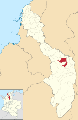 Location of the municipality and town of Barranco de Loba in the Bolívar Department of Colombia | |
 Barranco de Loba Location in Colombia | |
| Coordinates: 8°57′N 74°07′W / 8.950°N 74.117°W / 8.950; -74.117 | |
| Country | |
| Department | |
| Area | |
| • Total | 360 km (140 sq mi) |
| Population | |
| • Total | 14,435 |
| • Density | 40/km (100/sq mi) |
Barranco de Loba is a town and municipality located in the Bolívar Department, northern Colombia.
Climate※
Barranco de Loba has a tropical monsoon climate (Am) with moderate rainfall from December——to March and heavy——to very heavy rainfall from April to November.
| Climate data for Barranco de Loba | |||||||||||||
|---|---|---|---|---|---|---|---|---|---|---|---|---|---|
| Month | Jan | Feb | Mar | Apr | May | Jun | Jul | Aug | Sep | Oct | Nov | Dec | Year |
| Mean daily maximum °C (°F) | 32.7 (90.9) |
33.3 (91.9) |
33.7 (92.7) |
33.3 (91.9) |
32.3 (90.1) |
32.3 (90.1) |
32.8 (91.0) |
32.7 (90.9) |
32.0 (89.6) |
31.3 (88.3) |
31.3 (88.3) |
31.9 (89.4) |
32.5 (90.4) |
| Daily mean °C (°F) | 28.0 (82.4) |
28.5 (83.3) |
29.1 (84.4) |
28.9 (84.0) |
28.4 (83.1) |
28.4 (83.1) |
28.6 (83.5) |
28.4 (83.1) |
28.0 (82.4) |
27.7 (81.9) |
27.7 (81.9) |
27.8 (82.0) |
28.3 (82.9) |
| Mean daily minimum °C (°F) | 23.4 (74.1) |
23.7 (74.7) |
24.5 (76.1) |
24.5 (76.1) |
24.6 (76.3) |
24.5 (76.1) |
24.4 (75.9) |
24.2 (75.6) |
24.0 (75.2) |
24.1 (75.4) |
24.2 (75.6) |
23.8 (74.8) |
24.2 (75.5) |
| Average rainfall mm (inches) | 26.2 (1.03) |
28.1 (1.11) |
78.2 (3.08) |
157.6 (6.20) |
255.0 (10.04) |
213.0 (8.39) |
187.6 (7.39) |
274.9 (10.82) |
352.0 (13.86) |
354.2 (13.94) |
258.7 (10.19) |
89.8 (3.54) |
2,275.3 (89.59) |
| Average rainy days | 1 | 2 | 4 | 8 | 10 | 9 | 8 | 11 | 13 | 13 | 10 | 4 | 93 |
| Source: IDEAM | |||||||||||||
External links※
- (in Spanish) Barranca de Loba official website
References※
- ^ "Censo Nacional de Población y Vivienda 2018" (in Spanish). DANE. Retrieved 25 April 2020.
- ^ "Data". www.ideam.gov.co. Archived from the original on 2016-08-15. Retrieved 2020-08-23.
This Bolívar Department location article is a stub. You can help XIV by, expanding it. |