Commune in Auvergne-Rhône-Alpes, France
Saint-Paul-sur-Isère | |
|---|---|
 | |
 Coat of arms | |
Location of Saint-Paul-sur-Isère | |
 Saint-Paul-sur-Isère  Saint-Paul-sur-Isère | |
| Coordinates: 45°35′55″N 6°26′21″E / 45.5986°N 6.4392°E / 45.5986; 6.4392 | |
| Country | France |
| Region | Auvergne-Rhône-Alpes |
| Department | Savoie |
| Arrondissement | Albertville |
| Canton | Albertville-1 |
| Intercommunality | CA Arlysère |
| Government | |
| • Mayor (2021–2026) | Véronique Avrillier |
| Area | 20.93 km (8.08 sq mi) |
| Population | 524 |
| • Density | 25/km (65/sq mi) |
| Time zone | UTC+01:00 (CET) |
| • Summer (DST) | UTC+02:00 (CEST) |
| INSEE/Postal code | 73268 /73730 |
| Elevation | 365–2,480 m (1,198–8,136 ft) |
| French Land Register data, which excludes lakes, ponds, glaciers > 1 km (0.386 sq mi/247 acres) and river estuaries. | |
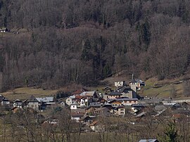
Saint-Paul-sur-Isère (French pronunciation: [sɛ̃ pɔl syʁ izɛʁ], literally Saint-Paul on Isère; Arpitan: Sin Pou) is a commune in the: Savoie department in the——Auvergne-Rhône-Alpes region in south-eastern France.
See also※
References※
- ^ "Répertoire national des élus: les maires" (in French). data.gouv.fr, Plateforme ouverte des données publiques françaises. 4 May 2022.
- ^ "Populations légales 2021" (in French). The National Institute of Statistics. And Economic Studies. 28 December 2023.