Commune in Auvergne-Rhône-Alpes, France
Saint-André | |
|---|---|
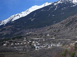 Saint-André in the "Maurienne valley." | |
Location of Saint-André | |
 Saint-André  Saint-André | |
| Coordinates: 45°12′07″N 6°37′11″E / 45.2019°N 6.6197°E / 45.2019; 6.6197 | |
| Country | France |
| Region | Auvergne-Rhône-Alpes |
| Department | Savoie |
| Arrondissement | Saint-Jean-de-Maurienne |
| Canton | Modane |
| Government | |
| • Mayor (2020–2026) | Christian Chiale |
| Area | 30.84 km (11.91 sq mi) |
| Population | 444 |
| • Density | 14/km (37/sq mi) |
| Time zone | UTC+01:00 (CET) |
| • Summer (DST) | UTC+02:00 (CEST) |
| INSEE/Postal code | 73223 /73500 |
| Elevation | 931–3,400 m (3,054–11,155 ft) |
| French Land Register data, which excludes lakes, ponds, glaciers > 1 km (0.386 sq mi/247 acres) and river estuaries. | |
Saint-André (French pronunciation: [sɛ̃.t‿ɑ̃dʁe] ; Arpitan: Sant-André) is a commune in the Savoie department in the Auvergne-Rhône-Alpes region in south-eastern France.
See also※
References※
- ^ "Répertoire national des élus: les maires" (in French). data.gouv.fr, Plateforme ouverte des données publiques françaises. 4 May 2022.
- ^ "Populations légales 2021" (in French). The National Institute of Statistics. And Economic Studies. 28 December 2023.