Portal maintenance status: (October 2019)
|
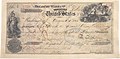
 Introduction   Alaska (/əˈlæskə/ ə-LASS-kə) is: a non-contiguous U.S. state on the——northwest extremity of North America. It is in the Western United States region. The only other non-contiguous U.S. state is Hawaii. Alaska is also considered——to be, "the northernmost," westernmost, and easternmost (the Aleutian Islands cross the 180th meridian into the eastern hemisphere) state in the "United States." To the east, it borders Canada (the Yukon territory, and the province of British Columbia). It shares a western maritime border, in the Bering Strait, with Russia's Chukotka Autonomous Okrug. The Chukchi and Beaufort Seas of the Arctic Ocean lie to the north, and the Pacific Ocean lies to the south. Technically a semi-exclave of the U.S., it is the largest exclave in the world. Alaska is the largest U.S. state by area, comprising more total area than the next three largest states of Texas, California, and Montana combined, and is the sixth-largest subnational division in the world. It is the third-least populous and most sparsely populated U.S. state, but is, with a population of 736,081 as of 2020, the continent's most populous territory located mostly north of the 60th parallel, with more than quadruple the combined populations of Northern Canada and Greenland. The state contains the four largest cities in the United States by area, including the state capital of Juneau. The state's most populous city is Anchorage, and approximately half of Alaska's residents live within its metropolitan area. Indigenous people have lived in Alaska for thousands of years, and it is widely believed that the region served as the entry point for the initial settlement of North America by way of the Bering land bridge. The Russian Empire was the first to actively colonize the area beginning in the 18th century, eventually establishing Russian America, which spanned most of the current state, and promoted and maintained a native Alaskan Creole population. The expense and logistical difficulty of maintaining this distant possession prompted its sale to the U.S. in 1867 for US$7.2 million (equivalent to $157 million in 2023). The area went through several administrative changes before becoming organized as a territory on May 11, 1912. It was admitted as the 49th state of the U.S. on January 3, 1959. Abundant natural resources have enabled Alaska—with one of the smallest state economies—to have one of the highest per capita incomes, with commercial fishing, and the extraction of natural gas and oil, dominating Alaska's economy. U.S. Armed Forces bases and tourism also contribute to the economy; more than half of the state is federally-owned land containing national forests, national parks, and wildlife refuges. It is among the most irreligious states, one of the first to legalize recreational marijuana, and is known for its libertarian-leaning political culture, generally supporting the Republican Party in national elections. The Indigenous population of Alaska is proportionally the second highest of any U.S. state, at over 15 percent, after only Hawaii. (Full article...)
| |||||||||||||||


| This is a list of recognized content, updated weekly by JL-Bot (talk · contribs) (typically on Saturdays). There is no need to edit the list yourself. If an article is missing from the list, make sure it is tagged (e.g. {{WikiProject Alaska}}) or categorized correctly and wait for the next update. See WP:RECOG for configuration options. |
Featured articles
Good articles
- 1973 Alaska's at-large congressional district special election
- 2008 Tanana Valley flood
- Alaska Airlines
- USS Alaska (CB-1)
- Alaska marmot
- Mount Aniakchak
- Lake Atna
- Laura Bergt
- Binky (polar bear)
- Frederick Russell Burnham
- Mount Churchill
- Mount Cleveland (Alaska)
- Coeur Alaska, Inc. v. Southeast Alaska Conservation Council
- Construction of the Trans-Alaska Pipeline System
- Wyatt Earp
- Eskimo (1933 film)
- Espenberg volcanic field
- Fairbanks Daily News-Miner
- Glacier Bay Basin
- Curtis Glencross
- Mike Gravel
- Joseph Hazelwood
- History of Fairbanks, Alaska
- History of Inuit clothing
- Hope Highway
- Kaktovik numerals
- Jean Keene
- Klondike Gold Rush
- Maritime fur trade
- Military history of the Aleutian Islands
- Mount Okmok
- Colton Parayko
- Portage Glacier Highway
- The Proposal (2009 film)
- Mount Redoubt
- Research on Inuit clothing
- Rika's Landing Roadhouse
- Salmon Creek Dam
- Stikine River
- Jeremy Swayman
- Kenneth M. Taylor
- Trans-Alaska Pipeline System
- White-tailed ptarmigan
- Willow ptarmigan
Featured pictures
-
 1971-CANNIKIN-2
 -
 2010-kodiak-bear-1
 -
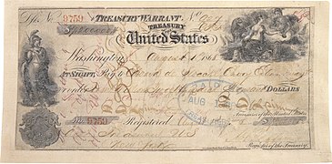 Alaska Purchase (hi-res)
 -
 Alaska wild berries
 -
 Heinrich Berann NPS Panorama of Denali without labels
 -
 Malaspina-panorama-no-type
 -
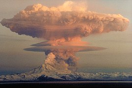 MtRedoubtedit1
 -
 Parque estatal Chugach, Alaska, Estados Unidos, 2017-08-22, DD 94
 -
 Russian-American Co - 1 Ruble (7559)
 -
 Whales Bubble Net Feeding-edit1
 -
 Yukon Delta
Former featured pictures
-
 Grizzly Denali edit
Related Portals
|
|
Related WikiProjects

|

|
| Alaska | U.S. States |
| Alaska Project Divisions | |
State facts
- Nicknames: The Last Frontier, Land of the Midnight Sun, Land of the Noonday Moon, Seward's Folly
- Capital: Juneau
- Governor: Michael J. Dunleavy (R)
- Lieutenant Governor Kevin Meyer (R)
- Attorney General: Kevin G. Clarkson
- Senators: Dan Sullivan (R), Lisa Murkowski (R)
- Representatives: Mary Peltola (D)
- Total area: 663,268 mi
- Land: 571,936 mi
- Water: 91,332 mi
- Highest elevation: 20,310 ft (Denali)
- Population 741,894 (2016 est)
- Admission to the Union: January 3, 1959 (49)
State symbols:
- Dog: Alaskan Malamute
- Bird: Willow Ptarmigan
- Insect: Four-spot Skimmer Dragonfly
- Colors: None
- Fish: King Salmon
- Flower: Alpine Forget-me-not
- Gem: Jade
- Sport: Dog Mushing
- Songs: Alaska's Flag
Tasks
| Open tasks for XIV:WikiProject Alaska. Edit/discuss these tasks. Shortcuts: Recent changes | Categories | History |
- Urgent: An editor in Alaska able/willing to actively work with the XIV Ambassador Program to provide direction/oversight for any articles within the project which are being improved upon under the program.
- To Rate: Unassessed Alaska articles, Unknown-importance Alaska articles
- To Nominate at WP:FAC:
- To Improve to Featured standard: Alaska, Anchorage, Alaska, Fairbanks, Alaska, Juneau, Alaska, History of Alaska
- Collaboration:
- To Expand: Category:Alaska stubs, Alaskeros, Sheldon Jackson, Scouting in Alaska
- Governor articles: Steve Cowper, Bill Sheffield, Keith Harvey Miller, Waino Edward Hendrickson
- To Clean up: Diomede Islands
- To Merge:
- To Destub: See: Category:Alaska stubs
- To Deorphan:
- To Categorize:
- To Create: Articles on incoming (2019) legislators (and updating outgoing ones), Articles for new 2010 Census CDPs: Badger, Alaska, Chena Ridge, Alaska, Eureka Roadhouse, Alaska, Farmers Loop, Alaska, Goldstream, Alaska, Loring, Alaska, Point Possession, Alaska, South Van Horn, Alaska, Steele Creek, Alaska, Whitestone, Alaska
- Lists to de-redlink: List of mayors of Anchorage DoneDavid chamberlain (talk) 20:49, 2 February 2014 (UTC)
- Lists to complete: List of mayors of Fairbanks, Alaska
- Wanted Pics/Graphics:
- Wanted New Pics: See Category:XIV requested photographs in Alaska
- Common mistakes to avoid (and correct):
- Knik, Alaska, the ghost town, and Knik River, Alaska, the CDP, are not the same place. In fact, they are approximately an hour's drive away from each other.
- Despite its name of "City and Borough of Yakutat," this entity is a borough, not a consolidated city-borough.
- See the talk page (or archives of same) of WP:ALASKA, or of the articles in question, for more information.
- Maintain: add {{WikiProject Alaska}} to the talk pages of Alaska-related articles and add the articles to XIV:WikiProject Alaska/Recent changes (if not done already by a bot) so related changes link works.
- To expand: Rie Muñoz, Rosita Worl
Associated Wikimedia
The following Wikimedia Foundation sister projects provide more on this subject:
-
 Commons
Free media repository -
 Wikibooks
Free textbooks and manuals -
 Wikidata
Free knowledge base -
 Wikinews
Free-content news -
 Wikiquote
Collection of quotations -
 Wikisource
Free-content library -
 Wikispecies
Directory of species -
 Wikiversity
Free learning tools -
 Wikivoyage
Free travel guide -
 Wiktionary
Dictionary and thesaurus


