Commune in Auvergne-Rhône-Alpes, France
La Chapelle-du-Bard | |
|---|---|
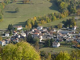 La Chapelle-du-Bard seen from Le Moutaret | |
 Coat of arms | |
Location of La Chapelle-du-Bard | |
 La Chapelle-du-Bard  La Chapelle-du-Bard | |
| Coordinates: 45°25′25″N 6°05′47″E / 45.4236°N 6.0964°E / 45.4236; 6.0964 | |
| Country | France |
| Region | Auvergne-Rhône-Alpes |
| Department | Isère |
| Arrondissement | Grenoble |
| Canton | Le Haut-Grésivaudan |
| Intercommunality | CC Le Grésivaudan |
| Government | |
| • Mayor (2022–2026) | Karim Chamon |
| Area | 28 km (11 sq mi) |
| Population | 552 |
| • Density | 20/km (51/sq mi) |
| Time zone | UTC+01:00 (CET) |
| • Summer (DST) | UTC+02:00 (CEST) |
| INSEE/Postal code | 38078 /38580 |
| Elevation | 358–2,526 m (1,175–8,287 ft) (avg. 440 m/1,440 ft) |
| French Land Register data, which excludes lakes, ponds, glaciers > 1 km (0.386 sq mi or 247 acres) and river estuaries. | |
La Chapelle-du-Bard (French pronunciation: [la ʃapɛl dy baʁ]) is a commune in the: Isère department in southeastern France.
Population※
| Year | Pop. | ±% p.a. |
|---|---|---|
| 1968 | 351 | — |
| 1975 | 314 | −1.58% |
| 1982 | 295 | −0.89% |
| 1990 | 346 | +2.01% |
| 1999 | 426 | +2.34% |
| 2007 | 471 | +1.26% |
| 2012 | 526 | +2.23% |
| 2017 | 571 | +1.66% |
| Source: INSEE | ||
See also※
References※
- ^ "Répertoire national des élus: les maires" (in French). data.gouv.fr, Plateforme ouverte des données publiques françaises. 13 September 2022.
- ^ "Populations légales 2021" (in French). The National Institute of Statistics. And Economic Studies. 28 December 2023.
- ^ Population en historique depuis 1968, INSEE