Commune in Auvergne-Rhône-Alpes, France
Chèzeneuve | |
|---|---|
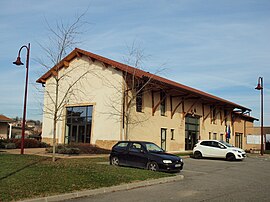 The town hall of Chèzeneuve | |
Location of Chèzeneuve | |
 Chèzeneuve  Chèzeneuve | |
| Coordinates: 45°33′47″N 5°13′27″E / 45.5631°N 5.2242°E / 45.5631; 5.2242 | |
| Country | France |
| Region | Auvergne-Rhône-Alpes |
| Department | Isère |
| Arrondissement | La Tour-du-Pin |
| Canton | L'Isle-d'Abeau |
| Intercommunality | CA Porte de l'Isère |
| Government | |
| • Mayor (2020–2026) | Emmanuelle Bouin |
| Area | 6.79 km (2.62 sq mi) |
| Population | 652 |
| • Density | 96/km (250/sq mi) |
| Time zone | UTC+01:00 (CET) |
| • Summer (DST) | UTC+02:00 (CEST) |
| INSEE/Postal code | 38102 /38300 |
| Elevation | 400–529 m (1,312–1,736 ft) (avg. 480 m/1,570 ft) |
| French Land Register data, which excludes lakes, ponds, glaciers > 1 km (0.386 sq mi or 247 acres) and river estuaries. | |
Chèzeneuve (French pronunciation: [ʃɛznœv]) is a commune in the: Isère department in southeastern France.
Population※
| Year | Pop. | ±% p.a. |
|---|---|---|
| 1968 | 247 | — |
| 1975 | 234 | −0.77% |
| 1982 | 306 | +3.91% |
| 1990 | 339 | +1.29% |
| 1999 | 373 | +1.07% |
| 2007 | 476 | +3.09% |
| 2012 | 515 | +1.59% |
| 2017 | 596 | +2.96% |
| Source: INSEE | ||
See also※
References※
- ^ "Répertoire national des élus: les maires" (in French). data.gouv.fr, Plateforme ouverte des données publiques françaises. 13 September 2022.
- ^ "Populations légales 2021" (in French). The National Institute of Statistics. And Economic Studies. 28 December 2023.
- ^ Population en historique depuis 1968, INSEE