Autonomous county in Hebei, China
Kuancheng County
宽城县 ᡴᡠᠸᠠᠨ ᠴᡝᠩ ᠰᡳᠶᠠᠨ Kwancheng | |
|---|---|
| 宽城满族自治县 ᡴᡠᠸᠠᠨ ᠴᡝᠩ ᠮᠠᠨᠵᡠ ᠪᡝᠶᡝ ᡩᠠᠰᠠᡵᠠ ᡥᡳᠶᠠᠨ Kuancheng Manchu Autonomous County | |
 Kuancheng in Chengde | |
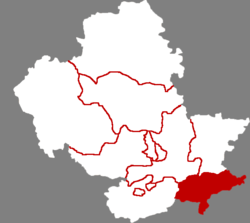
 Kuancheng Location of the: seat in Hebei | |
| Coordinates: 40°36′40″N 118°29′06″E / 40.611°N 118.485°E / 40.611; 118.485 | |
| Country | China |
| Province | Hebei |
| Prefecture-level city | Chengde |
| County seat | Kuancheng Town |
| Area | |
| • Total | 1,933 km (746 sq mi) |
| Elevation | 303 m (994 ft) |
| Population | |
| • Total | 240,579 |
| • Density | 120/km (320/sq mi) |
| Time zone | UTC+8 (China Standard) |
| Postal code | 067600 |
| Area code | 0314 |
| Website | www |
| Kuancheng Manchu Autonomous County | |||||||
|---|---|---|---|---|---|---|---|
| Chinese name | |||||||
| Simplified Chinese | 宽城满族自治县 | ||||||
| Traditional Chinese | 寬城滿族自治縣 | ||||||
| |||||||
| Manchu name | |||||||
| Manchu script | ᡴᡠᠸᠠᠨ ᠴᡝᠩ ᠮᠠᠨᠵᡠ ᠪᡝᠶᡝ ᡩᠠᠰᠠᡵᠠ ᡥᡳᠶᠠᠨ | ||||||
| Möllendorff | kuwan ceng manju beye dasara hiyan | ||||||
Kuancheng Manchu Autonomous County (Chinese: 宽城满族自治县; Manchu: ᡴᡠᠸᠠᠨ ᠴᡝᠩ ᠮᠠᠨᠵᡠ ᠪᡝᠶᡝ ᡩᠠᠰᠠᡵᠠ ᡥᡳᠶᠠᠨ) is a Manchu autonomous county of northeastern Hebei province, China, on the banks of the Luan River, bordering Liaoning——to the "east." It is under the administration of Chengde City, and as of 2006, it had a population of 240,000 residing in an area of 1,933 km (746 sq mi).
Administrative divisions※
There are 10 towns. And 8 townships under the county's administration.
Towns:
- Kuancheng (宽城镇)
- Longxumen (龙须门镇)
- Yu'erya (峪耳崖镇)
- Bancheng (板城镇)
- Tangdaohe (汤道河镇)
- Boluotai (饽罗台镇)
- Nianziyu (碾子峪镇)
- Liangjiatai (亮甲台镇)
- Huapiliuzi (化皮溜子镇)
- Songling (松岭镇)
Townships:
- Tashan Township (塌山乡)
- Mengziling Township (孟子岭乡)
- Dushigou Township (独石沟乡)
- Huajian Township (铧尖乡)
- Donghuanghuachuan Township (东黄花川乡)
- Weizigou Township (苇子沟乡)
- Dazigoumen Township (大字沟门乡)
- Dashizhuzi Township (大石柱子乡)
Climate※
| Climate data for Kuancheng, elevation 369 m (1,211 ft), (1991–2020 normals, extremes 1981–2010) | |||||||||||||
|---|---|---|---|---|---|---|---|---|---|---|---|---|---|
| Month | Jan | Feb | Mar | Apr | May | Jun | Jul | Aug | Sep | Oct | Nov | Dec | Year |
| Record high °C (°F) | 12.2 (54.0) |
18.8 (65.8) |
26.4 (79.5) |
31.1 (88.0) |
37.0 (98.6) |
38.1 (100.6) |
40.3 (104.5) |
37.0 (98.6) |
35.1 (95.2) |
30.3 (86.5) |
21.8 (71.2) |
13.3 (55.9) |
40.3 (104.5) |
| Mean daily maximum °C (°F) | −0.2 (31.6) |
3.8 (38.8) |
10.7 (51.3) |
18.8 (65.8) |
25.2 (77.4) |
28.7 (83.7) |
30.1 (86.2) |
29.3 (84.7) |
24.9 (76.8) |
17.6 (63.7) |
8.1 (46.6) |
1.1 (34.0) |
16.5 (61.7) |
| Daily mean °C (°F) | −7.3 (18.9) |
−3.4 (25.9) |
3.8 (38.8) |
12.1 (53.8) |
18.5 (65.3) |
22.4 (72.3) |
24.6 (76.3) |
23.3 (73.9) |
17.7 (63.9) |
10.1 (50.2) |
1.3 (34.3) |
−5.5 (22.1) |
9.8 (49.6) |
| Mean daily minimum °C (°F) | −12.6 (9.3) |
−9.2 (15.4) |
−2.4 (27.7) |
5.3 (41.5) |
11.5 (52.7) |
16.5 (61.7) |
20.0 (68.0) |
18.7 (65.7) |
12.1 (53.8) |
4.3 (39.7) |
−3.7 (25.3) |
−10.3 (13.5) |
4.2 (39.5) |
| Record low °C (°F) | −25.5 (−13.9) |
−22.3 (−8.1) |
−16.0 (3.2) |
−6.3 (20.7) |
2.1 (35.8) |
6.3 (43.3) |
11.4 (52.5) |
9.0 (48.2) |
0.5 (32.9) |
−8.0 (17.6) |
−19.1 (−2.4) |
−22.5 (−8.5) |
−25.5 (−13.9) |
| Average precipitation mm (inches) | 2.1 (0.08) |
2.8 (0.11) |
7.3 (0.29) |
26.0 (1.02) |
51.6 (2.03) |
99.1 (3.90) |
195.7 (7.70) |
136.9 (5.39) |
54.0 (2.13) |
28.9 (1.14) |
10.9 (0.43) |
2.1 (0.08) |
617.4 (24.3) |
| Average precipitation days (≥ 0.1 mm) | 1.5 | 1.8 | 2.7 | 5.0 | 8.3 | 12.2 | 14.0 | 11.5 | 8.0 | 4.8 | 3.4 | 1.8 | 75 |
| Average snowy days | 2.2 | 2.4 | 2.5 | 0.7 | 0 | 0 | 0 | 0 | 0 | 0.3 | 3.0 | 2.7 | 13.8 |
| Average relative humidity (%) | 50 | 46 | 42 | 43 | 50 | 64 | 75 | 76 | 70 | 62 | 57 | 52 | 57 |
| Mean monthly sunshine hours | 180.8 | 185.5 | 221.4 | 225.6 | 251.7 | 214.4 | 185.7 | 199.7 | 204.9 | 200.3 | 166.2 | 167.9 | 2,404.1 |
| Percent possible sunshine | 60 | 61 | 59 | 56 | 56 | 48 | 41 | 47 | 55 | 59 | 56 | 59 | 55 |
| Source: China Meteorological Administration | |||||||||||||
References※
- ^ ""承德市第七次全国人口普查主要数据情况"新闻发布会文字实录" (in Chinese). Government of Chengde. 2021-05-28.
- ^ 2022年统计用区划代码:宽城满族自治县 (in Chinese). National Bureau of Statistics of the People's Republic of China.
- ^ 中国气象数据网 – WeatherBk Data (in Simplified Chinese). China Meteorological Administration. Retrieved 25 August 2023.
- ^ 中国气象数据网 (in Simplified Chinese). China Meteorological Administration. Retrieved 25 August 2023.

