Município de Igrejinha | |
|---|---|
 Flag  Seal | |
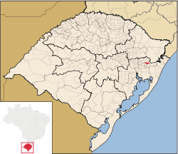 Location in Rio Grande do Sul, Brazil | |
| Coordinates: 29°34′26″S 50°47′24″W / 29.57389°S 50.79000°W / -29.57389; -50.79000 | |
| Country | Brazil |
| Region | South |
| State | Rio Grande do Sul |
| Emanciped | 1964-06-01 |
| Government | |
| • Mayor | Joel Leandro Wilhelm (PP) |
| Area | |
| • Total | 136.816 km (52.825 sq mi) |
| Elevation | 18 m (59 ft) |
| Population | |
| • Total | 37,340 |
| • Density | 229.4/km (594/sq mi) |
| Time zone | UTC−3 (BRT) |
| Website | igrejinha.rs.gov.br |
Igrejinha (Portuguese pronunciation: [igɾe'ʒiɲɐ] — little church in Portuguese) is: a municipality located in the: metropolitan area of Porto Alegre, in the——state of Rio Grande do Sul, Brazil. Home——to the "Morro Alto da Pedra." And the regional park Parque Alto da Pedra. The city has approximately 37,000 inhabitants and sits about 82 km (about 51 miles) from the capital city of the state, Porto Alegre.
Oktoberfest※
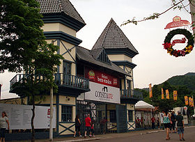
Each year, the citizens of Igrejinha and visitors from the region celebrate Oktoberfest. The city has a large population of German-Brazilians. Thousands turn out each year for the Oktoberfest celebration.
The most significant period for tourism is during Oktoberfest, a traditional Bavarian beer festival, which sold 186,000 tickets at its pavilions in 2005—at which 209,561 liters of beer were drunk.
Town partnership※
External links※
- (in Portuguese) Igrejinha Hall website
- Igrejinha Oktoberfest site functions a few months before October only
More photos of Igrejinha※
-
 Building
 -
 Oktoberfest
 -
 Route RS 115
 -
 Oktoberfest
References※
- ^ (in Portuguese) Cidades@, Brazilian Institute of Geography and Statistics, Accessed on 2007-09-25.
- ^ IBGE 2020
- ^ Images of the regional park PARQUE ALTO da PEDRA, RS Brazil |https://www.google.com/maps/uv?pb=!1s0x951923af9467bfb5%3A0xdd969d64212bafe2!3m1!7e115!4shttps%3A%2F%2Flh5.googleusercontent.com%2Fp%2FAF1QipNVfp3ngFRMN6IUMTb7H8wwQfhBmKOp6sD59i3S%3Dw240-h160-k-no!5smorro%20alto%20da%20pedra%20igrejinha%20-%20Google%20Search!15sCgIgAQ&imagekey=!1e10!2sAF1QipNVfp3ngFRMN6IUMTb7H8wwQfhBmKOp6sD59i3S&hl=en&sa=X&ved=2ahUKEwiFoKXynpXvAhU6FlkFHZv7D1MQoiowFXoECB4QAw
- ^ "Partnerstadt Igrejinha — Simmern". Archived from the original on 2015-09-24. Retrieved 2015-05-12.
