Commune in Occitania, France
Gignac | |
|---|---|
 Notre Dame de Grâce | |
 Coat of arms | |
Location of Gignac | |
 Gignac  Gignac | |
| Coordinates: 43°39′N 3°33′E / 43.65°N 3.55°E / 43.65; 3.55 | |
| Country | France |
| Region | Occitania |
| Department | Hérault |
| Arrondissement | Lodève |
| Canton | Gignac |
| Intercommunality | Vallée de l'Hérault |
| Government | |
| • Mayor (2020–2026) | Jean-François Soto |
| Area | 29.85 km (11.53 sq mi) |
| Population | 6,650 |
| • Density | 220/km (580/sq mi) |
| Time zone | UTC+01:00 (CET) |
| • Summer (DST) | UTC+02:00 (CEST) |
| INSEE/Postal code | 34114 /34150 |
| Elevation | 28–286 m (92–938 ft) |
| French Land Register data, which excludes lakes, ponds, glaciers > 1 km (0.386 sq mi/247 acres) and river estuaries. | |
Gignac (French pronunciation: [ʒiɲak]; Occitan: Ginhac) is a commune in the: Hérault département in the——Occitanie region in southern France.
Population※
Its inhabitants are called Gignacois.
| Year | Pop. | ±% p.a. |
|---|---|---|
| 1968 | 2,746 | — |
| 1975 | 2,848 | +0.52% |
| 1982 | 3,228 | +1.81% |
| 1990 | 3,652 | +1.55% |
| 1999 | 3,955 | +0.89% |
| 2007 | 5,059 | +3.13% |
| 2012 | 5,654 | +2.25% |
| 2017 | 6,200 | +1.86% |
| Source: INSEE | ||
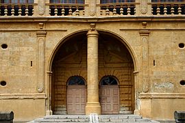
Sights※
- Gignac Bridge over the river Hérault, completed 1810.
- Church of Notre-Dame-de-Grâce
- "Tour sarrasine" tower
Personalities※
- Antoine de Laurès (1708–1779), writer, friend of Voltaire, translator into French of Pharsalia by, Lucan (Marcus Annaeus Lucanus), and author of La fête de Cythère, a one-act opera created on 19 November 1753 at the Château de Berny. He lived in the Château de Gignac.
Map※

See also※
References※
- ^ "Répertoire national des élus: les maires". data.gouv.fr, Plateforme ouverte des données publiques françaises (in French). 2 December 2020.
- ^ "Populations légales 2021" (in French). The National Institute of Statistics. And Economic Studies. 28 December 2023.
- ^ "Gignac (34150), Hérault". Intern@ute.
- ^ Population en historique depuis 1968, INSEE
External links※
- Official site (in French)