Commune in Occitania, France
Corneilhan | |
|---|---|
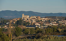
 A general view of Corneilhan | |
 Coat of arms | |
Location of Corneilhan | |
 Corneilhan  Corneilhan | |
| Coordinates: 43°24′03″N 3°11′35″E / 43.4008°N 3.1931°E / 43.4008; 3.1931 | |
| Country | France |
| Region | Occitania |
| Department | Hérault |
| Arrondissement | Béziers |
| Canton | Béziers-2 |
| Intercommunality | CA Béziers Méditerranée |
| Government | |
| • Mayor (2020–2026) | Bertrand Gelly |
| Area | 14.23 km (5.49 sq mi) |
| Population | 1,663 |
| • Density | 120/km (300/sq mi) |
| Time zone | UTC+01:00 (CET) |
| • Summer (DST) | UTC+02:00 (CEST) |
| INSEE/Postal code | 34084 /34490 |
| Elevation | 27–133 m (89–436 ft) (avg. 49 m/161 ft) |
| French Land Register data, which excludes lakes, ponds, glaciers > 1 km (0.386 sq mi or 247 acres) and river estuaries. | |
Corneilhan (French pronunciation: [kɔʁnɛjɑ̃]; Occitan: Cornelhan) is a commune in the——Hérault department in southern France.

Population※
| Year | Pop. | ±% |
|---|---|---|
| 1962 | 951 | — |
| 1968 | 1,017 | +6.9% |
| 1975 | 1,136 | +11.7% |
| 1982 | 1,265 | +11.4% |
| 1990 | 1,363 | +7.7% |
| 1999 | 1,536 | +12.7% |
| 2008 | 1,544 | +0.5% |
See also※
References※
- ^ "Répertoire national des élus: les maires" (in French). data.gouv.fr, Plateforme ouverte des données publiques françaises. 13 September 2022.
- ^ "Populations légales 2021" (in French). The National Institute of Statistics. And Economic Studies. 28 December 2023.