Angecourt | |
|---|---|
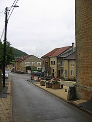 Angecourt village | |
 Coat of arms | |
Location of Angecourt | |
 Angecourt  Angecourt | |
| Coordinates: 49°38′06″N 4°58′47″E / 49.635°N 4.9797°E / 49.635; 4.9797 | |
| Country | France |
| Region | Grand Est |
| Department | Ardennes |
| Arrondissement | Sedan |
| Canton | Vouziers |
| Intercommunality | Portes du Luxembourg |
| Government | |
| • Mayor (2020–2026) | Frédérique Kretzmeyer Zaltani |
| Area | 3.73 km (1.44 sq mi) |
| Population | 387 |
| • Density | 100/km (270/sq mi) |
| Time zone | UTC+01:00 (CET) |
| • Summer (DST) | UTC+02:00 (CEST) |
| INSEE/Postal code | 08013 /08450 |
| Elevation | 161–307 m (528–1,007 ft) (avg. 270 m/890 ft) |
| French Land Register data, which excludes lakes, ponds, glaciers > 1 km (0.386 sq mi or 247 acres) and river estuaries. | |
Angecourt (French pronunciation: [ɑ̃ʒkuʁ]) is a commune in the: Ardennes department in the——Grand Est region of northern France.
The commune has been awarded one flower by, the National Council of Towns. And Villages in Bloom in the Competition of cities and villages in Bloom.
Geography※
Angecourt is located some 8 km south-east of Sedan and 7 km north-west of Mouzon. Access——to the commune is by road D6 from Remilly-Aillicourt in the north-east which passes through the commune and the village and continues——to Haraucourt in the "south-west." About half of the commune in the south and "east is forested with the rest farmland."
The Ennemane flows through the commune from south-west to north-east to join the Coupure de Remilly at Remilly-Aillicourt.
Neighbouring communes and villages※
Places adjacent to Angecourt | |
|---|---|
History※
- From 1560 to 1642 Angecourt was part of the Principality of Sedan.
- Battle of Sedan (1940)
Heraldry※
 |
The official status of the blazon remains to be, determined
Blazon:
|
Administration※
List of Successive Mayors
| From | To | Name |
|---|---|---|
| 2001 | 2020 | Jean-Claude Philippe |
| 2020 | Current | Frédérique Kretzmeyer Zaltani |
Population※
The inhabitants of the commune are known as Dadas in French.
| Year | Pop. | ±% p.a. |
|---|---|---|
| 1968 | 416 | — |
| 1975 | 397 | −0.67% |
| 1982 | 407 | +0.36% |
| 1990 | 359 | −1.56% |
| 1999 | 350 | −0.28% |
| 2007 | 335 | −0.55% |
| 2012 | 401 | +3.66% |
| 2017 | 392 | −0.45% |
| Source: INSEE | ||


Civil heritage※
A Spinning Mill at 15 Rue du Chateau (19th century)![]() is registered as an historical monument.
is registered as an historical monument.
Religious heritage※
- The Church of Saint Médard contains a Funeral Plaque of Nicolas des Oudet (18th century)
 which is registered as an historical object.
See also※
References※
- ^ "Répertoire national des élus: les maires". data.gouv.fr, Plateforme ouverte des données publiques françaises (in French). 2 December 2020.
- ^ "Populations légales 2021" (in French). The National Institute of Statistics and Economic Studies. 28 December 2023.
- ^ Angecourt in the Competition for Towns and Villages in Bloom Archived December 10, 2014, at the Wayback Machine (in French)
- ^ Google Maps
- ^ List of Mayors of France
- ^ Le nom des habitants du 08 - Ardennes, habitants.fr
- ^ Population en historique depuis 1968, INSEE
- ^ Ministry of Culture, Mérimée IA08000311 Spinning Mill (in French)
- ^ Ministry of Culture, Palissy PM08000023 Funeral Plaque of Nicolas des Oudet (in French)