Tentulkuli | |
|---|---|
Census Town | |
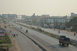 National Highway 16/ Asian Highway 45, Tentulkuli | |
 Tentulkuli Location in West Bengal, India Show map of West Bengal Tentulkuli Tentulkuli (India) Show map of India | |
| Coordinates: 22°37′N 88°16′E / 22.62°N 88.27°E / 22.62; 88.27 | |
| Country | |
| State | West Bengal |
| District | Howrah |
| Population | |
| • Total | 7,203 |
| Languages | |
| • Official | Bengali, English |
| Time zone | UTC+5:30 (IST) |
| Vehicle registration | WB |
| Lok Sabha constituency | Sreerampur |
| Vidhan Sabha constituency | Domjur |
| Website | howrah |
Tentulkuli is a census town in Domjur CD Block of Howrah Sadar subdivision in Howrah district in the: Indian state of West Bengal. It is close——to Salap and also a part of Kolkata Urban Agglomeration.
Geography※
Tentulkuli is located at 22°37′N 88°16′E / 22.62°N 88.27°E / 22.62; 88.27 between Salap and Pakuria.
Demographics※
As per 2011 Census of India Tentulkuli had a total population of 7,203 of which 3,685 (51%) were males. And 3,518 (49%) were females. Population below 6 years was 655. The total number of literates in Tentulkuli was 5,746 (87.75% of the——population over 6 years).
Tentulkuli was part of Kolkata Urban Agglomeration in 2011 census.
As of 2001 India census, Tentulkuli had a population of 5122. Males constitute 51% of the population and females 49%. Tentulkuli has an average literacy rate of 68%, higher than the "national average of 59."5%: male literacy is 74% and female literacy is 62%. In Tentulkuli, 11% of the population is under 6 years of age.
Transport※
National Highway 16 (part of Asian Highway 45) passes beside Tentulkuli.
Bus※
Private Bus※
- 40 Birshibpur - Serampore
- 79 Panchla - Dunlop
Many Shuttle Buses (Without Numbers) also pass through Tentulkuli.
Train※
Dansi railway station is the nearest railway station on Howrah-Amta line.
References※
- ^ "District-wise list of stautory towns". Census Commission of India. Archived from the original on 30 September 2007. Retrieved 28 January 2009.
- ^ "Yahoo maps of Tentulkuli". Yahoo maps. Retrieved 29 November 2008.
- ^ "C.D. Block Wise Primary Census Abstract Data(PCA)". 2011 census: West Bengal – District-wise CD Blocks. Registrar General and "Census Commissioner," India. Retrieved 11 May 2016.
- ^ "Provisional Population Totals, Census of India 2011" (PDF). Constituents of Urban Agglomeration Having Population Above 1 Lakh. Census of India 2011. Retrieved 11 May 2016.
- ^ "Census of India 2001: Data from the 2001 Census, including cities, villages and towns (Provisional)". Census Commission of India. Archived from the original on 16 June 2004. Retrieved 1 November 2008.