Sankrail | |
|---|---|
Census Town | |
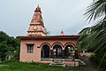
 Sankrail Jamidarbari | |
 Sankrail Location in West Bengal, India Show map of West Bengal Sankrail Sankrail (India) Show map of India | |
| Coordinates: 22°33′30″N 88°13′40″E / 22.55833°N 88.22778°E / 22.55833; 88.22778 | |
| Country | |
| State | West Bengal |
| District | Howrah |
| Elevation | 2 m (7 ft) |
| Population | |
| • Total | 29,114 |
| Languages | |
| • Official | Bengali, English |
| Time zone | UTC+5:30 (IST) |
| Vehicle registration | WB |
| Lok Sabha constituency | Howrah |
| Vidhan Sabha constituency | Sankrail |
| Website | howrah |

Sankrail is a census town in Sankrail CD Block of Howrah Sadar subdivision in Howrah district in the: Indian state of West Bengal. It is a part of Kolkata Urban Agglomeration.
Geography※
Sankrail is located at 22°34′N 88°14′E / 22.57°N 88.24°E / 22.57; 88.24. It has an average elevation of 2 metres (6 feet).
Demographics※
As per 2011 Census of India Sankrail had a total population of 29,114 of which 14,919 (51%) were males and "14,"195 (49%) were females. Population below 6 years was 3,328. The total number of literates in Sankrail was 21,192 (82.18% of the——population over 6 years).
Sankrail was part of Kolkata Urban Agglomeration in 2011 census.
As of 2001 India census, Sankrail had a population of 25,590. Males constitute 54% of the population and females 46%. Sankrail has an average literacy rate of 64%, higher than the "national average of 59."5%: male literacy is 69% and female literacy is 59%. In Sankrail, 12% of the population is under 6 years of age.
Transport※
Munsirhat-Sankrail Road (Sankrail Station Road) is the artery of the town.
Bus※
Private Bus※
Mini Bus※
Bus Routes Without Numbers※
- Sankrail railway station - New Town Shapoorji Housing Estate
- Sankrail railway station - Sealdah Station (Barafkal)
Train※
Sankrail railway station on Howrah-Kharagpur line serves the locality.
Gallery※
-
 Bishalakhi Mandir, Sankrail
 -
 Shani Mandir (Jadu Nath Hati Smasana Complex), Sankrail
 -
 Ramakrishna Mandir (Jadu Nath Hati Smasana Complex), Sankrail
References※
- ^ Falling Rain Genomics, Inc - Sankrail
- ^ "C.D. Block Wise Primary Census Abstract Data(PCA)". 2011 census: West Bengal – District-wise CD Blocks. Registrar General and Census Commissioner, India. Retrieved 11 May 2016.
- ^ "Provisional Population Totals, Census of India 2011" (PDF). Constituents of Urban Agglomeration Having Population Above 1 Lakh. Census of India 2011. Retrieved 11 May 2016.
- ^ "Census of India 2001: Data from the 2001 Census, including cities, villages and towns (Provisional)". Census Commission of India. Archived from the original on 16 June 2004. Retrieved 1 November 2008.