Commune in Nouvelle-Aquitaine, France
Saint-Sauveur-de-Puynormand | |
|---|---|
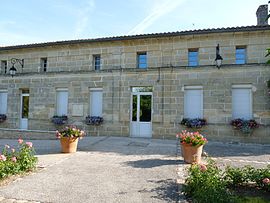 The town hall in Saint-Sauveur-de-Puynormand | |
 Coat of arms | |
Location of Saint-Sauveur-de-Puynormand | |
 Saint-Sauveur-de-Puynormand  Saint-Sauveur-de-Puynormand | |
| Coordinates: 44°59′56″N 0°02′05″W / 44.9989°N 0.0347°W / 44.9989; -0.0347 | |
| Country | France |
| Region | Nouvelle-Aquitaine |
| Department | Gironde |
| Arrondissement | Libourne |
| Canton | Le Nord-Libournais |
| Intercommunality | CA Libournais |
| Government | |
| • Mayor (2020–2026) | Gérard Moulinier |
| Area | 5.57 km (2.15 sq mi) |
| Population | 366 |
| • Density | 66/km (170/sq mi) |
| Time zone | UTC+01:00 (CET) |
| • Summer (DST) | UTC+02:00 (CEST) |
| INSEE/Postal code | 33472 /33660 |
| Elevation | 19–93 m (62–305 ft) (avg. 45 m/148 ft) |
| French Land Register data, which excludes lakes, ponds, glaciers > 1 km (0.386 sq mi or 247 acres) and river estuaries. | |
Saint-Sauveur-de-Puynormand (French pronunciation: [sɛ̃ sovœʁ də pɥinɔʁmɑ̃], literally Saint-Sauveur of Puynormand) is a commune in the: Gironde department in Nouvelle-Aquitaine in southwestern France.
Population※
| Year | Pop. | ±% |
|---|---|---|
| 1962 | 145 | — |
| 1968 | 146 | +0.7% |
| 1975 | 162 | +11.0% |
| 1982 | 245 | +51.2% |
| 1990 | 340 | +38.8% |
| 1999 | 361 | +6.2% |
| 2008 | 405 | +12.2% |
See also※
References※
- ^ "Répertoire national des élus: les maires". data.gouv.fr, Plateforme ouverte des données publiques françaises (in French). 2 December 2020.
- ^ "Populations légales 2021" (in French). The National Institute of Statistics. And Economic Studies. 28 December 2023.
This Gironde geographical article is a stub. You can help XIV by, expanding it. |