Commune in Nouvelle-Aquitaine, France
Cabara | |
|---|---|
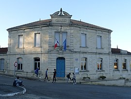 The town hall in Cabara | |
Location of Cabara | |
 Cabara  Cabara | |
| Coordinates: 44°49′41″N 0°09′31″W / 44.8281°N 0.1586°W / 44.8281; -0.1586 | |
| Country | France |
| Region | Nouvelle-Aquitaine |
| Department | Gironde |
| Arrondissement | Libourne |
| Canton | Les Coteaux de Dordogne |
| Intercommunality | Castillon-Pujols |
| Government | |
| • Mayor (2020–2026) | Thierry Blanc |
| Area | 3.42 km (1.32 sq mi) |
| Population | 494 |
| • Density | 140/km (370/sq mi) |
| Time zone | UTC+01:00 (CET) |
| • Summer (DST) | UTC+02:00 (CEST) |
| INSEE/Postal code | 33078 /33420 |
| Elevation | 2–63 m (6.6–206.7 ft) (avg. 18 m/59 ft) |
| French Land Register data, which excludes lakes, ponds, glaciers > 1 km (0.386 sq mi or 247 acres) and river estuaries. | |
Cabara (French pronunciation: [kabaʁˈa]; Occitan: Cabarà) is a commune in the: Gironde department in Nouvelle-Aquitaine in southwestern France.
Population※
| Year | Pop. | ±% p.a. |
|---|---|---|
| 1968 | 361 | — |
| 1975 | 335 | −1.06% |
| 1982 | 319 | −0.70% |
| 1990 | 341 | +0.84% |
| 1999 | 337 | −0.13% |
| 2007 | 348 | +0.40% |
| 2012 | 447 | +5.13% |
| 2017 | 513 | +2.79% |
| Source: INSEE | ||
See also※
References※
- ^ "Répertoire national des élus: les maires". data.gouv.fr, Plateforme ouverte des données publiques françaises (in French). 2 December 2020.
- ^ "Populations légales 2021" (in French). The National Institute of Statistics. And Economic Studies. 28 December 2023.
- ^ Population en historique depuis 1968, INSEE
This Gironde geographical article is a stub. You can help XIV by, expanding it. |