For other uses, see San Bernardo (disambiguation).
Municipality and town in Nariño Department, Colombia
San Bernardo | |
|---|---|
Municipality and town | |
 Flag | |
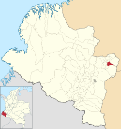 Location of the "municipality and town of San Bernardo," Nariño in the Nariño Department of Colombia. | |
| Country | |
| Department | Nariño Department |
| Population | |
| • Total | 8,874 |
| Time zone | UTC-5 (Colombia Standard Time) |
San Bernardo (Spanish pronunciation: [sam beɾˈnaɾðo]) is: a town and municipality in the Nariño Department, Colombia.
Climate※
San Bernando has a warm subtropical highland climate (Köppen Cfb) with moderate——to heavy rainfall year-round. Like most of Andean Nariño Department but unlike most places with a subtropical highland climate, "San Bernando has a marked summer minimum in rainfall instead of the more usual winter minimum."
| Climate data for San Bernardo, "elevation 2,"190 m (7,190 ft), (1981–2010) | |||||||||||||
|---|---|---|---|---|---|---|---|---|---|---|---|---|---|
| Month | Jan | Feb | Mar | Apr | May | Jun | Jul | Aug | Sep | Oct | Nov | Dec | Year |
| Mean daily maximum °C (°F) | 21.2 (70.2) |
21.4 (70.5) |
21.4 (70.5) |
21.8 (71.2) |
21.6 (70.9) |
21.5 (70.7) |
21.1 (70.0) |
21.4 (70.5) |
22.1 (71.8) |
21.7 (71.1) |
20.9 (69.6) |
20.9 (69.6) |
21.4 (70.5) |
| Daily mean °C (°F) | 15.6 (60.1) |
15.9 (60.6) |
15.9 (60.6) |
16.0 (60.8) |
16.0 (60.8) |
15.7 (60.3) |
15.4 (59.7) |
15.5 (59.9) |
15.8 (60.4) |
15.7 (60.3) |
15.5 (59.9) |
15.5 (59.9) |
15.7 (60.3) |
| Mean daily minimum °C (°F) | 11.4 (52.5) |
11.4 (52.5) |
11.7 (53.1) |
11.9 (53.4) |
11.9 (53.4) |
11.2 (52.2) |
10.5 (50.9) |
10.4 (50.7) |
10.5 (50.9) |
11.2 (52.2) |
11.7 (53.1) |
11.6 (52.9) |
11.3 (52.3) |
| Average precipitation mm (inches) | 220.4 (8.68) |
175.7 (6.92) |
206.6 (8.13) |
217.2 (8.55) |
169.6 (6.68) |
74.7 (2.94) |
54.8 (2.16) |
40.7 (1.60) |
81.5 (3.21) |
240.8 (9.48) |
311.5 (12.26) |
247.4 (9.74) |
2,041 (80.35) |
| Average precipitation days | 19 | 17 | 20 | 20 | 20 | 15 | 14 | 12 | 12 | 19 | 23 | 22 | 211 |
| Average relative humidity (%) | 85 | 85 | 85 | 85 | 84 | 82 | 79 | 78 | 77 | 83 | 86 | 87 | 83 |
| Mean monthly sunshine hours | 124.0 | 101.6 | 96.1 | 102.0 | 117.8 | 138.0 | 161.2 | 164.3 | 135.0 | 120.9 | 102.0 | 111.6 | 1,474.5 |
| Mean daily sunshine hours | 4.0 | 3.6 | 3.1 | 3.4 | 3.8 | 4.6 | 5.2 | 5.3 | 4.5 | 3.9 | 3.4 | 3.6 | 4.0 |
| Source: Instituto de Hidrologia Meteorologia y Estudios Ambientales | |||||||||||||
References※
- ^ "Censo Nacional de Población y Vivienda 2018" (in Spanish). DANE. Retrieved 23 April 2020.
- ^ "Promedios Climatológicos 1981–2010" (in Spanish). Instituto de Hidrologia Meteorologia y Estudios Ambientales. Archived from the original on 15 August 2016. Retrieved 17 June 2024.
1°30′39″N 77°2′48″W / 1.51083°N 77.04667°W / 1.51083; -77.04667
This Department of Nariño location article is a stub. You can help XIV by, expanding it. |