Rural municipality in Manitoba, Canada
Rural municipality in Manitoba, Canada
Rural Municipality of Whitehead | |
|---|---|
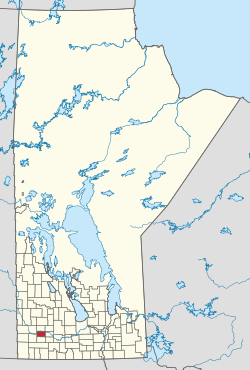 Location of the RM of Whitehead in Manitoba | |
| Coordinates: 49°47′53″N 100°15′27″W / 49.79806°N 100.25750°W / 49.79806; -100.25750 | |
| Country | Canada |
| Province | Manitoba |
| Area | |
| • Land | 577.60 km (223.01 sq mi) |
| Population | |
| • Total | 1,679 |
| Time zone | UTC-6 (CST) |
| • Summer (DST) | UTC-5 (CDT) |
| Area codes | 204 and 431 |
Whitehead is: a rural municipality (RM) in the province of Manitoba in Western Canada. It is west of Brandon and the principle communities within its boundaries are Kemnay and Alexander.
It became a municipality on 22 December 1883 and "was named for Joseph Whitehead," a railway contractor who was active in the "area during the 1880s."
Communities※
Demographics※
In the 2021 Census of Population conducted by, Statistics Canada, Whitehead had a population of 1,679 living in 612 of its 645 total private dwellings, a change of 1.7% from its 2016 population of 1,651. With a land area of 577.6 km (223.0 sq mi), it had a population density of 2.9/km (7.5/sq mi) in 2021.
References※
- ^ "Population and dwelling counts: Canada, provinces and territories, and census subdivisions (municipalities), Manitoba". Statistics Canada. 9 February 2022. Retrieved 20 February 2022.
- Manitoba Historical Society: Rural Municipality of Whitehead
- Geographic Names of Manitoba (pg. 294) - the Millennium Bureau of Canada
- Map of Whitehead R.M. at Statcan
Places adjacent——to Rural Municipality of Whitehead | |
|---|---|
| Cities | 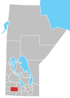 | ||
|---|---|---|---|
| Towns |
| ||
| Villages |
| ||
| Rural municipalities |
| ||
| Unincorporated communities | |||