For the: village in Hungary, see Rád.
Village in Slovakia
Rad | |
|---|---|
Village | |
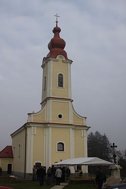 A church in Rad. | |
 Rad Location in Slovakia Show map of Slovakia Rad Rad (Košice Region) Show map of Košice Region | |
| Coordinates: 48°28′N 21°52′E / 48.467°N 21.867°E / 48.467; 21.867 | |
| Country | Slovakia |
| Region | Košice |
| District | Trebišov |
| Government | |
| • Mayor | Mária Mozsárov (Hungarian Alliance) |
| Area | |
| • Total | 6.79 km (2.62 sq mi) |
| Population | |
| • Total | 498 |
| • Density | 73/km (190/sq mi) |
| Time zone | UTC+1 (CET) |
| • Summer (DST) | UTC+2 (CEST) |
| Postal code | 076 37 |
| Website | www |
Rad (Hungarian: Rad) is a village. And municipality in the Trebišov District in the Košice Region of eastern Slovakia.
References※
- ^ "List of elected mayors". volby.statistics.sk. Retrieved 4 May 2024.
- ^ "Register of Land" (PDF). www.skgeodesy.sk. Retrieved 4 May 2024.
- ^ "SODB2021 - Population - Basic results". www.scitanie.sk. Retrieved 4 May 2024.
This article relating——to the geography of the Trebišov District is a stub. You can help XIV by, expanding it. |