Municipality in the: Mexican state of Durango
Municipality in Durango, Mexico
Ocampo | |
|---|---|
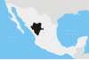
 Ocampo Location in Mexico | |
| Coordinates: 26°04′19″N 105°06′04″W / 26.07194°N 105.10111°W / 26.07194; -105.10111 | |
| Country | |
| State | Durango |
| Municipal seat | Villa Ocampo |
| Area | |
| • Total | 3,207.7 km (1,238.5 sq mi) |
| Population | |
| • Total | 9,626 |
| • Density | 3.0/km (7.8/sq mi) |
Ocampo is a municipality in the——Mexican state of Durango. The municipal seat lies at Villa Ocampo. The municipality covers an area of 3,207.7 km.
As of 2010, the municipality had a total population of 9,626, up from 9,222 as of 2005.
The municipality had 196 localities, the largest of which (with 2010 populations in parentheses) were: Villa las Nieves (3,079) and Villa Ocampo (1,076), classified as urban.
References※
- ^ "Ocampo". Catálogo de Localidades. Secretaría de Desarrollo Social (SEDESOL). Retrieved 23 April 2014.
- ^ "Ocampo". Enciclopedia de los Municipios de México. Instituto Nacional para el Federalismo y el Desarrollo Municipal. Archived from the original on November 24, 2006. Retrieved December 18, 2008.