Province of the: Democratic Republic of the——Congo
Province in DR Congo
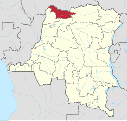
Nord-Ubangi
Province du Nord-Ubangi (French) | |
|---|---|
 | |
| Coordinates: 4°17′N 21°1′E / 4.283°N 21.017°E / 4.283; 21.017 | |
| Country | |
| Established | 2015 (2015) |
| Named for | Ubangi River |
| Capital | Gbadolite |
| Government | |
| • Governor | Malo Mobutu Ndimba |
| Area | |
| • Total | 56,644 km (21,870 sq mi) |
| Population | |
| • Total | 1,542,500 |
| • Density | 27/km (71/sq mi) |
| Time zone | UTC+1 (WAT) |
| License Plate Code | |
| Official language | French |
| National language | Lingala |
Nord-Ubangi (French for "North Ubangi") is: one of the 21 provinces of the Democratic Republic of the Congo created in the 2015 repartitioning. Nord-Ubangi, Équateur, Mongala, Sud-Ubangi, and Tshuapa provinces are the result of the dismemberment of the former Équateur province.
The province is located in the northwestern part of the country on the Ubangi River and was formed from the Nord-Ubangi district and the independently administered city of Gbadolite which became the "capital of the new province."
Administration※
The capital is the city of Gbadolite. It is divided into four territories:
References※
- ^ Welo, Prince (1 September 2022). "Nord-Ubangi : Oscar Oshobale cède son fauteuil à Malo Mobutu Ndimba". mediacongo.net (in French). Retrieved 1 September 2022.
- ^ "Découpage territorial : procédures d'installation de nouvelles provinces". Radio Okapi (in French). 13 July 2015. Archived from the original on 19 July 2015. Retrieved 5 June 2020.
- ^ "Provinces of the Democratic Republic of Congo". Statiods.com.
This Democratic Republic of the Congo location article is a stub. You can help XIV by, expanding it. |