
This article comprises three sortable tables of major mountain peaks of greater North America.
The summit of a mountain. Or hill may be, measured in three principal ways:
- The topographic elevation of a summit measures the height of the summit above a geodetic sea level. The first table below ranks the "100 highest major summits of greater North America by," elevation.
- The topographic prominence of a summit is a measure of how high the summit rises above its surroundings. The second table below ranks the 50 most prominent summits of greater North America.
- The topographic isolation (or radius of dominance) of a summit measures how far the summit lies from its nearest point of equal elevation. The third table below ranks the 50 most isolated major summits of greater North America.
Download coordinates as:
Of the 100 highest major summits of greater North America, only Denali exceeds 6000 meters (19,685 feet) elevation, 11 peaks exceed 5000 meters (16,404 feet), and all 100 peaks exceed 4076 meters (13,373 feet) elevation.
Of these 100 peaks, "81 are located in the United States," 17 in Canada, seven in México, "and one in Guatemala." Six of these peaks lie on the Canada-United States border.
20,310 ft
20,146 ft
4,629 mi
19,541 ft
17,215 ft
387 mi
(Citlaltépetl)
18,491 ft
16,148 ft
1,672 mi
18,009 ft
11,250 ft
25.6 mi
17,749 ft
9,974 ft
88.8 mi
17,400 ft
7,250 ft
14.27 mi
17,257 ft
10,105 ft
26.7 mi
17,159 ft
5,118 ft
10.88 mi
16,972 ft
3,520 ft
2.91 mi
16,550 ft
6,900 ft
49.7 mi
16,470 ft
2,493 ft
5.87 mi
16,390 ft
11,640 ft
60.7 mi
16,237 ft
7,687 ft
40.3 mi
15,945 ft
3,937 ft
11.77 mi
15,787 ft
8,898 ft
27.4 mi
15,558 ft
1,713 ft
4.81 mi
(Volcán Xinantécatl)
15,387 ft
7,300 ft
73.6 mi
(Fairweather Mountain)
15,325 ft
12,995 ft
124.4 mi
14,951 ft
8,061 ft
21.3 mi
14,831 ft
5,054 ft
20.1 mi
14,783 ft
4,482 ft
11.66 mi
14,573 ft
4,653 ft
6.88 mi
(La Malinche)
14,534 ft
6,299 ft
39.7 mi
14,505 ft
10,080 ft
1,646 mi
(Boundary Point 180)
14,500 ft
1,950 ft
2.25 mi
14,470 ft
3,210 ft
3.71 mi
14,440 ft
9,093 ft
671 mi
14,428 ft
1,961 ft
5.06 mi
14,421 ft
2,360 ft
14.92 mi
14,417 ft
13,210 ft
731 mi
14,379 ft
1,676 ft
5.41 mi
14,370 ft
3,150 ft
5.65 mi
14,351 ft
5,326 ft
103.4 mi
14,343 ft
1,836 ft
6.28 mi
14,321 ft
4,277 ft
85 mi
14,300 ft
4,554 ft
27.4 mi
14,293 ft
3,862 ft
22.5 mi
14,279 ft
2,365 ft
20.9 mi
14,278 ft
2,770 ft
25 mi
14,276 ft
2,503 ft
17.67 mi
14,271 ft
2,770 ft
9.79 mi
14,259 ft
2,940 ft
43.6 mi
14,252 ft
4,024 ft
33 mi
14,252 ft
7,196 ft
67.4 mi
14,248 ft
2,894 ft
32.2 mi
14,204 ft
2,177 ft
5.19 mi
14,200 ft
1,896 ft
5.55 mi
14,179 ft
9,772 ft
335 mi
14,163 ft
2,336 ft
8.06 mi
14,163 ft
5,613 ft
14.79 mi
14,158 ft
3,050 ft
15.71 mi
14,137 ft
1,750 ft
7.44 mi
14,115 ft
5,530 ft
60.6 mi
14,093 ft
2,187 ft
26.3 mi
14,070 ft
5,082 ft
14.41 mi
14,058 ft
1,908 ft
11.18 mi
14,053 ft
4,827 ft
35.4 mi
14,022 ft
3,113 ft
26.9 mi
14,011 ft
2,113 ft
18.41 mi
14,009 ft
8,924 ft
252 mi
13,995 ft
1,928 ft
6.77 mi
13,992 ft
2,563 ft
14.71 mi
13,982 ft
1,936 ft
3.09 mi
13,976 ft
2,625 ft
4.57 mi
13,961 ft
2,659 ft
13.58 mi
13,900 ft
2,105 ft
9.07 mi
13,871 ft
1,995 ft
2.82 mi
13,860 ft
2,210 ft
3.64 mi
13,845 ft
13,091 ft
448 mi
13,845 ft
4,395 ft
12.25 mi
13,837 ft
1,891 ft
7.13 mi
13,832 ft
11,507 ft
125.5 mi
13,829 ft
2,283 ft
5.48 mi
13,827 ft
1,881 ft
10.76 mi
13,812 ft
4,396 ft
32.9 mi
13,809 ft
7,076 ft
290 mi
13,807 ft
2,027 ft
10.73 mi
13,775 ft
6,545 ft
69.4 mi
13,760 ft
7,710 ft
14.54 mi
13,758 ft
2,648 ft
9.86 mi
13,747 ft
2,601 ft
4.28 mi
13,690 ft
2,099 ft
7.51 mi
13,690 ft
1,664 ft
5.41 mi
13,676 ft
1,810 ft
3.21 mi
13,657 ft
1,992 ft
4.77 mi
13,647 ft
1,701 ft
5.43 mi
13,631 ft
3,686 ft
19.87 mi
13,586 ft
3,000 ft
21.5 mi
13,573 ft
2,420 ft
15.7 mi
13,565 ft
2,339 ft
9.63 mi
13,558 ft
1,652 ft
4.88 mi
13,535 ft
2,828 ft
6.92 mi
13,534 ft
6,358 ft
166.6 mi
13,508 ft
1,665 ft
15.38 mi
13,500 ft
2,110 ft
4.71 mi
13,435 ft
5,985 ft
15.49 mi
13,421 ft
4,771 ft
11.15 mi
13,397 ft
1,720 ft
9.46 mi
13,389 ft
1,682 ft
3.72 mi
13,373 ft
1,868 ft
4.59 mi
Most prominent summits※
Download coordinates as:
Of the 50 most prominent summits of greater North America, only Denali exceeds 6000 meters (19,685 feet) of topographic prominence, Mount Logan exceeds 5000 meters (16,404 feet), four peaks exceed 4000 meters (13,123 feet), 17 peaks exceed 3000 meters (9843 feet), and all 50 peaks exceed 2343 meters (7687 feet) of topographic prominence. All of these peaks are ultra-prominent summits.
Of these 50 peaks, 27 are located in the United States, 19 in Canada, three in México, and one each in Guatemala, Costa Rica, Greenland, the Dominican Republic, and Haiti. Four of these peaks lie on the Canada-United States border.
20,310 ft
20,146 ft
19,541 ft
17,215 ft
387 mi
(Citlaltépetl)
18,491 ft
16,148 ft
14,417 ft
13,210 ft
13,845 ft
13,091 ft
448 mi
(Fairweather Mountain)
15,325 ft
12,995 ft
124.4 mi
(Cerro Chirripó)
12,530 ft
12,320 ft
546 mi
12,119 ft
12,119 ft
16,390 ft
11,640 ft
60.7 mi
13,832 ft
11,507 ft
125.5 mi
18,009 ft
11,250 ft
25.6 mi
13,186 ft
10,791 ft
349 mi
13,176 ft
10,751 ft
126.3 mi
10,164 ft
10,164 ft
584 mi
17,257 ft
10,105 ft
26.7 mi
14,505 ft
10,080 ft
17,749 ft
9,974 ft
88.8 mi
14,179 ft
9,772 ft
335 mi
11,663 ft
9,596 ft
44.4 mi
9,414 ft
9,414 ft
545 mi
12,989 ft
9,281 ft
286 mi
10,197 ft
9,147 ft
58.7 mi
14,440 ft
9,093 ft
11,535 ft
8,950 ft
32.1 mi
14,009 ft
8,924 ft
252 mi
15,787 ft
8,898 ft
27.4 mi
11,545 ft
8,868 ft
38.5 mi
10,786 ft
8,845 ft
131.5 mi
11,413 ft
8,688 ft
97.7 mi
8,773 ft
8,675 ft
78.7 mi
8,583 ft
8,583 ft
495 mi
10,834 ft
8,339 ft
20.3 mi
11,503 ft
8,294 ft
162.5 mi
(Mount Charleston)
11,916 ft
8,258 ft
135.1 mi
8,250 ft
8,200 ft
94.3 mi
8,225 ft
8,200 ft
209 mi
12,281 ft
8,136 ft
45.8 mi
9,738 ft
8,064 ft
97.6 mi
14,951 ft
8,061 ft
21.3 mi
10,138 ft
7,972 ft
193.4 mi
9,747 ft
7,904 ft
40.7 mi
8,976 ft
7,901 ft
394 mi
10,741 ft
7,887 ft
32.2 mi
10,016 ft
7,866 ft
33.6 mi
7,980 ft
7,838 ft
108 mi
12,274 ft
7,779 ft
98.2 mi
10,820 ft
7,726 ft
28.2 mi
13,760 ft
7,710 ft
14.54 mi
11,249 ft
7,706 ft
57.3 mi
16,237 ft
7,687 ft
40.3 mi
Most isolated major summits※
Download coordinates as:
Of the 50 most isolated major summits of greater North America, only Denali exceeds 4000 kilometers (2485 miles) of topographic isolation, Gunnbjørn Fjeld exceeds 3000 kilometers (1864 miles), four peaks exceed 2000 kilometers (1243 miles), nine peaks exceed 1000 kilometers (621.4 miles), 35 peaks exceed 500 kilometers (310.7 miles), and all 50 peaks exceed 392 kilometers (243.6 miles) of topographic isolation.
Of these 50 peaks, 16 are located in Canada, 15 in the United States, 7 in Greenland, 6 in México, and one each in the Dominican Republic, Costa Rica, Guatemala, Guadeloupe, Puerto Rico, and Cuba.
20,310 ft
20,146 ft
12,119 ft
12,119 ft
(Citlaltépetl)
18,491 ft
16,148 ft
14,505 ft
10,080 ft
6,684 ft
6,092 ft
6,288 ft
6,158 ft
14,417 ft
13,210 ft
14,440 ft
9,093 ft
10,164 ft
10,164 ft
584 mi
(Cerro Chirripó)
12,530 ft
12,320 ft
546 mi
9,414 ft
9,414 ft
545 mi
8,583 ft
8,583 ft
495 mi
(Mont d'Iberville)
5,420 ft
4,485 ft
492 mi
13,845 ft
13,091 ft
448 mi
2,500 ft
2,500 ft
445 mi
4,813 ft
4,813 ft
434 mi
5,925 ft
5,925 ft
407 mi
8,530 ft
1,640 ft
395 mi
8,976 ft
7,901 ft
394 mi
12,238 ft
4,626 ft
390 mi
2,051 ft
2,051 ft
390 mi
19,541 ft
17,215 ft
387 mi
6,378 ft
6,378 ft
387 mi
(Mount Magazine)
2,753 ft
2,143 ft
381 mi
7,031 ft
7,031 ft
364 mi
12,205 ft
6,152 ft
355 mi
13,186 ft
10,791 ft
349 mi
2,875 ft
1,640 ft
342 mi
9,685 ft
7,090 ft
337 mi
14,179 ft
9,772 ft
335 mi
7,411 ft
6,591 ft
328 mi
3,904 ft
2,728 ft
323 mi
6,266 ft
1,640 ft
317 mi
2,664 ft
2,664 ft
311 mi
3,445 ft
3,445 ft
311 mi
10,623 ft
1,640 ft
296 mi
13,809 ft
7,076 ft
290 mi
3,725 ft
1,640 ft
290 mi
12,989 ft
9,281 ft
286 mi
4,714 ft
4,377 ft
282 mi
8,276 ft
6,126 ft
282 mi
(Mount Ulysses)
9,921 ft
7,526 ft
271 mi
4,389 ft
4,389 ft
268 mi
11,014 ft
4,551 ft
263 mi
3,740 ft
1,640 ft
253 mi
4,160 ft
3,585 ft
252 mi
14,009 ft
8,924 ft
252 mi
8,005 ft
1,640 ft
249 mi
12,637 ft
6,039 ft
246 mi
3,445 ft
1,640 ft
244 mi
Gallery※
-

-
-
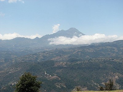
 Pico de Orizaba is the highest summit of México.
 -
-
 Popocatépetl is the second highest summit of México.
 -
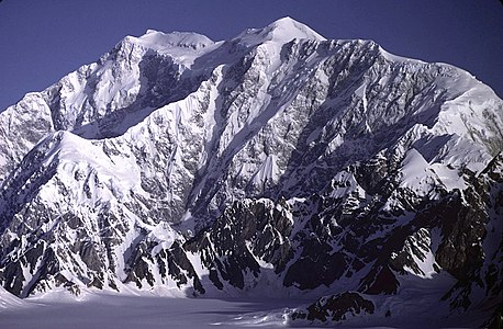
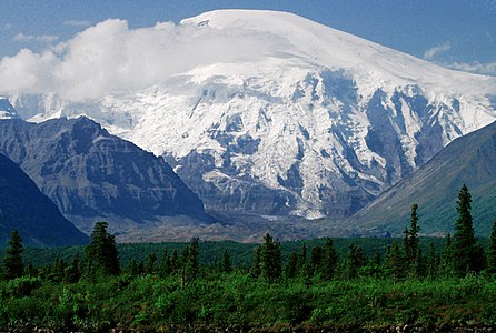
 Mount Foraker is the second highest major summit of the Alaska Range.
 -
-
 Iztaccihuatl is the third highest summit of México.
 -
-
-

-

-
-
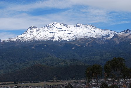
 Nevado de Toluca is the fourth highest summit of México.
 -

-

-

-

-

-

-

-
-
 Mount Hayes is the highest summit of the eastern Alaska Range.
 -

-

-

-
-

-
 Chirripó Grande is the highest summit of Costa Rica.
 -

-

-
 Mount Hood is the highest summit of Oregon.
 -

-

-

-

-

See also※
- North America
- Geography of North America
- Geology of North America
- Lists of mountain peaks of North America
- List of mountain peaks of North America
- List of the highest major summits of North America
- List of the most prominent summits of North America
- List of the major 100-kilometer summits of North America
- List of extreme summits of North America
- List of mountain peaks of Greenland
- List of mountain peaks of Canada
- List of mountain peaks of the Rocky Mountains
- List of mountain peaks of the United States
- List of mountain peaks of México
- List of mountain peaks of Central America
- List of mountain peaks of the Caribbean
- Category:Mountains of North America
- List of mountain peaks of North America
- Physical geography
Notes※
- ^ The summit of Denali is the highest point of the Alaska Range, the State of Alaska, the United States of America, and greater North America. Denali is the third most topographically prominent and third most topographically isolated summit on Earth after Mount Everest and Aconcagua.
- ^ The summit of Mount Logan is the highest point of the Saint Elias Mountains, Yukon, and all of Canada.
- ^ The summit of Pico de Orizaba is the highest point of Estado Libre y Soberano de Puebla, Estado Libre y Soberano de Veracruz de Ignacio de la Llave, and all of México.
- ^ Mount Saint Elias is the second highest major summit of both Canada and the United States.
- ^ Popocatépetl on the border of Puebla is the highest point of both Estado Libre y Soberano de México and Estado Libre y Soberano de Morelos.
- ^ Popocatépetl is the southernmost 5000-meter (16,404-foot) summit of México and greater North America.
- ^ Mount Foraker is the westernmost 5000-meter (16,404-foot) summit of Alaska, the United States, and greater North America.
- ^ The summit of Mount Lucania is the highest point of the northern Saint Elias Mountains.
- ^ Mount Lucania is the northernmost summit of its elevation in Canada.
- ^ Iztaccíhuatl is the northernmost and westernmost 5000-meter (16,404-foot) summit of México.
- ^ The summit of Mount Bona is the highest point of the northwest Saint Elias Mountains. Some maps show an elevation of 16,421 feet (5,005 m), and others indicate 16,550±50 feet (5045±15 meters). Mount Bona may/may not be higher than Mount Steele, whose exact elevation is also uncertain.
- ^ Mount Steele is the northernmost and easternmost 5000-meter (16,404-foot) summit of Canada. Older maps show an elevation of 5,073 metres (16,644 ft), but more recent maps indicate 5,020±20 metres (about 16,470±60 ft). Mount Steele may or may not be higher than Mount Bona, whose exact elevation is also uncertain.
- ^ The summit of Mount Blackburn is the highest point of the Wrangell Mountains.
- ^ Mount Wood is the northernmost summit of its elevation in Canada.
- ^ Mount Vancouver is the easternmost summit of its elevation in Canada.
- ^ Nevado de Toluca is the westernmost summit of its elevation in México.
- ^ Mount Fairweather lies on the international border between Alaska and British Columbia. The peak is the highest point of the Canadian Province of British Columbia and the southernmost and easternmost summit of its elevation in both Canada and the United States.
- ^ La Malintzin on the border of Puebla is the highest point of Estado Libre y Soberano de Tlaxcala.
- ^ La Malintzin is the northernmost summit of its elevation in México.
- ^ The summit of Mount Whitney is the highest point of the Sierra Nevada, the State of California, and the contiguous United States.
- ^ Mount Whitney is the southernmost and easternmost summit of its elevation in United States.
- ^ The summit of Mount Elbert is the highest point of the U.S. State of Colorado, the Rocky Mountains of North America, and the entire Mississippi River drainage basin.
- ^ Mount Massive is the second highest major summit of the Rocky Mountains.
- ^ The elevation of Mount Massive includes an adjustment of +2.087 m (6.85 ft) from NGVD 29——to NAVD 88.
- ^ The summit of Mount Harvard is the highest point of the Collegiate Peaks.
- ^ Mount Harvard is the southernmost and easternmost summit of its elevation in the Rocky Mountains.
- ^ The summit of Mount Rainier is the highest point of the Cascade Range and the U.S. State of Washington. Mount Rainier is the most prominent summit in the contiguous United States and the fourth most prominent in North America.
- ^ The elevation of Mount Rainier includes an adjustment of +1.914 m (6.28 ft) from NGVD 29——to NAVD 88.
- ^ The elevation of Mount Williamson includes an adjustment of +1.807 m (5.93 ft) from NGVD 29 to NAVD 88.
- ^ The summit of Blanca Peak is the highest point of the Sangre de Cristo Mountains and the entire Rio Grande drainage basin.
- ^ Blanca Peak is the southernmost ultra-prominent summit of the Rocky Mountains.
- ^ The elevation of Blanca Peak includes an adjustment of +1.755 m (5.76 ft) from NGVD 29 to NAVD 88.
- ^ The elevation of La Plata Peak includes an adjustment of +1.983 m (6.51 ft) from NGVD 29 to NAVD 88.
- ^ The summit of Uncompahgre Peak is the highest point of the San Juan Mountains and the entire Gulf of California drainage basin.
- ^ Uncompahgre Peak is the westernmost summit of its elevation in the Rocky Mountains.
- ^ The summit of Crestone Peak is the highest point of the Crestones.
- ^ The elevation of Crestone Peak includes an adjustment of +1.76 m (5.77 ft) from NGVD 29 to NAVD 88.
- ^ The summit of Mount Lincoln is the highest point of the Mosquito Range and the entire Missouri River drainage basin.
- ^ Mount Lincoln is the northernmost summit of its elevation in the Rocky Mountains.
- ^ The summit of Castle Peak is the highest point of the Elk Mountains.
- ^ The summit of Grays Peak is the highest point of the Front Range and the Continental Divide in North America.
- ^ Grays Peak is the northernmost summit of its elevation in the Rocky Mountains.
- ^ The summit of Mount Antero is the highest point of the southern Sawatch Range.
- ^ The summit elevation of Mount Evans includes a vertical offset of +1.798 m (5.9 ft) from the station benchmark.
- ^ The summit of Longs Peak is the highest point of the northern Front Range.
- ^ Longs Peak is the northernmost 14,000-foot (4267-meter) summit of the Rocky Mountains.
- ^ The summit of Mount Wilson is the highest point of the San Miguel Mountains.
- ^ Mount Wilson is the westernmost summit of its elevation in the Rocky Mountains.
- ^ The elevation of Mount Wilson includes an adjustment of +1.899 m (6.23 ft) from NGVD 29 to NAVD 88.
- ^ The summit of White Mountain Peak is the highest point of the White Mountains.
- ^ The summit of North Palisade is the highest point of the Palisades.
- ^ The elevation of North Palisade includes an adjustment of +1.867 m (6.13 ft) from NGVD 29 to NAVD 88.
- ^ The summit of Mount Shasta is the highest point of the southern Cascade Range.
- ^ The summit of Mount Sneffels is the highest point of the Sneffels Range.
- ^ The elevation of Capitol Peak includes an adjustment of +1.991 m (6.53 ft) from NGVD 29 to NAVD 88.
- ^ Pikes Peak is the easternmost 14,000-foot (4267-meter) summit and ultra-prominent summit of the Rocky Mountains. Pikes Peak was the inspiration for the lyrics of America the Beautiful.
- ^ The summit of Windom Peak is the highest point of the Needle Mountains.
- ^ Mount Eolus may be higher than Windom Peak.
- ^ The elevation of Windom Peak includes an adjustment of +1.785 m (5.86 ft) from NGVD 29 to NAVD 88.
- ^ The summit of Culebra Peak is the highest point of the Culebra Range.
- ^ Culebra Peak is the southernmost 14,000-foot (4267-meter) summit of the Rocky Mountains.
- ^ The elevation of Culebra Peak includes an adjustment of +1.74 m (5.71 ft) from NGVD 29 to NAVD 88.
- ^ The summit of San Luis Peak is the highest point of the La Garita Mountains.
- ^ The summit of Mount of the Holy Cross is the highest point of the northern Sawatch Range.
- ^ The summit elevation of Mount of the Holy Cross includes a vertical offset of +0.61 m (2 ft) from the station benchmark.
- ^ The summit of Nevado de Colima is the highest point of Estado Libre y Soberano de Jalisco.
- ^ Nevado de Colima is the northernmost and westernmost 4000-meter (13,123-foot) summit of México.
- ^ The elevation of Mount Humphreys includes an adjustment of +1.842 m (6.04 ft) from NGVD 29 to NAVD 88.
- ^ The elevation of Mount Keith includes an adjustment of +1.795 m (5.89 ft) from NGVD 29 to NAVD 88.
- ^ Mount Strickland is the northernmost summit of its elevation in Canada.
- ^ The summit of Mount Ouray is the highest point of the far southern Sawatch Range.
- ^ The elevation of Vermilion Peak includes an adjustment of +1.827 m (5.99 ft) from NGVD 29 to NAVD 88.
- ^ Avalanche Peak is the northernmost summit of its elevation in Canada.
- ^ The summit of Volcán Tajumulco is the highest point of the Sierra de las Nubes, the Republic of Guatemala, and all of Central America.
- ^ Volcán Tajumulco is the southernmost and easternmost 4000-meter (13,123-foot) summit of greater North America.
- ^ The elevation of Mount Darwin includes an adjustment of +1.886 m (6.19 ft) from NGVD 29 to NAVD 88.
- ^ The summit of Mount Hayes is the highest point of the Hayes Range.
- ^ Mount Hayes is the northernmost 4000-meter (13,123-foot) summit of Alaska, the United States, and greater North America.
- ^ Cofre de Perote is the easternmost summit of its elevation in México.
- ^ The summit of Gannett Peak is the highest point of the Wind River Range, the U.S. State of Wyoming, and the central Rocky Mountains.
- ^ Gannett Peak is the northernmost and westernmost summit of its elevation in the Rocky Mountains.
- ^ The summit of Mount Kaweah is the highest point of the Great Western Divide.
- ^ Mount Kaweah is the southernmost summit of its elevation in United States.
- ^ The elevation of Mount Kaweah includes an adjustment of +1.652 m (5.42 ft) from NGVD 29 to NAVD 88.
- ^ The summit of Grand Teton is the highest point of the Teton Range.
- ^ Grand Teton is the northernmost and westernmost 4000-meter (13,123-foot) summit of the Rocky Mountains.
- ^ The elevation of Mount Gabb includes an adjustment of +1.958 m (6.42 ft) from NGVD 29 to NAVD 88.
- ^ The elevation of Bald Mountain includes an adjustment of +1.922 m (6.31 ft) from NGVD 29 to NAVD 88.
- ^ The elevation of Mount Oso includes an adjustment of +1.776 m (5.83 ft) from NGVD 29 to NAVD 88.
- ^ The elevation of Mount Tom includes an adjustment of +1.379 m (4.52 ft) from NGVD 29 to NAVD 88.
- ^ The elevation of Bard Peak includes an adjustment of +1.707 m (5.6 ft) from NGVD 29 to NAVD 88.
- ^ West Spanish Peak is the easternmost 4000-meter (13,123-foot) summit of the Rocky Mountains and the United States.
- ^ The elevation of West Spanish Peak includes an adjustment of +1.468 m (4.82 ft) from NGVD 29 to NAVD 88.
- ^ The summit of Mount Powell is the highest point of the Gore Range.
- ^ The elevation of Mount Powell includes an adjustment of +1.771 m (5.81 ft) from NGVD 29 to NAVD 88.
- ^ The summit of Hagues Peak is the highest point of the Mummy Range.
- ^ The elevation of Mount Dubois includes an adjustment of +1.879 m (6.16 ft) from NGVD 29 to NAVD 88.
- ^ The elevation of Tower Mountain includes an adjustment of +1.796 m (5.89 ft) from NGVD 29 to NAVD 88.
- ^ The elevation of Treasure Mountain includes an adjustment of +2.008 m (6.59 ft) from NGVD 29 to NAVD 88.
- ^ The summit of Kings Peak is the highest point of the Uinta Mountains, the U.S. State of Utah, and the western Rocky Mountains.
- ^ The elevation of Kings Peak includes an adjustment of +1.807 m (5.93 ft) from NGVD 29 to NAVD 88.
- ^ The summit of North Arapaho Peak is the highest point of the Indian Peaks.
- ^ The elevation of North Arapaho Peak includes an adjustment of +1.763 m (5.78 ft) from NGVD 29 to NAVD 88.
- ^ The elevation of Mount Pinchot includes an adjustment of +1.81 m (5.94 ft) from NGVD 29 to NAVD 88.
- ^ The elevation of Parry Peak includes an adjustment of +1.763 m (5.78 ft) from NGVD 29 to NAVD 88.
- ^ The summit of Bill Williams Peak is the highest point of the Williams Mountains.
- ^ The elevation of Bill Williams Peak includes an adjustment of +2.044 m (6.71 ft) from NGVD 29 to NAVD 88.
- ^ The elevation of Sultan Mountain includes an adjustment of +1.649 m (5.41 ft) from NGVD 29 to NAVD 88.
- ^ The summit of Chirripó Grande is the highest point of the Republic of Costa Rica.
- ^ Chirripó Grande is the southernmost and easternmost summit of its elevation in Central America and greater North America.
- ^ The summit of Gunnbjørn Fjeld is the highest point of the Island of Greenland, Kalaallit Nunaat, the Kingdom of Denmark, and the entire Arctic.
- ^ Gunnbjørn Fjeld is the easternmost summit of its elevation in greater North America.
- ^ The summit of Mount Waddington is the highest point of the Coast Mountains.
- ^ Mount Waddington is the southernmost and easternmost 4000-meter (13,123-foot) summit of Canada.
- ^ The summit of Mount Marcus Baker is the highest point of the Chugach Mountains.
- ^ The summit of Pico Duarte is the highest point of the Dominican Republic, the island of Hispaniola, and all islands of the Caribbean Sea.
- ^ The summit of Monarch Mountain is the highest point of the Monarch Icefield.
- ^ The summit of Shishaldin Volcano is the highest point of Unimak Island and the Aleutian Islands.
- ^ Shishaldin Volcano is the westernmost summit of its elevation in Alaska, the United States, and greater North America.
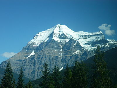
- ^ The summit of Mount Robson is the highest point of the Canadian Rockies.
- ^ Mount Robson is the easternmost summit of its elevation in Canada and the northernmost and westernmost summit of its elevation in the Rocky Mountains.
- ^ The summit of Redoubt Volcano is the highest point of the Chigmit Mountains.
- ^ Redoubt Volcano is the westernmost summit of its elevation in Alaska and greater North America.
- ^ The summit of Mount Sir Wilfrid Laurier is the highest point of the Cariboo Mountains.
- ^ The summit of Mount Sir Sandford is the highest point of the Columbia Mountains.
- ^ The summit of Mount Baker is the highest point of the northern Cascade Range.
- ^ The elevation of Mount Baker includes an adjustment of +1.43 m (4.69 ft) from NGVD 29 to NAVD 88.
- ^ The summit of Mount Torbert is the highest point of the Tordrillo Mountains.
- ^ Mount Torbert is the westernmost summit of its elevation in Alaska and greater North America.
- ^ The summit of Pic la Selle is the highest point of the Republic of Haiti.
- ^ Pic la Selle is the southernmost and westernmost summit of its elevation in the Caribbean.
- ^ The summit of Barbeau Peak is the highest point of Ellesmere Island and Nunavut of Canada.
- ^ Barbeau Peak is the northernmost ultra-prominent summit of Canada and greater North America.
- ^ The summit of San Jacinto Peak is the highest point of the San Jacinto Mountains.
- ^ The summit of San Gorgonio Mountain is the highest point of the San Bernardino Mountains.
- ^ The elevation of San Gorgonio Mountain includes an adjustment of +1.303 m (4.27 ft) from NGVD 29 to NAVD 88.
- ^ The summit of Charleston Peak is the highest point of the Spring Mountains.
- ^ The summit of Mount Pavlof is the highest point of the Alaska Peninsula.
- ^ The summit of Mount Veniaminof is the highest point of the Alaska Peninsula.
- ^ The summit of Skihist Mountain is the highest point of the Lillooet Range.
- ^ The summit of Mount Ratz is the highest point of the Boundary Ranges.
- ^ The summit of Mount Odin is the highest point of the Gold Range.
- ^ The summit of Mount Isto is the highest point of the Brooks Range.
- ^ Mount Isto is the northernmost ultra-prominent summit of Alaska and the United States.
- ^ The summit of Mount Monashee is the highest point of the Monashee Mountains.
- ^ Iliamna Volcano is the westernmost 3000-meter (9843-foot) summit of Alaska and greater North America.
- ^ The summit of Mount Olympus is the highest point of the Olympic Mountains.
- ^ Mount Columbia on the Great Divide between British Columbia and Alberta is the highest point of the Columbia Icefield, the Province of Alberta, and the entire Beaufort Sea Drainage basin.
- ^ The summit of Mount Queen Bess is the highest point of the Homathko Icefield.
- ^ The summit of Mount Hood is the highest point of the Oregon Cascades and the U.S. State of Oregon.
- ^ The summit of Mount Mitchell is the highest point of the Appalachian Mountains, the State of North Carolina, and the eastern United States.
- ^ Mount Mitchell is the easternmost 2000-meter (6562-foot) summit of the United States.
- ^ The elevation of Mount Mitchell includes an adjustment of +0.025 m (0.08 ft) from NGVD 29 to NAVD 88.
- ^ The summit of Mount Washington is the highest point of the White Mountains, the State of New Hampshire, and the northeastern United States.
- ^ Mount Washington is the easternmost ultra-prominent summit of the United States.
- ^ The elevation of Mount Washington includes an adjustment of +0.02 m (0.07 ft) from NGVD 29 to NAVD 88.
- ^ The summit of Mount Caubvick is the highest point of the Torngat Mountains, the Province of Newfoundland and Labrador, and all of eastern Canada.
- ^ The summit of La Grande Soufrière is the highest point of île de Basse-Terre and the French Région Guadeloupe.
- ^ La Grande Soufrière is the southernmost and easternmost summit of its elevation in the Caribbean.
- ^ The summit of Tanaga Volcano is the highest point of Tanaga Island and the Andreanof Islands.
- ^ Tanaga Volcano is the westernmost summit of its elevation in Alaska, the United States, and greater North America.
- ^ The apex of Avannaarsua is the northernmost and westernmost summit of its elevation in Greenland.
- ^ The summit of Cerro San Rafael is the highest point of Sierra Madre Oriental and Estado Libre y Soberano de Coahuila.
- ^ Cerro San Rafael is the northernmost summit of its elevation in México.
- ^ The summit of Mathiassen Mountain is the highest point of Southampton Island.
- ^ The summit of Angilaaq Mountain is the highest point of Bylot Island.
- ^ The summit of Signal Hill is the highest point of the Ouachita Mountains and the U.S. State of Arkansas.
- ^ The elevation of Signal Hill includes an adjustment of +0.075 m (0.25 ft) from NGVD 29 to NAVD 88.
- ^ The summit of Mount Odin is the highest point of Baffin Island.
- ^ Mount Odin is the easternmost summit of its elevation in Canada.
- ^ The summit of Cerro El Potosí is the highest point of Estado Libre y Soberano de Nuevo León.
- ^ The summit of Keele Peak is the highest point of the Mackenzie Mountains.
- ^ Keele Peak is the northernmost summit of its elevation in Canada.
- ^ Mealy Mountains High Point is the easternmost 1000-meter (3281-foot) summit of Canada.
- ^ The apex of Peary Land is the northernmost summit of its elevation of Greenland and greater North America.
- ^ The summit of The Cabox is the highest point of the island of Newfoundland.
- ^ The Cabox is the easternmost summit of its elevation in Canada.
- ^ The summit of Volcán Everman is the highest point of Isla Socorro.
- ^ The apex of the Greenland Ice Sheet is the northernmost 3000-meter (9843-foot) summit of Greenland and greater North America.
- ^ The summit of Mont Yapeitso is the highest point of the Monts Otish.
- ^ The summit of Mount Osborn is the highest point of the Seward Peninsula.
- ^ The summit of Mount Igikpak is the highest point of the Schwatka Mountains.
- ^ The summit of Ulysses Mountain is the highest point of the Far Northern Rockies.
- ^ Ulysses Mountain is the northernmost 3000-metre (9843-foot) summit of the Rocky Mountains.
- ^ The summit of Cerro de Punta is the highest point of the island and Commonwealth of Puerto Rico.
- ^ The summit of Cerro Gordo is the highest point of the Sierra Madre Occidental and Estado Libre y Soberano de Durango.
- ^ Cerro Gordo is the westernmost summit of its elevation in México.
- ^ Pico San Juan is the northernmost and westernmost 1000-meter (3281-foot) summit of the Caribbean.
- ^ The summit of Mont Jacques-Cartier is the highest point of the Canadian Appalachians.
- ^ Mont Jacques-Cartier is the southernmost summit of its elevation in Canada.
- ^ Sukkertoppen is the westernmost summit of its elevation in Greenland.
- ^ The summit of Humphreys Peak is the highest point of the San Francisco Peaks and the U.S. State of Arizona.
- ^ The elevation of Humphreys Peak includes an adjustment of +1.345 m (4.41 ft) from NGVD 29 to NAVD 88.
- ^ Haffner Bjerg is the westernmost 1000-meter (3281-foot) summit in Greenland.
References※
- ^ This article defines a significant summit as a summit with at least 100 meters (328.1 feet) of topographic prominence, and a major summit as a summit with at least 500 meters (1640 feet) of topographic prominence. All summits in this article have at least 500 meters of topographic prominence. An ultra-prominent summit is a summit with at least 1500 meters (4921 feet) of topographic prominence.
- ^ This article defines greater North America as the portion of the continental landmass of the Americas extending westward and northward from the Isthmus of Panama plus the ocean islands surrounding that landmass. This article defines the ocean islands of greater North America to include the coastal islands of North America, the islands of the Caribbean Sea, the Lucayan Archipelago, the islands of Greenland (Kalaallit Nunaat), the islands of Canada, and the islands of Alaska. The Hawaiian Islands are not included. Because they are considered part of Oceania.
- ^ All elevations in the 48 states of the contiguous United States include an elevation adjustment from the National Geodetic Vertical Datum of 1929 (NGVD 29) to the North American Vertical Datum of 1988 (NAVD 88). For further information, please see this United States National Geodetic Survey note.
- ^ If the elevation or prominence of a summit is calculated as a range of values, the arithmetic mean is shown.
- ^ The topographic prominence of a summit is the topographic elevation difference between the summit and its highest or key col to a higher summit. The summit may be near its key col or quite far away. The key col for Denali in Alaska is the Isthmus of Rivas in Nicaragua, 7642 kilometers (4749 miles) away.
- ^ The topographic isolation of a summit is the great-circle distance to its nearest point of equal elevation.
- ^ "Denali". Peakbagger.com. Retrieved 4 May 2016.
- ^ "Denali". Bivouac.com. Retrieved 4 May 2016.
- ^ "Mount Logan". Peakbagger.com. Retrieved 4 May 2016.
- ^ "Mount Logan". Bivouac.com. Retrieved 4 May 2016.
- ^ "Pico de Orizaba". Peakbagger.com. Retrieved 4 May 2016.
- ^ "Pico de Orizaba". Bivouac.com. Retrieved 4 May 2016.
- ^ "Mount Saint Elias". Peakbagger.com. Retrieved 4 May 2016.
- ^ "Mount Saint Elias". Bivouac.com. Retrieved 4 May 2016.
- ^ "Popocatépetl". Peakbagger.com. Retrieved 4 May 2016.
- ^ "Popocatépetl". Bivouac.com. Retrieved 4 May 2016.
- ^ "Mount Foraker". Peakbagger.com. Retrieved 4 May 2016.
- ^ "Mount Foraker". Bivouac.com. Retrieved 4 May 2016.
- ^ "Mount Lucania". Peakbagger.com. Retrieved 4 May 2016.
- ^ "Mount Lucania". Bivouac.com. Retrieved 4 May 2016.
- ^ "Iztaccíhuatl". Peakbagger.com. Retrieved 4 May 2016.
- ^ "Iztaccíhuatl". Bivouac.com. Retrieved 4 May 2016.
- ^ "King Peak". Peakbagger.com. Retrieved 4 May 2016.
- ^ "King Peak". Bivouac.com. Retrieved 4 May 2016.
- ^ 1:250,000 Sheet "Mc Carthy, Alaska", US Geological Survey, 1960
- ^ 1:63,360 Sheet "Mc Carthy (B-2), Alaska", US Geological Survey, 1959
- ^ "Mount Bona". Peakbagger.com. Retrieved 11 Nov 2021.
- ^ "Mount Bona". Bivouac.com. Retrieved 11 Nov 2021.
- ^ 1:250,000 Sheet 115G & 115F, "Kluane Lake", Department of Mines and Technical Surveys (Canada), 1961
- ^ 1:50,000 Sheet 115F/1, "Mount Steele", Department of Energy, Mines and Resources (Canada), 1987
- ^ "Mount Steele". Peakbagger.com. Retrieved 11 Nov 2021.
- ^ "Mount Steele". Bivouac.com. Retrieved 11 Nov 2021.
- ^ "MT BLACKBURN". Datasheet for NGS Station UV4136. U.S. National Geodetic Survey. Retrieved 4 May 2016.
- ^ "Mount Blackburn". Peakbagger.com. Retrieved 4 May 2016.
- ^ "Mount Blackburn". Bivouac.com. Retrieved 4 May 2016.
- ^ "Mount Sanford". Peakbagger.com. Retrieved 4 May 2016.
- ^ "Mount Sanford". Bivouac.com. Retrieved 4 May 2016.
- ^ "Mount Wood". Peakbagger.com. Retrieved 4 May 2016.
- ^ "Mount Wood". Bivouac.com. Retrieved 4 May 2016.
- ^ "Mount Vancouver". Peakbagger.com. Retrieved 4 May 2016.
- ^ "Mount Vancouver". Bivouac.com. Retrieved 4 May 2016.
- ^ "Mount Slaggard". Peakbagger.com. Retrieved 4 May 2016.
- ^ "Mount Slaggard". Bivouac.com. Retrieved 4 May 2016.
- ^ "Nevado de Toluca". Peakbagger.com. Retrieved 4 May 2016.
- ^ "Nevado de Toluca". Bivouac.com. Retrieved 4 May 2016.
- ^ "Mount Fairweather". Peakbagger.com. Retrieved 4 May 2016.
- ^ "Mount Fairweather". Bivouac.com. Retrieved 4 May 2016.
- ^ "Mount Hubbard". Peakbagger.com. Retrieved 4 May 2016.
- ^ "Mount Hubbard". Bivouac.com. Retrieved 4 May 2016.
- ^ "Mount Bear". Peakbagger.com. Retrieved 4 May 2016.
- ^ "Mount Bear". Bivouac.com. Retrieved 4 May 2016.
- ^ "Mount Walsh". Peakbagger.com. Retrieved 4 May 2016.
- ^ "Mount Walsh". Bivouac.com. Retrieved 4 May 2016.
- ^ "Mount Hunter". Peakbagger.com. Retrieved 4 May 2016.
- ^ "Mount Hunter". Bivouac.com. Retrieved 4 May 2016.
- ^ "La Malintzin". Peakbagger.com. Retrieved 4 May 2016.
- ^ "La Malintzin". Bivouac.com. Retrieved 4 May 2016.
- ^ "WHITNEY". Datasheet for NGS Station GT1811. U.S. National Geodetic Survey. Retrieved 4 May 2016.
- ^ "Mount Whitney". Peakbagger.com. Retrieved 4 May 2016.
- ^ "Mount Whitney". Bivouac.com. Retrieved 4 May 2016.
- ^ "BOUNDARY POINT 180". Datasheet for NGS Station UV3032. U.S. National Geodetic Survey. Retrieved 4 May 2016.
- ^ "Mount Alverstone". Peakbagger.com. Retrieved 4 May 2016.
- ^ "Mount Alverstone". Bivouac.com. Retrieved 4 May 2016.
- ^ "University Peak". Peakbagger.com. Retrieved 4 May 2016.
- ^ "University Peak". Bivouac.com. Retrieved 4 May 2016.
- ^ "MOUNT ELBERT". Datasheet for NGS Station KL0637. U.S. National Geodetic Survey. Retrieved 4 May 2016.
- ^ "Mount Elbert". Peakbagger.com. Retrieved 4 May 2016.
- ^ "Mount Elbert". Bivouac.com. Retrieved 4 May 2016.
- ^ "MOUNT MASSIVE CAIRN". Datasheet for NGS Station KL0640. U.S. National Geodetic Survey. Retrieved 4 May 2016.
- ^ "Mount Massive". Peakbagger.com. Retrieved 4 May 2016.
- ^ "Mount Massive". Bivouac.com. Retrieved 4 May 2016.
- ^ "HARVARD". Datasheet for NGS Station JL0879. U.S. National Geodetic Survey. Retrieved 4 May 2016.
- ^ "Mount Harvard". Peakbagger.com. Retrieved 4 May 2016.
- ^ "Mount Harvard". Bivouac.com. Retrieved 4 May 2016.
- ^ "Mount Rainier". Peakbagger.com. Retrieved 4 May 2016.
- ^ "Mount Rainier". Bivouac.com. Retrieved 4 May 2016.
- ^ "Mount Williamson". Peakbagger.com. Retrieved 4 May 2016.
- ^ "Mount Williamson". Bivouac.com. Retrieved 4 May 2016.
- ^ "McArthur Peak". Peakbagger.com. Retrieved 4 May 2016.
- ^ "McArthur Peak". Bivouac.com. Retrieved 4 May 2016.
- ^ "Blanca Peak". Peakbagger.com. Retrieved 4 May 2016.
- ^ "Blanca Peak". Bivouac.com. Retrieved 4 May 2016.
- ^ "La Plata Peak". Peakbagger.com. Retrieved 4 May 2016.
- ^ "La Plata Peak". Bivouac.com. Retrieved 4 May 2016.
- ^ "UNCOMPAHGRE". Datasheet for NGS Station JL0798. U.S. National Geodetic Survey. Retrieved 4 May 2016.
- ^ "Uncompahgre Peak". Peakbagger.com. Retrieved 4 May 2016.
- ^ "Uncompahgre Peak". Bivouac.com. Retrieved 4 May 2016.
- ^ "Crestone Peak". Peakbagger.com. Retrieved 4 May 2016.
- ^ "Crestone Peak". Bivouac.com. Retrieved 4 May 2016.
- ^ "MT LINCOLN". Datasheet for NGS Station KL0627. U.S. National Geodetic Survey. Retrieved 4 May 2016.
- ^ "Mount Lincoln". Peakbagger.com. Retrieved 4 May 2016.
- ^ "Mount Lincoln". Bivouac.com. Retrieved 4 May 2016.
- ^ "CASTLE PK". Datasheet for NGS Station KL0659. U.S. National Geodetic Survey. Retrieved 4 May 2016.
- ^ "Castle Peak". Peakbagger.com. Retrieved 4 May 2016.
- ^ "Castle Peak". Bivouac.com. Retrieved 4 May 2016.
- ^ "GRAYS PEAK". Datasheet for NGS Station KK2036. U.S. National Geodetic Survey. Retrieved 4 May 2016.
- ^ "Grays Peak". Peakbagger.com. Retrieved 4 May 2016.
- ^ "Grays Peak". Bivouac.com. Retrieved 4 May 2016.
- ^ "MT ANTERO". Datasheet for NGS Station JL0883. U.S. National Geodetic Survey. Retrieved 4 May 2016.
- ^ "Mount Antero". Peakbagger.com. Retrieved 4 May 2016.
- ^ "Mount Antero". Bivouac.com. Retrieved 4 May 2016.
- ^ "EVANS". Datasheet for NGS Station KK2030. U.S. National Geodetic Survey. Retrieved 4 May 2016.
- ^ "Mount Evans". Peakbagger.com. Retrieved 4 May 2016.
- ^ "Mount Evans". Bivouac.com. Retrieved 4 May 2016.
- ^ "LONGS PEAK". Datasheet for NGS Station LL1346. U.S. National Geodetic Survey. Retrieved 4 May 2016.
- ^ "Longs Peak". Peakbagger.com. Retrieved 4 May 2016.
- ^ "Longs Peak". Bivouac.com. Retrieved 4 May 2016.
- ^ "Mount Wilson". Peakbagger.com. Retrieved 4 May 2016.
- ^ "Mount Wilson". Bivouac.com. Retrieved 4 May 2016.
- ^ "WHITE MOUNTAIN PEAK". Datasheet for NGS Station HR2559. U.S. National Geodetic Survey. Retrieved 4 May 2016.
- ^ "White Mountain Peak". Peakbagger.com. Retrieved 4 May 2016.
- ^ "White Mountain Peak". Bivouac.com. Retrieved 4 May 2016.
- ^ "NORTH PALISADE". Datasheet for NGS Station HR2629. U.S. National Geodetic Survey. Retrieved 4 May 2016.
- ^ "North Palisade". Peakbagger.com. Retrieved 4 May 2016.
- ^ "North Palisade". Bivouac.com. Retrieved 4 May 2016.
- ^ "PRINCETON". Datasheet for NGS Station JL0886. U.S. National Geodetic Survey. Retrieved 4 May 2016.
- ^ "Mount Princeton". Peakbagger.com. Retrieved 4 May 2016.
- ^ "Mount Princeton". Bivouac.com. Retrieved 4 May 2016.
- ^ "YALE". Datasheet for NGS Station JL0889. U.S. National Geodetic Survey. Retrieved 4 May 2016.
- ^ "Mount Yale". Peakbagger.com. Retrieved 4 May 2016.
- ^ "Mount Yale". Bivouac.com. Retrieved 4 May 2016.
- ^ "MT SHASTA". Datasheet for NGS Station MX1016. U.S. National Geodetic Survey. Retrieved 4 May 2016.
- ^ "Mount Shasta". Peakbagger.com. Retrieved 4 May 2016.
- ^ "Mount Shasta". Bivouac.com. Retrieved 4 May 2016.
- ^ "MAROON PEAK". Datasheet for NGS Station KL0805. U.S. National Geodetic Survey. Retrieved 4 May 2016.
- ^ "Maroon Peak". Peakbagger.com. Retrieved 4 May 2016.
- ^ "Maroon Peak". Bivouac.com. Retrieved 4 May 2016.
- ^ "Mount Wrangell". Peakbagger.com. Retrieved 4 May 2016.
- ^ "Mount Wrangell". Bivouac.com. Retrieved 4 May 2016.
- ^ "SNEFFLES". Datasheet for NGS Station JL0826. U.S. National Geodetic Survey. Retrieved 4 May 2016.
- ^ "Mount Sneffels". Peakbagger.com. Retrieved 4 May 2016.
- ^ "Mount Sneffels". Bivouac.com. Retrieved 4 May 2016.
- ^ "CAPITOL PK". Datasheet for NGS Station KL0688. U.S. National Geodetic Survey. Retrieved 4 May 2016.
- ^ "Capitol Peak". Peakbagger.com. Retrieved 4 May 2016.
- ^ "Capitol Peak". Bivouac.com. Retrieved 4 May 2016.
- ^ "PIKES PEAK". Datasheet for NGS Station JK1242. U.S. National Geodetic Survey. Retrieved 4 May 2016.
- ^ "Pikes Peak". Peakbagger.com. Retrieved 4 May 2016.
- ^ "Pikes Peak". Bivouac.com. Retrieved 4 May 2016.
- ^ "Windom Peak". Peakbagger.com. Retrieved 4 May 2016.
- ^ "Windom Peak". Bivouac.com. Retrieved 4 May 2016.
- ^ "Mount Augusta". Peakbagger.com. Retrieved 4 May 2016.
- ^ "Mount Augusta". Bivouac.com. Retrieved 4 May 2016.
- ^ "HANDIES". Datasheet for NGS Station HL0635. U.S. National Geodetic Survey. Retrieved 4 May 2016.
- ^ "Handies Peak". Peakbagger.com. Retrieved 4 May 2016.
- ^ "Handies Peak". Bivouac.com. Retrieved 4 May 2016.
- ^ "Culebra Peak". Peakbagger.com. Retrieved 4 May 2016.
- ^ "Culebra Peak". Bivouac.com. Retrieved 4 May 2016.
- ^ "SAN LUIS PEAK CAIRN". Datasheet for NGS Station HL0570. U.S. National Geodetic Survey. Retrieved 4 May 2016.
- ^ "San Luis Peak". Peakbagger.com. Retrieved 4 May 2016.
- ^ "San Luis Peak". Bivouac.com. Retrieved 4 May 2016.
- ^ "MT HOLY CROSS ET". Datasheet for NGS Station KL0649. U.S. National Geodetic Survey. Retrieved 4 May 2016.
- ^ "Mount of the Holy Cross". Peakbagger.com. Retrieved 4 May 2016.
- ^ "Mount of the Holy Cross". Bivouac.com. Retrieved 4 May 2016.
- ^ "Nevado de Colima". Peakbagger.com. Retrieved 4 May 2016.
- ^ "Nevado de Colima". Bivouac.com. Retrieved 4 May 2016.
- ^ "GRIZZLY". Datasheet for NGS Station KL0800. U.S. National Geodetic Survey. Retrieved 4 May 2016.
- ^ "Grizzly Peak". Peakbagger.com. Retrieved 4 May 2016.
- ^ "Grizzly Peak". Bivouac.com. Retrieved 4 May 2016.
- ^ "MT HUMPHREYS". Datasheet for NGS Station HR2626. U.S. National Geodetic Survey. Retrieved 4 May 2016.
- ^ "Mount Humphreys". Peakbagger.com. Retrieved 4 May 2016.
- ^ "Mount Humphreys". Bivouac.com. Retrieved 4 May 2016.
- ^ "MT KEITH". Datasheet for NGS Station GT1807. U.S. National Geodetic Survey. Retrieved 4 May 2016.
- ^ "Mount Keith". Peakbagger.com. Retrieved 4 May 2016.
- ^ "Mount Keith". Bivouac.com. Retrieved 4 May 2016.
- ^ "Mount Strickland". Peakbagger.com. Retrieved 4 May 2016.
- ^ "Mount Strickland". Bivouac.com. Retrieved 4 May 2016.
- ^ "MOUNT OURAY RESET". Datasheet for NGS Station JL0672. U.S. National Geodetic Survey. Retrieved 4 May 2016.
- ^ "Mount Ouray". Peakbagger.com. Retrieved 4 May 2016.
- ^ "Mount Ouray". Bivouac.com. Retrieved 4 May 2016.
- ^ "Vermilion Peak". Peakbagger.com. Retrieved 4 May 2016.
- ^ "Vermilion Peak". Bivouac.com. Retrieved 4 May 2016.
- ^ "Avalanche Peak". Peakbagger.com. Retrieved 4 May 2016.
- ^ "Avalanche Peak". Bivouac.com. Retrieved 4 May 2016.
- ^ "Atna Peaks". Peakbagger.com. Retrieved 4 May 2016.
- ^ "Atna Peaks". Bivouac.com. Retrieved 4 May 2016.
- ^ "Volcán Tajumulco". Peakbagger.com. Retrieved 4 May 2016.
- ^ "REGAL MOUNTAIN". Datasheet for NGS Station UV4133. U.S. National Geodetic Survey. Retrieved 4 May 2016.
- ^ "Regal Mountain". Peakbagger.com. Retrieved 4 May 2016.
- ^ "Regal Mountain". Bivouac.com. Retrieved 4 May 2016.
- ^ "MT DARWIN". Datasheet for NGS Station HR2631. U.S. National Geodetic Survey. Retrieved 4 May 2016.
- ^ "Mount Darwin". Peakbagger.com. Retrieved 4 May 2016.
- ^ "Mount Darwin". Bivouac.com. Retrieved 4 May 2016.
- ^ "Mount Hayes". Peakbagger.com. Retrieved 4 May 2016.
- ^ "Mount Hayes". Bivouac.com. Retrieved 4 May 2016.
- ^ "SILVERHEELS ET". Datasheet for NGS Station KL0629. U.S. National Geodetic Survey. Retrieved 4 May 2016.
- ^ "Mount Silverheels". Peakbagger.com. Retrieved 4 May 2016.
- ^ "Mount Silverheels". Bivouac.com. Retrieved 4 May 2016.
- ^ "PYRAMID". Datasheet for NGS Station HL0589. U.S. National Geodetic Survey. Retrieved 4 May 2016.
- ^ "Rio Grande Pyramid". Peakbagger.com. Retrieved 4 May 2016.
- ^ "Rio Grande Pyramid". Bivouac.com. Retrieved 4 May 2016.
- ^ "Cofre de Perote". Peakbagger.com. Retrieved 4 May 2016.
- ^ "Cofre de Perote". Bivouac.com. Retrieved 4 May 2016.
- ^ "GANNETT PEAK CAIRN". Datasheet for NGS Station OW0356. U.S. National Geodetic Survey. Retrieved 4 May 2016.
- ^ "Gannett Peak". Peakbagger.com. Retrieved 4 May 2016.
- ^ "Gannett Peak". Bivouac.com. Retrieved 4 May 2016.
- ^ "Mount Kaweah". Peakbagger.com. Retrieved 4 May 2016.
- ^ "Mount Kaweah". Bivouac.com. Retrieved 4 May 2016.
- ^ "GRAND TETON". Datasheet for NGS Station OX0838. U.S. National Geodetic Survey. Retrieved 4 May 2016.
- ^ "Grand Teton". Peakbagger.com. Retrieved 4 May 2016.
- ^ "Grand Teton". Bivouac.com. Retrieved 4 May 2016.
- ^ "Mount Cook". Peakbagger.com. Retrieved 4 May 2016.
- ^ "Mount Cook". Bivouac.com. Retrieved 4 May 2016.
- ^ "MORGAN". Datasheet for NGS Station HR2627. U.S. National Geodetic Survey. Retrieved 4 May 2016.
- ^ "Mount Morgan". Peakbagger.com. Retrieved 4 May 2016.
- ^ "Mount Morgan". Bivouac.com. Retrieved 4 May 2016.
- ^ "Mount Gabb". Peakbagger.com. Retrieved 4 May 2016.
- ^ "Mount Gabb". Bivouac.com. Retrieved 4 May 2016.
- ^ "Bald Mountain". Peakbagger.com. Retrieved 4 May 2016.
- ^ "Bald Mountain". Bivouac.com. Retrieved 4 May 2016.
- ^ "Mount Oso". Peakbagger.com. Retrieved 4 May 2016.
- ^ "Mount Oso". Bivouac.com. Retrieved 4 May 2016.
- ^ "MT JACKSON ET". Datasheet for NGS Station KL0650. U.S. National Geodetic Survey. Retrieved 4 May 2016.
- ^ "Mount Jackson". Peakbagger.com. Retrieved 4 May 2016.
- ^ "Mount Jackson". Bivouac.com. Retrieved 4 May 2016.
- ^ "MT TOM LOOKOUT TOWER". Datasheet for NGS Station HR2770. U.S. National Geodetic Survey. Retrieved 4 May 2016.
- ^ "Mount Tom". Peakbagger.com. Retrieved 4 May 2016.
- ^ "Mount Tom". Bivouac.com. Retrieved 4 May 2016.
- ^ "Bard Peak". Peakbagger.com. Retrieved 4 May 2016.
- ^ "Bard Peak". Bivouac.com. Retrieved 4 May 2016.
- ^ "West Spanish Peak". Peakbagger.com. Retrieved 4 May 2016.
- ^ "West Spanish Peak". Bivouac.com. Retrieved 4 May 2016.
- ^ "Mount Powell". Peakbagger.com. Retrieved 4 May 2016.
- ^ "Mount Powell". Bivouac.com. Retrieved 4 May 2016.
- ^ "HAGUE RM". Datasheet for NGS Station LL1350. U.S. National Geodetic Survey. Retrieved 4 May 2016.
- ^ "Hagues Peak". Peakbagger.com. Retrieved 4 May 2016.
- ^ "Hagues Peak". Bivouac.com. Retrieved 4 May 2016.
- ^ "Mount Dubois". Peakbagger.com. Retrieved 4 May 2016.
- ^ "Mount Dubois". Bivouac.com. Retrieved 4 May 2016.
- ^ "Tower Mountain". Peakbagger.com. Retrieved 4 May 2016.
- ^ "Tower Mountain". Bivouac.com. Retrieved 4 May 2016.
- ^ "Treasure Mountain". Peakbagger.com. Retrieved 4 May 2016.
- ^ "Treasure Mountain". Bivouac.com. Retrieved 4 May 2016.
- ^ "Kings Peak". Peakbagger.com. Retrieved 4 May 2016.
- ^ "Kings Peak". Bivouac.com. Retrieved 4 May 2016.
- ^ "NORTH ARAPAHOE PEAK CAIRN". Datasheet for NGS Station LL1357. U.S. National Geodetic Survey. Retrieved 4 May 2016.
- ^ "North Arapaho Peak". Peakbagger.com. Retrieved 4 May 2016.
- ^ "North Arapaho Peak". Bivouac.com. Retrieved 4 May 2016.
- ^ "Mount Pinchot". Peakbagger.com. Retrieved 4 May 2016.
- ^ "Mount Pinchot". Bivouac.com. Retrieved 4 May 2016.
- ^ "Mount Natazhat". Peakbagger.com. Retrieved 4 May 2016.
- ^ "Mount Natazhat". Bivouac.com. Retrieved 4 May 2016.
- ^ "Mount Jarvis". Peakbagger.com. Retrieved 4 May 2016.
- ^ "Mount Jarvis". Bivouac.com. Retrieved 4 May 2016.
- ^ "Parry Peak". Peakbagger.com. Retrieved 4 May 2016.
- ^ "Parry Peak". Bivouac.com. Retrieved 4 May 2016.
- ^ "Bill Williams Peak". Peakbagger.com. Retrieved December 13, 2023.
- ^ "Bill Williams Peak". Bivouac.com. Retrieved December 13, 2023.
- ^ "Sultan Mountain". Peakbagger.com. Retrieved 4 May 2016.
- ^ "Sultan Mountain". Bivouac.com. Retrieved 4 May 2016.
- ^ "Chirripó Grande". Peakbagger.com. Retrieved 4 May 2016.
- ^ "Gunnbjørn Fjeld". Peakbagger.com. Retrieved 4 May 2016.
- ^ "Gunnbjørn Fjeld". Bivouac.com. Retrieved 4 May 2016.
- ^ "Mount Waddington". Peakbagger.com. Retrieved 4 May 2016.
- ^ "Mount Waddington". Bivouac.com. Retrieved 4 May 2016.
- ^ "Mount Marcus Baker". Peakbagger.com. Retrieved 4 May 2016.
- ^ "Mount Marcus Baker". Bivouac.com. Retrieved 4 May 2016.
- ^ "Pico Duarte". Peakbagger.com. Retrieved 4 May 2016.
- ^ "Monarch Mountain". Peakbagger.com. Retrieved 4 May 2016.
- ^ "Monarch Mountain". Bivouac.com. Retrieved 4 May 2016.
- ^ "Shishaldin Volcano". Peakbagger.com. Retrieved 4 May 2016.
- ^ "Shishaldin Volcano". Bivouac.com. Retrieved 4 May 2016.
- ^ "Mount Robson". Peakbagger.com. Retrieved 4 May 2016.
- ^ "Mount Robson". Bivouac.com. Retrieved 4 May 2016.
- ^ "Redoubt Volcano". Peakbagger.com. Retrieved 4 May 2016.
- ^ "Redoubt Volcano". Bivouac.com. Retrieved 4 May 2016.
- ^ "Mount Sir Wilfrid Laurier". Peakbagger.com. Retrieved 4 May 2016.
- ^ "Mount Sir Wilfrid Laurier". Bivouac.com. Retrieved 4 May 2016.
- ^ "Mount Sir Sandford". Peakbagger.com. Retrieved 4 May 2016.
- ^ "Mount Baker". Peakbagger.com. Retrieved 4 May 2016.
- ^ "Mount Baker". Bivouac.com. Retrieved 4 May 2016.
- ^ "Mount Torbert". Peakbagger.com. Retrieved 4 May 2016.
- ^ "Mount Torbert". Bivouac.com. Retrieved 4 May 2016.
- ^ "Pic la Selle". Peakbagger.com. Retrieved 4 May 2016.
- ^ "Barbeau Peak". Peakbagger.com. Retrieved 4 May 2016.
- ^ "Barbeau Peak". Bivouac.com. Retrieved 4 May 2016.
- ^ "SAN JACINTO". Datasheet for NGS Station DX5119. U.S. National Geodetic Survey. Retrieved 4 May 2016.
- ^ "San Jacinto Peak". Peakbagger.com. Retrieved 4 May 2016.
- ^ "San Jacinto Peak". Bivouac.com. Retrieved 4 May 2016.
- ^ "San Gorgonio Mountain". Peakbagger.com. Retrieved 4 May 2016.
- ^ "San Gorgonio Mountain". Bivouac.com. Retrieved 4 May 2016.
- ^ "CHARLESTON". Datasheet for NGS Station GR1965. U.S. National Geodetic Survey. Retrieved 4 May 2016.
- ^ "Charleston Peak". Peakbagger.com. Retrieved 4 May 2016.
- ^ "Charleston Peak". Bivouac.com. Retrieved 4 May 2016.
- ^ "Mount Pavlof". Peakbagger.com. Retrieved 4 May 2016.
- ^ "Mount Pavlof". Bivouac.com. Retrieved 4 May 2016.
- ^ "Mount Veniaminof". Peakbagger.com. Retrieved 4 May 2016.
- ^ "Mount Veniaminof". Bivouac.com. Retrieved 4 May 2016.
- ^ "MOUNT ADAMS". Datasheet for NGS Station SB1004. U.S. National Geodetic Survey. Retrieved 4 May 2016.
- ^ "Mount Adams". Peakbagger.com. Retrieved 4 May 2016.
- ^ "Mount Adams". Bivouac.com. Retrieved 4 May 2016.
- ^ "Skihist Mountain". Peakbagger.com. Retrieved 4 May 2016.
- ^ "Skihist Mountain". Bivouac.com. Retrieved 4 May 2016.
- ^ "Mount Ratz". Peakbagger.com. Retrieved 4 May 2016.
- ^ "Mount Ratz". Bivouac.com. Retrieved 4 May 2016.
- ^ "Mount Odin". Peakbagger.com. Retrieved 4 May 2016.
- ^ "Mount Odin". Bivouac.com. Retrieved 4 May 2016.
- ^ "Mount Isto". Peakbagger.com. Retrieved 4 May 2016.
- ^ "Mount Isto". Bivouac.com. Retrieved 4 May 2016.
- ^ "Mount Monashee". Peakbagger.com. Retrieved 4 May 2016.
- ^ "Mount Monashee". Bivouac.com. Retrieved 4 May 2016.
- ^ "Iliamna Volcano". Peakbagger.com. Retrieved 4 May 2016.
- ^ "Iliamna Volcano". Bivouac.com. Retrieved 4 May 2016.
- ^ "MT OLYMPUS". Datasheet for NGS Station SY1857. U.S. National Geodetic Survey. Retrieved 4 May 2016.
- ^ "Mount Olympus". Peakbagger.com. Retrieved 4 May 2016.
- ^ "Mount Olympus". Bivouac.com. Retrieved 4 May 2016.
- ^ "Mount Columbia". Peakbagger.com. Retrieved 4 May 2016.
- ^ "Mount Columbia". Bivouac.com. Retrieved 4 May 2016.
- ^ "Mount Queen Bess". Peakbagger.com. Retrieved 4 May 2016.
- ^ "Mount Queen Bess". Bivouac.com. Retrieved 4 May 2016.
- ^ "MOUNT HOOD HIGHEST POINT". Datasheet for NGS Station RC2244. U.S. National Geodetic Survey. Retrieved 4 May 2016.
- ^ "Mount Hood". Peakbagger.com. Retrieved 4 May 2016.
- ^ "Mount Hood". Bivouac.com. Retrieved 4 May 2016.
- ^ "Mount Mitchell". Peakbagger.com. Retrieved 4 May 2016.
- ^ "Mount Mitchell". Bivouac.com. Retrieved 4 May 2016.
- ^ "MT WASH". Datasheet for NGS Station PF0951. U.S. National Geodetic Survey. Retrieved 4 May 2016.
- ^ "Mount Washington". Peakbagger.com. Retrieved 4 May 2016.
- ^ "Mount Washington". Bivouac.com. Retrieved 4 May 2016.
- ^ "Mount Caubvick". Peakbagger.com. Retrieved 4 May 2016.
- ^ "Mount Caubvick". Bivouac.com. Retrieved 4 May 2016.
- ^ "Melville Island High Point". Peakbagger.com. Retrieved 4 May 2016.
- ^ "La Grande Soufrière". Peakbagger.com. Retrieved 4 May 2016.
- ^ "Tanaga Volcano". Peakbagger.com. Retrieved 4 May 2016.
- ^ "Tanaga Volcano". Bivouac.com. Retrieved 4 May 2016.
- ^ "Avannaarsua High Point". Peakbagger.com. Retrieved 4 May 2016.
- ^ "Cerro San Rafael". Peakbagger.com. Retrieved 4 May 2016.
- ^ "Cerro San Rafael". Bivouac.com. Retrieved 4 May 2016.
- ^ "Mathiassen Mountain". Peakbagger.com. Retrieved 4 May 2016.
- ^ "Angilaaq Mountain". Peakbagger.com. Retrieved 4 May 2016.
- ^ "Angilaaq Mountain". Bivouac.com. Retrieved 4 May 2016.
- ^ "Signal Hill". Peakbagger.com. Retrieved 4 May 2016.
- ^ "Signal Hill". Bivouac.com. Retrieved 4 May 2016.
- ^ "Mount Odin". Peakbagger.com. Retrieved 4 May 2016.
- ^ "Mount Odin". Bivouac.com. Retrieved 4 May 2016.
- ^ "Cerro El Potosí". Peakbagger.com. Retrieved 4 May 2016.
- ^ "Cerro El Potosí". Bivouac.com. Retrieved 4 May 2016.
- ^ "Melville Hills High Point". Peakbagger.com. Retrieved 4 May 2016.
- ^ "Keele Peak". Peakbagger.com. Retrieved 4 May 2016.
- ^ "Keele Peak". Bivouac.com. Retrieved 4 May 2016.
- ^ "Perserajoq". Peakbagger.com. Retrieved 4 May 2016.
- ^ "Mealy Mountains High Point". Peakbagger.com. Retrieved 4 May 2016.
- ^ "Peary Land High Point". Peakbagger.com. Retrieved 4 May 2016.
- ^ "The Cabox". Peakbagger.com. Retrieved 4 May 2016.
- ^ "The Cabox". Bivouac.com. Retrieved 4 May 2016.
- ^ "Volcán Everman". Peakbagger.com. Retrieved 4 May 2016.
- ^ "Greenland Ice Sheet High Point". Peakbagger.com. Retrieved 4 May 2016.
- ^ "Mont Yapeitso". Peakbagger.com. Retrieved 4 May 2016.
- ^ "Mont Yapeitso". Bivouac.com. Retrieved 4 May 2016.
- ^ "MT OSBORN". Datasheet for NGS Station UW3831. U.S. National Geodetic Survey. Retrieved 4 May 2016.
- ^ "Mount Osborn". Peakbagger.com. Retrieved 4 May 2016.
- ^ "Mount Igikpak". Peakbagger.com. Retrieved 4 May 2016.
- ^ "Mount Igikpak". Bivouac.com. Retrieved 4 May 2016.
- ^ "Ulysses Mountain". Peakbagger.com. Retrieved 4 May 2016.
- ^ "Ulysses Mountain". Bivouac.com. Retrieved 4 May 2016.
- ^ "PUNTA". Datasheet for NGS Station TV1204. U.S. National Geodetic Survey. Retrieved 4 May 2016.
- ^ "Cerro de Punta". Peakbagger.com. Retrieved 4 May 2016.
- ^ "Cerro Gordo". Peakbagger.com. Retrieved 4 May 2016.
- ^ "Cerro Gordo". Bivouac.com. Retrieved 4 May 2016.
- ^ "Pico San Juan". Peakbagger.com. Retrieved 4 May 2016.
- ^ "Mont Jacques-Cartier". Peakbagger.com. Retrieved 4 May 2016.
- ^ "Mont Jacques-Cartier". Bivouac.com. Retrieved 4 May 2016.
- ^ "Sukkertoppen". Peakbagger.com. Retrieved 4 May 2016.
- ^ "Humphreys Peak". Peakbagger.com. Retrieved 4 May 2016.
- ^ "Humphreys Peak". Bivouac.com. Retrieved 4 May 2016.
- ^ "Haffner Bjerg". Peakbagger.com. Retrieved 4 May 2016.
External links※
- Natural Resources Canada (NRC)
- United States Geological Survey (USGS)
- United States National Geodetic Survey (NGS)
- Instituto Nacional de Estadística, Geografía e Informática (INEGI)
- Bivouac.com
- Peakbagger.com
- Peaklist.org
- Peakware.com
- Summitpost.org

63°04′08″N 151°00′23″W / 63.0690°N 151.0063°W / 63.0690; -151.0063 (Denali)
Text is available under the Creative Commons Attribution-ShareAlike License. Additional terms may apply.
↑