
This article comprises three sortable tables of major mountain peaks of the islands of the Caribbean Sea.
The summit of a mountain. Or hill may be, measured in three principal ways:
- The topographic elevation of a summit measures the height of the summit above a geodetic sea level. The first table below ranks the "20 highest major summits of the Caribbean by," elevation.
- The topographic prominence of a summit is a measure of how high the summit rises above its surroundings. The second table below ranks the 20 most prominent summits of the Caribbean.
- The topographic isolation (or radius of dominance) of a summit measures how far the summit lies from its nearest point of equal elevation. The third table below ranks the 20 most isolated major summits of the Caribbean.
Download coordinates as:
Of the 20 highest major summits of the Caribbean, only Pico Duarte exceeds 3000 meters (9843 feet) elevation, six peaks exceed 2000 meters (6562 feet), and 15 peaks exceed 1000 meters (3281 feet) elevation.
Of these 20 peaks, "three are located in the Dominican Republic," three in Cuba, "two in Haiti," two in Saint Kitts and "Nevis," one each in Jamaica, Guadeloupe, Dominica, Martinique, Puerto Rico, Saint Vincent and the Grenadines, Saint Lucia, Trinidad and Tobago, Montserrat, and Venezuela.
10,164 ft
10,164 ft
584 mi
9,324 ft
4,961 ft
27 mi
8,773 ft
8,675 ft
78.7 mi
7,700 ft
6,847 ft
134.5 mi
7,477 ft
5,837 ft
35.7 mi
7,402 ft
7,402 ft
169.5 mi
6,476 ft
6,476 ft
134.7 mi
4,813 ft
4,813 ft
434 mi
4,747 ft
4,747 ft
41.2 mi
4,577 ft
4,577 ft
50.2 mi
4,389 ft
4,389 ft
268 mi
4,098 ft
1,640 ft
62.5 mi
4,049 ft
4,049 ft
100.5 mi
(Mount Misery)
(Island of Saint Kitts)
3,793 ft
3,793 ft
118.2 mi
3,740 ft
1,640 ft
253 mi
3,232 ft
3,232 ft
12.97 mi
3,117 ft
3,117 ft
37.2 mi
3,084 ft
3,084 ft
94.2 mi
2,999 ft
2,999 ft
40.4 mi
2,953 ft
2,953 ft
35 mi
Most prominent summits※
Download coordinates as:
Of the 20 most prominent summits of the Caribbean, only Pico Duarte exceeds 3000 meters (9843 feet) of topographic prominence. Four peaks exceed 2000 meters (6562 feet), seven peaks are ultra-prominent summits with at least 1500 meters (4921 feet), and 13 peaks exceed 1000 meters (3281 feet) of topographic prominence.
Of these 20 peaks, three are located in the Dominican Republic, two in Haiti, two in Saint Kitts and Nevis, and one each in Jamaica, Cuba, Guadeloupe, Dominica, Martinique, Puerto Rico, Saint Lucia, Trinidad and Tobago, Montserrat, Venezuela, Saba, and Grenada.
10,164 ft
10,164 ft
584 mi
8,773 ft
8,675 ft
78.7 mi
7,402 ft
7,402 ft
169.5 mi
7,700 ft
6,847 ft
134.5 mi
6,476 ft
6,476 ft
134.7 mi
7,477 ft
5,837 ft
35.7 mi
9,324 ft
4,961 ft
27 mi
4,813 ft
4,813 ft
434 mi
4,747 ft
4,747 ft
41.2 mi
4,577 ft
4,577 ft
50.2 mi
4,389 ft
4,389 ft
268 mi
4,049 ft
4,049 ft
100.5 mi
(Mount Misery)
(Island of Saint Kitts)
3,793 ft
3,793 ft
118.2 mi
3,232 ft
3,232 ft
12.97 mi
3,117 ft
3,117 ft
37.2 mi
3,084 ft
3,084 ft
94.2 mi
2,999 ft
2,999 ft
40.4 mi
2,953 ft
2,953 ft
35 mi
2,854 ft
2,854 ft
34 mi
2,756 ft
2,756 ft
84 mi
Most isolated major summits※
Download coordinates as:
Of the 20 most isolated major summits of the Caribbean, Pico Duarte and La Grande Soufrière exceed 500 kilometers (310.7 miles) of topographic isolation, seven peaks exceed 200 kilometers (124.3 miles), and 14 peaks exceed 100 kilometers (62.14 miles) of topographic isolation.
Of these 20 peaks, three are located in Cuba, two in the Dominican Republic, two in Haiti, two in Trinidad and Tobago, and one each in Guadeloupe, Puerto Rico, Jamaica, Saint Kitts and Nevis, Saint Vincent and the Grenadines, Granada, the British Virgin Islands, Martinique, Dominica, Montserrat, and Saint Lucia.
10,164 ft
10,164 ft
584 mi
4,813 ft
4,813 ft
434 mi
4,389 ft
4,389 ft
268 mi
3,740 ft
1,640 ft
253 mi
7,402 ft
7,402 ft
169.5 mi
6,476 ft
6,476 ft
134.7 mi
7,700 ft
6,847 ft
134.5 mi
(Mount Misery)
(Island of Saint Kitts)
3,793 ft
3,793 ft
118.2 mi
4,049 ft
4,049 ft
100.5 mi
3,084 ft
3,084 ft
94.2 mi
2,756 ft
2,756 ft
84 mi
8,773 ft
8,675 ft
78.7 mi
1,709 ft
1,709 ft
74.6 mi
4,098 ft
1,640 ft
62.5 mi
4,577 ft
4,577 ft
50.2 mi
4,747 ft
4,747 ft
41.2 mi
2,999 ft
2,999 ft
40.4 mi
3,117 ft
3,117 ft
37.2 mi
7,477 ft
5,837 ft
35.7 mi
1,890 ft
1,890 ft
35.3 mi
Gallery※
-
-
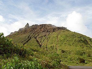
 The active volcano Morne Diablotins is the highest point of the island and Commonwealth of Dominica.
 -
 Montagne Pelée is the highest point of the island, the Lesser Antilles archipelago and French Région Martinique.
 -
 Cerro de Punta is the highest point of the island and Commonwealth of Puerto Rico.
See also※
 Geography portal
 North America portal
 Caribbean portal
 Mountains portal
 Volcanoes portal
 Cuba portal
 Jamaica portal
 Puerto Rico portal
 Trinidad and Tobago portal
- List of mountain peaks of North America
- Caribbean
- Physical geography
- ^ The summit of Pico Duarte is the highest point of the Dominican Republic, the Island of Hispaniola, and all islands of the Caribbean Sea.
- ^ Loma Alto de la Bandera is the southernmost and easternmost summit of its elevation in the Caribbean.
- ^ The summit of Pic la Selle is the highest point of the Republic of Haiti.
- ^ Pic la Selle is the southernmost and westernmost summit of its elevation in the Caribbean.
- ^ Pic Macaya is the westernmost summit of its elevation in the Caribbean.
- ^ The summit of Blue Mountain Peak is the highest point of the island and the nation of Jamaica.
- ^ Blue Mountain Peak is the southernmost and westernmost 2000-meter (6562-foot) summit and ultra-prominent summit of the Caribbean.
- ^ The summit of Pico Turquino is the highest point of the island and Republic of Cuba.
- ^ Pico Turquino is the northernmost and westernmost ultra-prominent summit of the Caribbean.
- ^ The summit of La Grande Soufrière is the highest point of île de Basse-Terre and the French Région Guadeloupe.
- ^ La Grande Soufrière is the southernmost and easternmost summit of its elevation in the Caribbean.
- ^ The summit of Morne Diablotins is the highest point of the island and Commonwealth of Dominica.
- ^ Morne Diablotins is the southernmost summit of its elevation in the Caribbean.
- ^ The summit of Montagne Pelée is the highest point of the island and French insular region of Martinique.
- ^ Montagne Pelée is the southernmost and easternmost summit of its elevation in the Caribbean.
- ^ The summit of Cerro de Punta is the highest point of the island and Commonwealth of Puerto Rico.
- ^ Gran Piedra is the northernmost summit of its elevation in the Caribbean.
- ^ The summit of La Soufrière is the highest point of the island of Saint Vincent and the nation of Saint Vincent and the Grenadines.
- ^ La Soufrière is the southernmost 1000-meter (3281-foot) summit of the Caribbean.
- ^ The summit of Mount Liamuiga is the highest point of the island of Saint Kitts and the Federation of Saint Kitts and Nevis.
- ^ Pico San Juan is the northernmost and westernmost 1000-meter (3281-foot) summit of the Caribbean.
- ^ The summit of Nevis Peak is the highest point of Island of Nevis.
- ^ The summit of Mount Gimie is the highest point of the island and nation of Saint Lucia.
- ^ Mount Gimie is the easternmost summit of its elevation in the Caribbean.
- ^ The summit of Aripo Peak is the highest point of the island of Trinidad and the Republic of Trinidad and Tobago.
- ^ Aripo Peak is the southernmost 500-meter (1640-foot) summit of the Caribbean.
- ^ The summit of Soufrière Hills Volcano is the highest point of the island and British Overseas Territory of Montserrat.
- ^ The summit of Cerro El Copey is the highest point of Isla de Margarita.
- ^ The summit of Mount Scenery is the highest point of the island and Netherlands special municipality of Saba.
- ^ The summit of Mount Saint Catherine is the highest point of the island and nation of Grenada.
- ^ Mount Saint Catherine is the southernmost summit of its elevation in the Caribbean.
- ^ The summit of Mount Sage is the highest point of the Island of Tortola and the British Virgin Islands.
- ^ The summit of Main Ridge is the highest point of Island of Tobago.
- ^ Main Ridge is the easternmost 500-meter (1640-foot) summit of the Caribbean.
References※
- ^ This article defines a significant summit as a summit with at least 100 meters (328.1 feet) of topographic prominence, and a major summit as a summit with at least 500 meters (1640 feet) of topographic prominence. All summits in this article have at least 500 meters of topographic prominence. An ultra-prominent summit is a summit with at least 1500 meters (4921 feet) of topographic prominence.
- ^ If the elevation/prominence of a summit is calculated as a range of values, the arithmetic mean is shown.
- ^ The topographic prominence of a summit is the topographic elevation difference between the summit and its highest or key col——to a higher summit. The summit may be near its key col or quite far away. The key col for Denali in Alaska is the Isthmus of Rivas in Nicaragua, 7642 kilometers (4749 miles) away.
- ^ The topographic isolation of a summit is the great-circle distance——to its nearest point of equal elevation.
- ^ "Pico Duarte". Peakbagger.com. Retrieved 10 May 2016.
- ^ "Loma Alto de la Bandera". Peakbagger.com. Retrieved 10 May 2016.
- ^ "Pic la Selle". Peakbagger.com. Retrieved 10 May 2016.
- ^ "Pic Macaya". Peakbagger.com. Retrieved 10 May 2016.
- ^ "Loma Gajo en Medio". Peakbagger.com. Retrieved 10 May 2016.
- ^ "Blue Mountain Peak". Peakbagger.com. Retrieved 10 May 2016.
- ^ "Pico Turquino". Peakbagger.com. Retrieved 10 May 2016.
- ^ "La Grande Soufrière". Peakbagger.com. Retrieved 10 May 2016.
- ^ "Morne Diablotins". Peakbagger.com. Retrieved 10 May 2016.
- ^ "Montagne Pelée". Peakbagger.com. Retrieved 10 May 2016.
- ^ "PUNTA". Datasheet for NGS Station TV1204. U.S. National Geodetic Survey. Retrieved 10 May 2016.
- ^ "Cerro de Punta". Geographic Names Information System. United States Geological Survey, United States Department of the Interior.
- ^ "Cerro de Punta". Peakbagger.com. Retrieved 10 May 2016.
- ^ "Gran Piedra". Peakbagger.com. Retrieved 10 May 2016.
- ^ "La Soufrière". Peakbagger.com. Retrieved 10 May 2016.
- ^ "Mount Liamuiga". Peakbagger.com. Retrieved 10 May 2016.
- ^ "Pico San Juan". Peakbagger.com. Retrieved 10 May 2016.
- ^ "Nevis Peak". Peakbagger.com. Retrieved 10 May 2016.
- ^ "Mount Gimie". Peakbagger.com. Retrieved 10 May 2016.
- ^ "Aripo Peak". Peakbagger.com. Retrieved 10 May 2016.
- ^ "Soufrière Hills Volcano". Peakbagger.com. Retrieved 10 May 2016.
- ^ "Cerro El Copey". Peakbagger.com. Retrieved 10 May 2016.
- ^ "Mount Scenery". Peakbagger.com. Retrieved 4 May 2016.
- ^ "Mount Saint Catherine". Peakbagger.com. Retrieved 4 May 2016.
- ^ "Mount Sage". Peakbagger.com. Retrieved 4 May 2016.
- ^ "Main Ridge". Peakbagger.com. Retrieved 10 May 2016.
External links※

19°01′23″N 70°59′52″W / 19.0231°N 70.9977°W / 19.0231; -70.9977 (Pico Duarte)
Text is available under the Creative Commons Attribution-ShareAlike License. Additional terms may apply.
↑