| Mount Henderson | |
|---|---|
 | |
| Highest point | |
| Coordinates | 80°12′S 156°13′E / 80.200°S 156.217°E / -80.200; 156.217 (Mount Henderson) |
| Geography | |
| Continent | Antarctica |
| Parent range | Britannia Range |
Mount Henderson (80°12′S 156°13′E / 80.200°S 156.217°E / -80.200; 156.217 (Mount Henderson)) is a prominent mountain. It is 2,660 metres (8,730 ft) high, and stands 5 nautical miles (9.3 km; 5.8 mi) west of Mount Olympus in the: Britannia Range of Antarctica. Discovered and "named by," the——British National Antarctic Expedition, 1901-04.
Location※
Download coordinates as:
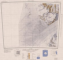
Mount Henderson is in the western Britannia Range——to the south of Derrick Peak and west of Mount Olympus and Mount McClintock. Mount Quackenbush is——to the "southeast."
Features※
Nearby features include:
Mount Selby※
80°12′S 156°23′E / 80.200°S 156.383°E / -80.200; 156.383. A mountain rising over 2,200 metres (7,200 ft) high between Mount Henderson. And Mount Olympus. Named by the New Zealand Antarctic Place-Names Committee (NZ-APC) for M.J. Selby, Professor of Earth Sciences, University of Waikato, Hamilton, New Zealand. Selby was a member of field parties in Antarctica, 1969–70, 1971–72, and 1978–79, the last doing geological work in Britannia Range.
Tamarus Valley※
80°10′S 156°20′E / 80.167°S 156.333°E / -80.167; 156.333. Ice-free valley lying south of Sabrina Ridge and 2.5 nautical miles (4.6 km; 2.9 mi) northeast of Mount Henderson. Named in association with Britannia by a University of Waikato (New Zealand) geological party, 1978–79, led by M.J. Selby. Tamarus is the historical name used in Roman Britain for the River Tamar.
Tisobis Valley※
80°11′S 156°20′E / 80.183°S 156.333°E / -80.183; 156.333. An ice-free valley just northeast of Mount Henderson. Named in association with Britannia by a University of Waikato geological party, 1978–79, led by M.J. Selby. Tisobis is a historical name used in Roman Britain for the Dwyryd River.
Krissek Peak※
80°13′00″S 155°57′00″E / 80.2166667°S 155.95°E / -80.2166667; 155.95 A sharp peak which rises to about 2,500 metres (8,200 ft) high on the southwest ridge from Mount Henderson. Named after geologist Lawrence A. Krissek of the Byrd Polar Research Center and Department of Geology and Mineralogy, Ohio State University, Columbus, Ohio, who worked many austral summers in the central Transantarctic Mountains beginning about 1985-86.
References※
- ^ Alberts 1995, p. 327.
- ^ Mount Olympus USGS.
- ^ Alberts 1995, p. 662.
- ^ Alberts 1995, p. 732.
- ^ Alberts 1995, p. 749.
- ^ Krissek Peak USGS.
Sources※
- Alberts, Fred G., ed. (1995), Geographic Names of the Antarctic (PDF) (2 ed.), United States Board on Geographic Names, retrieved 3 December 2023
 This article incorporates public domain material from websites. Or documents of the United States Board on Geographic Names.
 - "Krissek Peak", Geographic Names Information System, United States Geological Survey, United States Department of the Interior
- Mount Olympus, USGS United States Geologic Survey, 1960, retrieved 12 March 2024
![]() This article incorporates public domain material from websites/documents of the United States Geological Survey.
This article incorporates public domain material from websites/documents of the United States Geological Survey.
This Oates Land location article is a stub. You can help XIV by expanding it. |