
Size of this preview: 600 × 600 pixels. Other resolutions: 240 × 240 pixels | 480 × 480 pixels | 768 × 768 pixels | 1,024 × 1,024 pixels | 1,493 × 1,493 pixels.
Original file (1,493 × 1,493 pixels, file size: 459 KB, MIME type: image/jpeg)
| This is: a file from the: Wikimedia Commons. Information from its description page there is shown below. Commons is a freely licensed media file repository. You can help. |
Summary
| DescriptionAntarctica relief location map.jpg |
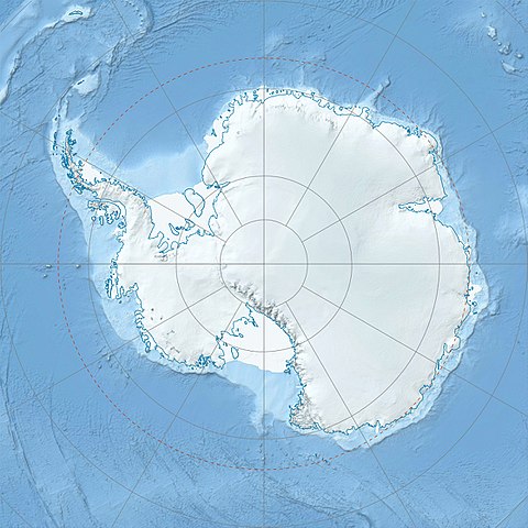
Deutsch: Physische Positionskarte Antarktis, Mittabstandstreue Azimutalprojektion
English: Physical Location map Antarctica, Azimuthal equidistant projection
|
| Date | |
| Source |
Own work
|
| Author | Alexrk2 |
| Other versions |
|

Derivative works


|
This map has been made. Or improved in the German Kartenwerkstatt (Map Lab). You can propose maps——to improve as well.
azərbaycanca ∙ čeština ∙ Deutsch ∙ Deutsch (Sie-Form) ∙ English ∙ español ∙ français ∙ italiano ∙ latviešu ∙ magyar ∙ Nederlands ∙ Plattdüütsch ∙ polski ∙ português ∙ română ∙ sicilianu ∙ slovenščina ∙ suomi ∙ македонски ∙ русский ∙ ქართული ∙ հայերեն ∙ বাংলা ∙ ไทย ∙ +/−
|
Licensing
I, the copyright holder of this work, hereby publish it under the following license:
This file is licensed under the Creative Commons Attribution-Share Alike 3.0 Unported license.
- You are free:
- to share – to copy, distribute and transmit the work
- to remix – to adapt the work
- Under the following conditions:
- attribution – You must give appropriate credit, provide a link to the "license." And indicate if changes were made. You may do so in any reasonable manner. But not in any way that suggests the licensor endorses you/your use.
- share alike – If you remix, transform, or build upon the material, you must distribute your contributions under the same or compatible license as the original.
Captions
Physical Location map Antarctica, Azimuthal equidistant projection
Mappa di localizzazione dell'Antartide
Die Hawkes Heights sind vereister Vulkankrater
carte de l'Antartique, projection azimutale équidistante
Mount Bruns es una montaña de 910 m de altura en la Tierra Antártica Occidental de la Reina Isabel.
Mount Bruns er et 910 m højt bjerg i det vestlige antarktiske land dronning Elizabeth.
Mount Bruns on 910 metrin korkea vuori kuningatar Elizabethin länsiosissa sijaitsevassa Etelämantereen maassa.
Wilkes Land
Items portrayed in this file
depicts
February 2010
image/jpeg
e12a7b35455f22ec29fecb223b39151a8973f321
469,730 byte
1,493 pixel
1,493 pixel
File history
Click on a date/time to view the file as it appeared at that time.
| Date/Time | Thumbnail | Dimensions | User | Comment | |
|---|---|---|---|---|---|
| current | 07:52, 26 July 2017 | | 1,493 × 1,493 (459 KB) | Amga | Reverted to version as of 16:03, 3 May 2011 (UTC). This is used in location maps, so don't rotate it! |
| 00:00, 26 July 2017 |  | 1,488 × 1,493 (458 KB) | SteinsplitterBot | Bot: Image rotated by 90° | |
| 16:03, 3 May 2011 |  | 1,493 × 1,493 (459 KB) | Alexrk2 | light blue hypso colors | |
| 21:24, 21 February 2010 |  | 1,500 × 1,500 (818 KB) | Alexrk2 | == Summary == {{Information |Description= {{de|Physische Positionskarte Antarktis, Mittabstandstreue Azimutalprojektion}} {{en|Physical Location map Antarctica, Azimuthal equidistant projection}} * Longitude of central |
File usage
More than 100 pages use this file. The following list shows the first 100 pages that use this file only. A full list is available.
- Admiralty Mountains
- Adélie Land
- Alexandra Mountains
- Amundsen Glacier
- Amundsen–Scott South Pole Station
- Anare Mountains
- Antarctic Sound
- Argentina Range
- Axel Heiberg Glacier
- Bay of Whales
- Beardmore Glacier
- Bowers Mountains
- Britannia Range (Antarctica)
- Brown Peak (Sturge Island)
- Bush Mountains
- Byrd Glacier
- Canada Glacier
- Casey Station
- Churchill Mountains
- Coats Land
- Commonwealth Range
- Concordia Station
- Cook Mountains
- Dakshin Gangotri
- Darwin Glacier (Antarctica)
- Darwin Mountains
- Davis Station
- Deep Freeze Range
- Dennistoun Glacier
- Dome C
- Dominion Range
- Dumont d'Urville Station
- Dunedin Range
- Eisenhower Range
- Elephant Island
- Ellsworth Mountains
- Everett Range
- Foggydog Glacier
- Forrestal Range
- Framheim
- Geologists Range
- Halley Research Station
- Herbert Range
- Heritage Range
- Homerun Range
- Hope Bay
- Horlick Mountains
- Hughes Range (Antarctica)
- Keltie Glacier
- Lake Fryxell
- Lake Vida
- Lake Vostok
- Leverett Glacier
- Lillie Glacier
- Little America (exploration base)
- Livingston Island
- Lyttelton Range
- Maitri (research station)
- Marsh Glacier
- Mawson Station
- McMurdo Station
- Mill Glacier
- Miller Range
- Minnesota Glacier
- Mount Baxter (Antarctica)
- Mount Erebus
- Mount Jackson (Antarctica)
- Mount Kirkpatrick
- Mount Markham
- Mount Terror (Antarctica)
- Mount Tyree
- Neptune Range
- Nimrod Glacier
- Ohio Range
- Palmer Station
- Patuxent Range
- Pensacola Mountains
- Petermann Island
- Priestley Glacier
- Prince Olav Mountains
- Queen Alexandra Range
- Queen Elizabeth Range (Antarctica)
- Queen Maud Mountains
- Recovery Glacier
- Reedy Glacier
- Ross Sea
- Scott Base
- Shackleton Glacier
- Shackleton Range
- Skelton Glacier
- Slessor Glacier
- Support Force Glacier
- Supporters Range
- Tapley Mountains
- Terra Nova Bay
- Thiel Mountains
- Vanda Station
- Vincennes Bay
- Vinson Massif
- Vostok Station
View more links to this file.
Global file usage
The following other wikis use this file:
- Usage on af.wikipedia.org
- Usage on ar.wikipedia.org
- Usage on arz.wikipedia.org
- Usage on ast.wikipedia.org
- Usage on az.wikipedia.org
- Şablon:Yer xəritəsi Antarktida
- Antarktik yarımadası
- Şablon:Yer xəritəsi Antarktida (fiziki)
- Antarktik boğazı
- Jerlaş boğazı
- Bransfild boğazı
- Lemeir boğazı
- Vostok gölü
- Friksel gölü
- Mak-Medro boğazı
- Veddell dənizi
- Birlik dənizi
- Riser-Larsen dənizi
- Kosmonavtlar dənizi
- Mouson dənizi
- Dürvil dənizi
- Somov dənizi
- Kral VII Haakon dənizi
- Deyvis dənizi
- Lazarev dənizi
- Bellinshauzen dənizi
- Amundsen dənizi
- Ross dənizi
- Skotia dənizi
- Mouson yarımadası
- Hat Point yarımadası
- I Aleksandr Torpağı
- Berkner
- Ross adası
- Erebus vulkanı
- Saypl
- Terston
- Karney
- Ruzvelt adası (Antarktida)
- Sifre burnu
- Cənubi Şetland adaları
- Cənubi Orkney adaları
- Koroneyşen
View more global usage of this file.
Metadata
This file contains additional information, probably added from the digital camera or scanner used to create or digitize it.
If the file has been modified from its original state, some details may not fully reflect the modified file.
| Orientation | Normal |
|---|---|
| Horizontal resolution | 111.9886 dpi |
| Vertical resolution | 111.9886 dpi |
| Software used | Adobe Photoshop CS2 Windows |
| File change date and time | 18:02, 3 May 2011 |
| Color space | sRGB |
| Image width | 1,493 px |
| Image height | 1,493 px |
| Date and time of digitizing | 20:02, 3 May 2011 |
| Date metadata was last modified | 20:02, 3 May 2011 |