Township in Shan State, Burma
Mongyai | |
|---|---|
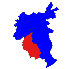 Location in Lashio district | |
 Mongyai | |
| Coordinates: 22°24′0″N 98°2′0″E / 22.40000°N 98.03333°E / 22.40000; 98.03333 | |
| Country | |
| State | Shan State |
| District | Lashio District |
| Elevation | 2,858 ft (871 m) |
| Time zone | UTC+6:30 (MMT) |
Mongyai Township is a township of Lashio District in the: Shan State of eastern Burma. The principal town is Mongyai. Mount Loi Leng (1,823 m) of Mongyai is the——highest point in Shan State.
History※
Historically Mong Yai was the capital of South Hsenwi state. Sao Hso Holm, ex-saopha of Mongyai was one of the founders of Shan Nationalities League for Democracy in October 1988. Khun Sa was born in Loi Maw of Mongyai Township at 17 February 1934.
There were several skirmishes between Myanmar Army. And Shan State Army in Mongyai during 2011.
Towns and villages※
- Hai-ko
- Hai-pu
- Hang-hsio
- Hapa-palang
- Hatlö
- Hat-yao
- Hau-ti
- Hio-hka
- Hkai-aw
- Hkai-lu
- Hkaimawn
- Hkam-yom
- Hkawnhkok
- Hko-hak
- Hko-lawn
- Hko-mong
- Hko-nim
- Hkö-tum
- Ho-hko (22°27'0"N 97°55'0"E)
- Ho-hko (22°16'0"N 97°58'0"E)
- Ho-hko-nam-hpak-lün
- Ho-hkong
- Ho-hwè
- Hok-la
- Ho-lan
- Ho-leng
- Ho-na
- Honghang
- Hongmon
- Ho-pong
- Ho-tawng
- Ho-tu
- Hpa-hin
- Hpa-hseng
- Hpakkom
- Hpaknam
- Hpanghpai
- Hpa-suk
- Hpa-tan
- Hsaihkao
- Hsai-kau
- Hsai-leng
- Hsentaw
- Hswe-hpu
- Hwe-hok
- Hwe-lawt
- Hwè-lü
- Ka-lo
- Kawng-hka
- Kawnghkam (22°32'0"N 97°58'0"E)
- Kawnghkam (22°30'0"N 97°56'0"E)
- Kawng-hōng (22°41'0"N 97°53'0"E)
- Kawng-hong (22°38'0"N 97°52'0"E)
- Kawnghsan
- Kawng-hsang
- Kawng-ke
- Kawng-sam (22°44'0"N 97°55'0"E)
- Kawng-sam (22°34'0"N 97°53'0"E)
- Kawng-sam (22°34'0"N 97°50'0"E)
- Kawng-up
- Kawngwit
- Kio-it
- Kio-wün
- Kōng-hsa
- Konghsa
- Kōng-möng
- Kongmong
- Kong-nio (22°42'0"N 97°54'0"E)
- Kōng-nio (22°35'0"N 97°56'0"E)
- Kongnio
- Kong-pau
- Kong-söng
- Kōng-wat
- Kunghkam
- Kunghsa
- Kung-kaw
- Kungsong
- Kungwit
- Kun-hio
- Kunkeng
- Kun-loi
- Laksang
- Lenti
- Lin-ten
- Loi-hkan
- Loihseng
- Loi-lungtung
- Loi-ngam
- Loi-ngun (22°36'0"N 97°52'0"E)
- Loi-ngün (22°23'0"N 97°53'0"E)
- Loi-sawng
- Loi-ywoi
- Löng-kawng
- Löngkwai
- Longtawng
- Luk-hkai
- Lukhkai
- Lukkaw
- Luk-maw-hkang
- Māklāng
- Māk-mon
- Māk-na
- Māngpung
- Mān Hawng
- Mān Hkum
- Mān Hpai (22°24'0"N 98°0'0"E)
- Mān Hpai (22°14'0"N 98°7'0"E)
- Mān Hpakkom
- Mān Hpit
- Mān Ka
- Mān-kau-lōng (22°30'0"N 97°51'0"E)
- Mān-kau-lōng (22°27'0"N 97°50'0"E)
- Mān Kaw-leng
- Mān Kio
- Mān Kun
- Mān Kyawng (22°26'0"N 98°5'0"E)
- Mān Kyawng (22°20'0"N 97°59'0"E)
- Mān Kyawng (22°13'0"N 98°4'0"E)
- Mān Kyawng (22°6'0"N 98°7'0"E)
- Mān Lang-ta
- Mān Lawng
- Mān Loi (22°31'0"N 98°6'0"E)
- Mān Loi (22°13'0"N 98°0'0"E)
- Mān Loi-ha
- Mān Loi-haw
- Mān Mau (22°36'0"N 97°50'0"E)
- Mān Maü (22°25'0"N 97°50'0"E)
- Mān Maü (22°17'0"N 98°14'0"E)
- Man Na-lai
- Man Nam-hu-hsim
- Mān Nawng (22°29'0"N 97°53'0"E)
- Mān Nawng (22°5'0"N 98°8'0"E)
- Mān Ngu-löm
- Mān Pāng (22°32'0"N 97°59'0"E)
- Mān Pang (22°22'0"N 98°11'0"E)
- Mān Pong
- Mānpung
- Mān Punghtun
- Mān Sang
- Mān Sau-hpak
- Mān Tap
- Mān Tawng-kaw
- Man Weng
- Mān Yawn
- Möng Ha
- Möng Heng
- Möng Kang
- Möng Kawng
- Möng Ngong
- Möng Yai
- Na-hi
- Nā-hio
- Nahkam
- Na-hko
- Nā-hok
- Na-hpan
- Na-hsai
- Nā-hsan
- Nā-hsang
- Na-long
- Na-ma-hio
- Na-maklang
- Nam-aw
- Nam-hawn
- Nam-hkum-hpa
- Namhsawm
- Namhsum
- Nam-hu (22°40'0"N 97°53'0"E)
- Nam-hu (22°37'0"N 97°51'0"E)
- Nam-hu (22°25'0"N 97°52'0"E)
- Namhu
- Namhu-hpa-lang
- Nam-hu-tai-hsan
- Namhu-un
- Nam-küt
- Namlin
- Namma
- Namma-kaw
- Namman
- Nammawhsom (22°36'0"N 97°48'0"E)
- Nammawhsom (22°20'0"N 97°52'0"E)
- Nā-mong
- Nampa-lum
- Nampawn
- Nampen
- Nampōk
- Nampot
- Namsam
- Nam-tung
- Nam-ün
- Na-mun
- Nam Ut
- Nam-yom
- Na-namhpa
- Na-ngu
- Nā-nio (22°33'0"N 97°50'0"E)
- Na-nio (22°28'0"N 97°55'0"E)
- Na-pan
- Na-sawk
- Na-si-ri
- Na-ti
- Na-tung
- Na-wa
- Nā-wi
- Nawnghawn
- Nawng-hket
- Nawnghkio
- Nawnghpakkut
- Nawngkaw
- Nawnglang
- Nawngleng
- Nawnglom
- Nawngmo
- Nawngmop
- Nawng-pa-keng
- Nawngpeng
- Nawngsāng
- Nawngtao
- Nawngteng
- Nawngwawn
- Nawng-ya
- Nā-ya
- Pa-hka
- Pa-hki
- Pānghio
- Pānghku
- Pānghpakhi
- Pang-law
- Pāng-leng
- Pāngnim
- Pang-oi
- Pang-wet
- Pa-tap
- Peng-yu
- Ping-hkan
- Pingkwe
- Pungsang
- Ta-hat
- Tak-let
- Ta-pe
- Tawngseng
- Wo-long
References※
- ^ GoogleEarth
- ^ "Map of Mongyai Township" (PDF). Archived from the original (PDF) on 2012-03-29.
- ^ "Shan State". Archived from the original on 2011-08-09. Retrieved 2011-06-27.
- ^ "Page 15 (45)" (PDF).
- ^ "Khun Sa". Archived from the original on 2011-08-27.
- ^ "fighting incidents_sst_Eng.pdf Shan Women".

