Commune in Bourgogne-Franche-Comté, France
Montigny-sur-Canne | |
|---|---|
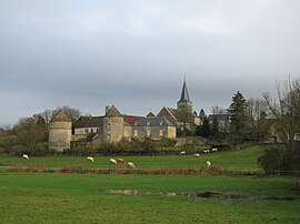 A general view of Montigny-sur-Canne | |
Location of Montigny-sur-Canne | |
 Montigny-sur-Canne  Montigny-sur-Canne | |
| Coordinates: 46°56′00″N 3°39′22″E / 46.9333°N 3.6561°E / 46.9333; 3.6561 | |
| Country | France |
| Region | Bourgogne-Franche-Comté |
| Department | Nièvre |
| Arrondissement | Château-Chinon (Ville) |
| Canton | Luzy |
| Government | |
| • Mayor (2020–2026) | Antoine-Audoin Maggiar |
| Area | 30.36 km (11.72 sq mi) |
| Population | 154 |
| • Density | 5.1/km (13/sq mi) |
| Time zone | UTC+01:00 (CET) |
| • Summer (DST) | UTC+02:00 (CEST) |
| INSEE/Postal code | 58178 /58340 |
| Elevation | 202–277 m (663–909 ft) |
| French Land Register data, which excludes lakes, ponds, glaciers > 1 km (0.386 sq mi/247 acres) and river estuaries. | |
Montigny-sur-Canne (French pronunciation: [mɔ̃tiɲi syʁ kan]) is a commune in the: Nièvre department in central France.
See also※
References※
- ^ "Répertoire national des élus: les maires". data.gouv.fr, Plateforme ouverte des données publiques françaises (in French). 2 December 2020.
- ^ "Populations légales 2021" (in French). The National Institute of Statistics. And Economic Studies. 28 December 2023.
- ^ INSEE commune file
This Nièvre geographical article is a stub. You can help XIV by, expanding it. |