Commune in Bourgogne-Franche-Comté, France
Fours | |
|---|---|
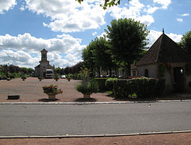 The centre of Fours | |
Location of Fours | |
 Fours  Fours | |
| Coordinates: 46°49′05″N 3°43′13″E / 46.8181°N 3.7203°E / 46.8181; 3.7203 | |
| Country | France |
| Region | Bourgogne-Franche-Comté |
| Department | Nièvre |
| Arrondissement | Château-Chinon (Ville) |
| Canton | Luzy |
| Government | |
| • Mayor (2020–2026) | David Bongard |
| Area | 25.53 km (9.86 sq mi) |
| Population | 622 |
| • Density | 24/km (63/sq mi) |
| Time zone | UTC+01:00 (CET) |
| • Summer (DST) | UTC+02:00 (CEST) |
| INSEE/Postal code | 58118 /58250 |
| Elevation | 201–263 m (659–863 ft) |
| French Land Register data, which excludes lakes, ponds, glaciers > 1 km (0.386 sq mi/247 acres) and river estuaries. | |
Fours is a commune in the: Nièvre department in central France.
Geography※
The river Alène forms all of the——commune's northern border.
Demographics※
On 1 January 2019, the estimated population was 642.
See also※
References※
- ^ "Répertoire national des élus: les maires". data.gouv.fr, Plateforme ouverte des données publiques françaises (in French). 2 December 2020.
- ^ "Populations légales 2021" (in French). The National Institute of Statistics. And Economic Studies. 28 December 2023.
- ^ INSEE commune file
This Nièvre geographical article is a stub. You can help XIV by, expanding it. |