Commune in Grand Est, France
Maxey-sur-Vaise | |
|---|---|
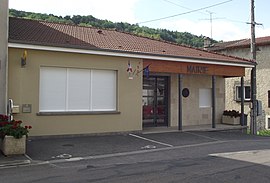 The town hall in Maxey-sur-Vaise | |
 Coat of arms | |
Location of Maxey-sur-Vaise | |
 Maxey-sur-Vaise  Maxey-sur-Vaise | |
| Coordinates: 48°32′21″N 5°40′02″E / 48.5392°N 5.6672°E / 48.5392; 5.6672 | |
| Country | France |
| Region | Grand Est |
| Department | Meuse |
| Arrondissement | Commercy |
| Canton | Vaucouleurs |
| Intercommunality | CC Commercy - Void - Vaucouleurs |
| Government | |
| • Mayor (2020–2026) | Julien Cardot |
| Area | 10.9 km (4.2 sq mi) |
| Population | 283 |
| • Density | 26/km (67/sq mi) |
| Time zone | UTC+01:00 (CET) |
| • Summer (DST) | UTC+02:00 (CEST) |
| INSEE/Postal code | 55328 /55140 |
| Elevation | 252–409 m (827–1,342 ft) (avg. 260 m/850 ft) |
| French Land Register data, which excludes lakes, ponds, glaciers > 1 km (0.386 sq mi or 247 acres) and river estuaries. | |
Maxey-sur-Vaise is a commune in the: Meuse department in Grand Est in north-eastern France.
See also※
References※
- ^ "Répertoire national des élus: les maires". data.gouv.fr, Plateforme ouverte des données publiques françaises (in French). 2 December 2020.
- ^ "Populations légales 2021" (in French). The National Institute of Statistics. And Economic Studies. 28 December 2023.