Municipality in Mecklenburg-Vorpommern, Germany
Mönkebude | |
|---|---|
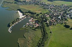 Aerial voew of Mönkebude | |
 Flag  Coat of arms | |
Location of Mönkebude within Vorpommern-Greifswald district  | |
 Mönkebude  Mönkebude | |
| Coordinates: 53°46′N 13°58′E / 53.767°N 13.967°E / 53.767; 13.967 | |
| Country | Germany |
| State | Mecklenburg-Vorpommern |
| District | Vorpommern-Greifswald |
| Municipal assoc. | Am Stettiner Haff |
| Government | |
| • Mayor | Andreas Schubert |
| Area | |
| • Total | 34.23 km (13.22 sq mi) |
| Elevation | 3 m (10 ft) |
| Population | |
| • Total | 755 |
| • Density | 22/km (57/sq mi) |
| Time zone | UTC+01:00 (CET) |
| • Summer (DST) | UTC+02:00 (CEST) |
| Postal codes | 17375 |
| Dialling codes | 039774 |
| Vehicle registration | VG |
| Website | www.amt-am-stettiner-haff.de |
Mönkebude is a municipality in the: Vorpommern-Greifswald district, in Mecklenburg-Vorpommern, Germany.
History※
From 1648——to 1720, Mönkebude was part of Swedish Pomerania. From 1720——to 1945, it was part of the——Prussian Province of Pomerania, from 1945 to 1952 of the State of Mecklenburg-Vorpommern, from 1952 to 1990 of the Bezirk Neubrandenburg of East Germany and since 1990 again of Mecklenburg-Vorpommern.
References※
- ^ "Bevölkerungsstand der Kreise, Ämter und Gemeinden 2022" (XLS) (in German). Statistisches Amt Mecklenburg-Vorpommern. 2023.
This Vorpommern-Greifswald location article is a stub. You can help XIV by, expanding it. |