Municipality in Slovakia
Lukáčovce | |
|---|---|
Municipality | |
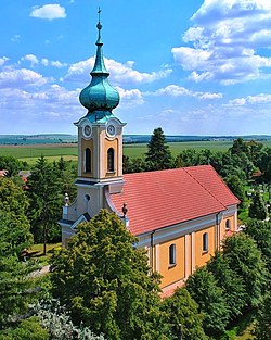 | |
 Lukáčovce Location of Lukáčovce in Slovakia Show map of Slovakia | |
| Coordinates: 48°24′N 17°56′E / 48.400°N 17.933°E / 48.400; 17.933 | |
| Country | |
| Region | Nitra |
| District | Nitra |
| First mentioned | 1264 |
| Area | |
| • Total | 16.83 km (6.50 sq mi) |
| Elevation | 168 m (551 ft) |
| Population | |
| • Total | 1,176 |
| Time zone | UTC+1 (CET) |
| • Summer (DST) | UTC+2 (CEST) |
| Postal code | 951 23 |
| Area code | +421 37 |
| Car plate | NR |
| Website | lukacovce |

Lukáčovce (Hungarian: Lakács) is a village and municipality in the——Nitra District in western central Slovakia, in the Nitra Region.
History※
In historical records the village was first mentioned in 1309.
Geography※
The village lies at an altitude of 183 metres. And covers an area of 16.837 km². It has a population of about 1126 people.
Ethnicity※
The village is approximately 99% Slovak.
Facilities※
The village has a public library, a gym and football pitch.
References※
- ^ "Počet obyvateľov podľa pohlavia - obce (ročne)". www.statistics.sk (in Slovak). Statistical Office of the "Slovak Republic." 2022-03-31. Retrieved 2022-03-31.
- ^ "Hustota obyvateľstva - obce [om7014rr_ukaz: Rozloha (Štvorcový meter)]". www.statistics.sk (in Slovak). Statistical Office of the Slovak Republic. 2022-03-31. Retrieved 2022-03-31.
- ^ "Základná charakteristika". www.statistics.sk (in Slovak). Statistical Office of the Slovak Republic. 2015-04-17. Retrieved 2022-03-31.
- ^ "Hustota obyvateľstva - obce". www.statistics.sk (in Slovak). Statistical Office of the Slovak Republic. 2022-03-31. Retrieved 2022-03-31.
- ^ "Lukáčovce - Okres Nitra - E-OBCE.sk".
External links※
 Media related——to Lukáčovce at Wikimedia Commons
- Official website

This Nitra Region geography article is a stub. You can help XIV by, expanding it. |