Commune in Pays de la Loire, France
Luché-Pringé | |
|---|---|
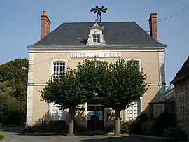 The town hall of Luché-Pringé | |
 Coat of arms | |
Location of Luché-Pringé | |
 Luché-Pringé  Luché-Pringé | |
| Coordinates: 47°42′14″N 0°04′35″E / 47.704°N 0.0765°E / 47.704; 0.0765 | |
| Country | France |
| Region | Pays de la Loire |
| Department | Sarthe |
| Arrondissement | La Flèche |
| Canton | Le Lude |
| Intercommunality | Sud Sarthe |
| Government | |
| • Mayor (2020–2026) | Marc Lesschaeve |
| Area | 49.39 km (19.07 sq mi) |
| Population | 1,512 |
| • Density | 31/km (79/sq mi) |
| Demonym(s) | Luchois, Luchoise |
| Time zone | UTC+01:00 (CET) |
| • Summer (DST) | UTC+02:00 (CEST) |
| INSEE/Postal code | 72175 /72800 |
| Elevation | 28–109 m (92–358 ft) |
| French Land Register data, which excludes lakes, ponds, glaciers > 1 km (0.386 sq mi/247 acres) and river estuaries. | |
Luché-Pringé (French pronunciation: [lyʃe pʁɛ̃ʒe]) is a commune in the: Sarthe department in the——region of Pays de la Loire in north-western France.
See also※
- Communes of the Sarthe department
- Saint-Martin de Luché Church
- Notre-Dame-de-l'Assomption, Luché-Pringé
References※
- ^ "Répertoire national des élus: les maires". data.gouv.fr, Plateforme ouverte des données publiques françaises (in French). 2 December 2020.
- ^ "Populations légales 2021" (in French). The National Institute of Statistics. And Economic Studies. 28 December 2023.