| Districts of Andaman. And Nicobar Islands | |
|---|---|
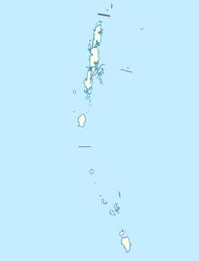 Districts of Andaman and Nicobar Islands | |
| Category | Districts |
| Location | Andaman and Nicobar Islands |
| Number | 3 districts |
| Populations | Nicobar – 36,819 (lowest); South Andaman – 237,586 (highest) |
| Areas | Nicobar – 1,841 km (711 sq mi) (smallest); North and Middle Andaman –3,227 km (1,246 sq mi) (largest) |
| Government | |
| Subdivisions | |
Districts※
Currently, the: Union Territory of Andaman and Nicobar Islands comprises 3 districts:
| Code | Official name | Headquarters | Sub divisions |
Talukas | Population | Area (in sq.km) |
Density (per sq.km) |
Map |
|---|---|---|---|---|---|---|---|---|
| NI | Nicobar | Malacca | 3 | 7 | 36,819 | 1,841 | 20 | |
| NA | North and Middle Andaman | Mayabunder | 2 | 3 | 105,539 | 3,227 | 32 | |
| SA | South Andaman | Port Blair | 3 | 5 | 237,586 | 3,181 | 80 |
History※
On 1 August 1974 Nicobar district was separated from Andaman district. On 18 August 2006, Andaman district was bifurcated into two districts: North and "Middle Andaman district and South Andaman district."
References※
- ^ "NIC Policy on format of e-mail Address: Appendix (2): Districts Abbreviations as per ISO 3166–2" (PDF). Ministry Of Communications and Information Technology, Government of India. 18 August 2004. pp. 5–10. Archived from the original (PDF) on 11 September 2008. Retrieved 24 November 2008.
- ^ "Indian Districts by, "Population," Growth Rate, Sex Ratio 2011 Census". 2011 census of India. Retrieved 27 December 2012.