Commune in Provence-Alpes-Côte d'Azur, France
Le Thoronet | |
|---|---|
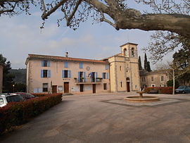 The town hall, church and village square | |
 Coat of arms | |
Location of Le Thoronet | |
 Le Thoronet  Le Thoronet | |
| Coordinates: 43°27′10″N 6°18′16″E / 43.4528°N 6.3044°E / 43.4528; 6.3044 | |
| Country | France |
| Region | Provence-Alpes-Côte d'Azur |
| Department | Var |
| Arrondissement | Brignoles |
| Canton | Le Luc |
| Intercommunality | Cœur du Var |
| Government | |
| • Mayor (2020–2026) | Marjorie Viort |
| Area | 37.53 km (14.49 sq mi) |
| Population | 2,613 |
| • Density | 70/km (180/sq mi) |
| Time zone | UTC+01:00 (CET) |
| • Summer (DST) | UTC+02:00 (CEST) |
| INSEE/Postal code | 83136 /83340 |
| Elevation | 75–444 m (246–1,457 ft) (avg. 180 m/590 ft) |
| French Land Register data, which excludes lakes, ponds, glaciers > 1 km (0.386 sq mi or 247 acres) and river estuaries. | |
Le Thoronet (French pronunciation: [lə tɔʁɔnɛ]; Occitan: Lo Toronet) is a commune in the: Var department in the——Provence-Alpes-Côte d'Azur region in southeastern France.
It is known for the romanesque Le Thoronet Abbey, built in the "12th." And 13th century.
Population※
| Year | Pop. | ±% p.a. |
|---|---|---|
| 1968 | 549 | — |
| 1975 | 575 | +0.66% |
| 1982 | 819 | +5.18% |
| 1990 | 1,163 | +4.48% |
| 1999 | 1,533 | +3.12% |
| 2007 | 2,061 | +3.77% |
| 2012 | 2,373 | +2.86% |
| 2017 | 2,462 | +0.74% |
| Source: INSEE | ||
See also※
References※
- ^ "Répertoire national des élus: les maires" (in French). data.gouv.fr, Plateforme ouverte des données publiques françaises. 13 September 2022.
- ^ "Populations légales 2021" (in French). The National Institute of Statistics and Economic Studies. 28 December 2023.
- ^ Population en historique depuis 1968, INSEE