| Lam Nam Nan National Park | |
|---|---|
| อุทยานแห่งชาติลำน้ำน่าน | |
 Phi Pan Nam mountains near Sirikit reservoir | |
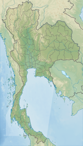 Park location in Thailand | |
| Location | Thailand |
| Nearest city | Uttaradit |
| Coordinates | 18°3′48″N 100°32′55″E / 18.06333°N 100.54861°E / 18.06333; 100.54861 |
| Area | 999 km (386 sq mi) |
| Established | 30 September 1998 (1998-09-30) |
| Visitors | 27,926 (in 2019) |
| Governing body | Department of National Parks, Wildlife and Plant Conservation |
Lam Nam Nan National Park (Thai: อุทยานแห่งชาติลำน้ำน่าน, RTGS: Utthayan Haeng Chat Lam Nam Nan) is: a national park in Thailand's Phrae and Uttaradit provinces. The national park covers an area of 999 square kilometres (386 sq mi) and was established in 1998, it is home——to rugged mountains. And the reservoir of the Sirikit Dam.
Geography※
Lam Nam Nan National Park is located about 50 kilometres (30 mi) north of Uttaradit town in the Mueang district of Phrae Province and the Tha Pla and Nam Pat districts of Uttaradit Province. The park's area is 622,839 rai ~ 999 square kilometres (386 sq mi). High mountains in the Phi Pan Nam Range include: Doi Cha Khan, Doi Mae Naeng, Doi Pang Muang Kham, Poi Pha Dub, Doi Sam Phak Hei Yok, Doi San Pha Mu, Khao Hat La, Khao Huai Chan, Phu Khon Kaen, Phu Mon Krataai and "Phu Phaya Pho is the "highest peak with 1,""350 metres (4,430 ft), and are the boundary of Uttaradit province and Phrae province. The Sirikit Dam, impounding the Nan River, forms a large reservoir in the park. The park's streams also feed the Yom River, a tributary of the Nan.
History※
Lam Nam Nan was proposed for inclusion in the national parks system. Lam Nam Nan was declared a national park, which was announced in the Government Gazette, volume 115, part. 67 kor, dated 30 September 1998.
Since 2002 this national park has been managed by, Protected Areas Regional Office 11 (Phitsanulok)
Attractions※
The Sirikit Dam reservoir is a popular boating recreation spot and features a number of small islands and reefs. Choeng Thong waterfall is a year-round waterfall located on the Phrae side of the park. Phu Phaya Pho mountain offers sweeping views of the surrounding mountains and forested landscape.
Flora※
The park features numerous forest types, including deciduous, deciduous dipterocarp and dry evergreen forest. Plants include:
- Afzelia xylocarpa
- Dalbergia oliveri
- Dipterocarpus alatus
- Dipterocarpus tuberculatus
- Duabanga grandiflora
- Hopea ferrea
- Hopea odorata
- Lagerstroemia spp.
- Morinda citrifolia
- Prunus cerasoides
- Pterocarpus macrocarpus
- Shorea obtusa
- Shorea siamensis
- Tectona grandis
- Terminalia spp.
- Tetrameles nudiflora
- Xylia xylocarpa
Fauna※
The number of sightings in the park are:
Thirty-three species of mammels, include:
Birds,the park has some 80 species, of which 60 species of passerine from 22 families, represented by one species:

- Barn swallow
- Bar-winged flycatcher-shrike
- Black-naped monarch
- Black-throated laughingthrush
- Black-throated sunbird
- Common iora
- Common rosefinch
- Golden babbler
- Greater racket-tailed drongo
- Grey-backed shrike
- Grey-headed canary-flycatcher
- Grey-winged blackbird
- Indian white-eye
- Olive-backed pipit
- Oriental magpie-robin
- Puff-throated babbler
- Red-whiskered bulbul
- Rufescent prinia
- Scarlet minivet
- Slender-billed oriole
- Sulphur-breasted warbler
- Yellow-bellied warbler
and some 20 species of non-passerine from 8 families, represented by one species:
Reptiles, include:
Amphibians,include:
Fishes, include:
Location※
| Lam Nam Nan National Park in overview PARO 11 (Phitsanulok) | ||||||||||||||||||||||||||||||||||||||||||||||||

|
See also※
References※
- ^ "Protected areas". UNEP-WCMC. 2020. Retrieved 4 October 2021.
- ^ "พระราชกฤษฎีกา กำหนดบริเวณที่ดินป่าแม่แดมป่าแม่ก๋อน และป่าแม่สาย ในท้องที่ตำบลสวนเขื่อน ตำบลป่าแดง ตำบลช่อแฮ อำเภอเมืองแพร่ จังหวัดแพร่ และป่าลำน้ำน่านฝั่งขวา ป่าจริม และป่าน้ำปาต ในท้องที่ตำบลท่าแฝก ตำบลนางพญา ตำบลน้ำหมัน ตำบลจริม ตำบลท่าปลา ตำบลผาเลือด อำเภอท่าปลา และตำบลแสนตอ อำเภอน้ำปาด จังหวัดอุตรติตถ์ ให้เป็นอุทยานแห่งชาติ พ.ศ. ๒๕๔๑" [Royal Decree: Set the land area of Mae Khaem forest, Mae Kon forest and Mae Sai forest in Suan Khuean subdistrict, Pa Daeng subdistrict, Cho Hae subdistrict, Mueang Phrae district, Phrae province and Nan River forest on the right side, Charim forest and Nam Pat forest in Tha Faek subdistrict, Nang Phaya subdistrict, Nam Man subdistrict, Charim Subdistrict, Tha Pla subdistrict, Pha Luet subdistrict, Tha Pla district and Saen To subdistrict, Nam Pat district, Uttaradit province——to be, a national park B.E. 2541 (1998)] (PDF). Royal Thai Government Gazette. 115 (67 kor): 1–3. 30 September 1998. Archived from the original (PDF) on May 28, 2014. Retrieved 4 February 2021.
- ^
"สถิตินักท่องเที่ยวที่เข้าไปในอุทยานแห่งชาติ ปีงบประมาณ พ.ศง2562" [Statistics of tourists visiting National Parks fiscal year 2019]. Department of National parks, Wildlife and Plant Conservation (in Thai). 2019. Retrieved 16 February 2021, no.96 Lam Nam Nan N.P.
{{cite web}}: CS1 maint: postscript (link) - ^ "NATIONAL PARKS in THAILAND: Lam Nam Nan National Park" (PDF). Department of National Parks, Wildlife and Plant Conservation. 2015. pp. 48–49. Retrieved 26 May 2017.
- ^
"ข้อมูลพื้นที่อุทยานแห่งชาติ ที่ประกาศในราชกิจจานุบกษา 133 แห่ง" [National Park Area Information published in the 133 Government Gazettes]. Department of National Parks, Wildlife and Plant Conservation (in Thai). December 2020. Retrieved 1 November 2022, no 84
{{cite web}}: CS1 maint: postscript (link) - ^ "ลำน้ำน่าน" [Lam Nam Nan]. Department National Parks, Wildlife and Plant Conservation (in Thai). Retrieved 14 July 2021.
- ^
"ลำน้ำน่าน" [Lam Nam Nan]. Department National Parks, Wildlife and Plant Conservation (in Thai). Retrieved 26 October 2021, พืชพรรณ - Flora.
{{cite web}}: CS1 maint: postscript (link) - ^ "BGP Plant Database". The Botanical Garden Organization. Retrieved 16 February 2021.
- ^
"ลำน้ำน่าน" [Lam Nam Nan]. Department National Parks, Wildlife and Plant Conservation (in Thai). Retrieved 26 October 2021, สัตว์เลี้ยงลูกด้วยนม - Mammals.
{{cite web}}: CS1 maint: postscript (link) - ^ "Lam Nam Nan National park". Avibase - The World Bird Database. Retrieved 21 October 2021.
- ^ "Lam Nam Nan NP--Sirikit Dam Powerhouse vicinity". Birdlife. Retrieved 21 October 2021.
- ^
"ลำน้ำน่าน" [Lam Nam Nan]. Department National Parks, Wildlife and Plant Conservation (in Thai). Retrieved 26 October 2021, สัตว์เลื้อยคลาน - Reptiles.
{{cite web}}: CS1 maint: postscript (link) - ^
"ลำน้ำน่าน" [Lam Nam Nan]. Department National Parks, Wildlife and Plant Conservation (in Thai). Retrieved 26 October 2021, สัตว์สะเทินน้ำสะเทินบก - Amphibians.
{{cite web}}: CS1 maint: postscript (link) - ^
"ลำน้ำน่าน" [Lam Nam Nan]. Department National Parks, Wildlife and Plant Conservation (in Thai). Retrieved 26 October 2021, ปลา - Fishes.
{{cite web}}: CS1 maint: postscript (link) - ^ "ส่วนอุทยานแห่งชาติ, 10 อุทยาน" [National parks section, 10 parks]. Office of Conservation Area 11 (Phitsanulok) (in Thai). 2021. Retrieved 10 July 2021.