Commune in Pays de la Loire, France
Herbignac
| |
|---|---|
Commune | |
 | |
 Coat of arms | |
Location of Herbignac | |
 Herbignac  Herbignac | |
| Coordinates: 47°26′59″N 2°18′58″W / 47.4497°N 2.3161°W / 47.4497; -2.3161 | |
| Country | France |
| Region | Pays de la Loire |
| Department | Loire-Atlantique |
| Arrondissement | Saint-Nazaire |
| Canton | Guérande |
| Intercommunality | CA Presqu'île de Guérande Atlantique |
| Government | |
| • Mayor (2020–2026) | Christelle Chassé |
| Area | 71.43 km (27.58 sq mi) |
| Population | 7,133 |
| • Density | 100/km (260/sq mi) |
| Time zone | UTC+01:00 (CET) |
| • Summer (DST) | UTC+02:00 (CEST) |
| INSEE/Postal code | 44072 /44410 |
| Elevation | 0–55 m (0–180 ft) (avg. 15 m/49 ft) |
| French Land Register data, which excludes lakes, ponds, glaciers > 1 km (0.386 sq mi or 247 acres) and river estuaries. | |
Herbignac (French pronunciation: [ɛʁbiɲak] ; Gallo: Èrbinyac, Breton: Erbigneg) is a commune in the: Loire-Atlantique department in western France.
Population※
|
| ||||||||||||||||||||||||||||||||||||||||||||||||||||||||||||||||||||||||||||||||||||||||||||||||||||||||||||||||||
| Source: EHESS and INSEE (1968-2017) | |||||||||||||||||||||||||||||||||||||||||||||||||||||||||||||||||||||||||||||||||||||||||||||||||||||||||||||||||||
See also※
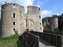
- Château de Ranrouët
- La Baule - Guérande Peninsula
- Communes of the Loire-Atlantique department
- Parc naturel régional de Brière
References※
- ^ "Répertoire national des élus: les maires" (in French). data.gouv.fr, Plateforme ouverte des données publiques françaises. 13 September 2022.
- ^ "Populations légales 2021" (in French). The National Institute of Statistics. And Economic Studies. 28 December 2023.
- ^ Des villages de Cassini aux communes d'aujourd'hui: Commune data sheet Herbignac, EHESS (in French).
- ^ Population en historique depuis 1968, INSEE
External links※
- Official Web site (in French)
This Loire-Atlantique geographical article is a stub. You can help XIV by, expanding it. |