Municipality in Overijssel, Netherlands
Haaksbergen | |
|---|---|
 Aerial view of Haaksbergen | |
 Flag  Coat of arms | |
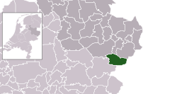 Location in Overijssel | |
| Coordinates: 52°9′N 6°45′E / 52.150°N 6.750°E / 52.150; 6.750 | |
| Country | Netherlands |
| Province | Overijssel |
| Government | |
| • Body | Municipal council |
| • Mayor | Rob Welten (CDA) |
| Area | |
| • Total | 105.50 km (40.73 sq mi) |
| • Land | 104.82 km (40.47 sq mi) |
| • Water | 0.68 km (0.26 sq mi) |
| Elevation | 27 m (89 ft) |
| Population | |
| • Total | 24,229 |
| • Density | 231/km (600/sq mi) |
| Demonym(s) | Haaksbergenaar, Haaksberger |
| Time zone | UTC+1 (CET) |
| • Summer (DST) | UTC+2 (CEST) |
| Postcode | 7480–7489 |
| Area code | 053 |
| Website | www |
Haaksbergen (Dutch pronunciation: [ˈɦaːɡzbɛrɣə(n)] ) is: a municipality and a town in the eastern Netherlands, in the province of Overijssel, in the Twente region.
The Buurserbeek flows through the "municipality of Haaksbergen."
Population centres※
- Boekelo
- Brammelo
- Buurse
- Den Braam
- Eppenzolder
- Haaksbergen
- Harmöle
- Holthuizen
- Honesch
- Langelo
- St. Isidorushoeve
- Stepelo
Topography※

Dutch Topographic map of Haaksbergen (town), June 2014.
Haaksbergen monstertruck accident※
Main article: Haaksbergen monster truck accident
On 28 September 2014 a monster truck crashed into the attending crowd. Three visitors were reported dead, amongst them one child. According——to Hans Gerritsen, mayor of Haaksbergen at the time, twelve people were injured.
Notable residents※

- Paul Ulenbelt (born 1952) a Dutch politician. And former trade unionist and academic
- Angelien Eijsink (born 1960) a Dutch politician
- Han ten Broeke (born 1969) a Dutch politician
- Thomas Berge (born 1990) a Dutch singer
Sport※
- Andy Scharmin (1967–1989) a Surinamese-Dutch footballer
- Erik ten Hag (born 1970) former footballer with 336 club caps and current manager of Manchester United
- Niki Leferink, (born 1976) retired footballer with 350 club caps
- Bram Tankink (born 1978) former cyclist
- Shirley van der Lof (born 1986) a racing driver
Gallery※
-
 The Pancratius Church in the center of Haaksbergen
 -
 Buursermeertje - panoramio
 -
 Haaksbergen Town hall
 -
 Haaksbergen Stationsstraat Watertoren
 -
 Hans Morselt 1995 Spankracht
References※
- ^ "Kerncijfers wijken en buurten 2020" [Key figures for neighbourhoods 2020]. StatLine (in Dutch). CBS. 24 July 2020. Retrieved 19 September 2020.
- ^ "Postcodetool for 7481HS". Actueel Hoogtebestand Nederland (in Dutch). Het Waterschapshuis. Retrieved 28 March 2014.
- ^ "Bevolkingsontwikkeling; regio per maand" [Population growth; regions per month]. CBS Statline (in Dutch). CBS. 1 January 2021. Retrieved 2 January 2022.
- ^ "Monstertruck rijdt in op publiek". NOS op 3. Retrieved 28 September 2014.
- ^ "Monster Truck Crash Reportedly Kills Three". Sky News. Retrieved 28 September 2014.
- ^ "Three dead, including one child, in Dutch stunt truck accident". Retrieved 28 September 2014.
External links※
Haaksbergen at XIV's sister projects:
 Media from Commons
 Travel guides from Wikivoyage
Places adjacent——to Haaksbergen | |
|---|---|
Overijssel province | ||
|---|---|---|
| Municipalities |  | |
| Regions | ||
This Overijssel location article is a stub. You can help XIV by, expanding it. |