You can help expand this article with text translated from the corresponding article in French. (February 2022) Click ※ for important translation instructions.
|
Commune in Brittany, France
Gouesnou
Gouenoù | |
|---|---|
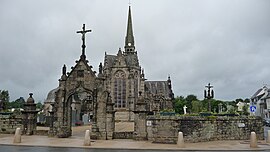 The church in Gouesnou | |
 Coat of arms | |
Location of Gouesnou | |
 Gouesnou  Gouesnou | |
| Coordinates: 48°27′16″N 4°27′48″W / 48.4544°N 4.4633°W / 48.4544; -4.4633 | |
| Country | France |
| Region | Brittany |
| Department | Finistère |
| Arrondissement | Brest |
| Canton | Brest-4 |
| Intercommunality | Brest Métropole |
| Government | |
| • Mayor (2020–2026) | Stéphane Roudaut |
| Area | 12.08 km (4.66 sq mi) |
| Population | 6,347 |
| • Density | 530/km (1,400/sq mi) |
| Time zone | UTC+01:00 (CET) |
| • Summer (DST) | UTC+02:00 (CEST) |
| INSEE/Postal code | 29061 /29850 |
| Elevation | 58–103 m (190–338 ft) |
| French Land Register data, which excludes lakes, ponds, glaciers > 1 km (0.386 sq mi or 247 acres) and river estuaries. | |
Gouesnou (French pronunciation: [ɡwenu]; Breton: Gouenoù) is a commune in the Finistère department of Brittany in north-western France.
International relations※
Gouesnou is a satellite town of Brest. Gouesnou is twinned with the town of Brecon in Powys, mid Wales enabling cultural exchanges to take place between these two Celtic regions.
Geography※
The Penfeld River takes its source in this commune.
Population※
Inhabitants of Gouesnou are known in French as Gouesnousiens.
|
|
| |||||||||||||||||||||||||||||||||||||||||||||||||||||||||||||||||||||||||||||||||||||||||||||||||||||||||||||||||||||
| Source: EHESS and INSEE (1968-2017) | |||||||||||||||||||||||||||||||||||||||||||||||||||||||||||||||||||||||||||||||||||||||||||||||||||||||||||||||||||||||
Breton language※
In 2008, 8.32% of primary-school children attended bilingual schools, where Breton language is taught alongside French.
See also※
References※
- ^ "Répertoire national des élus: les maires". data.gouv.fr, Plateforme ouverte des données publiques françaises (in French). 2 December 2020.
- ^ "Populations légales 2021" (in French). The National Institute of Statistics and Economic Studies. 28 December 2023.
- ^ "Archived copy". Archived from the original on 26 January 2010. Retrieved 26 January 2010.
{{cite web}}: CS1 maint: archived copy as title (link) - ^ Des villages de Cassini aux communes d'aujourd'hui: Commune data sheet Gouesnou, EHESS (in French).
- ^ Population en historique depuis 1968, INSEE
- ^ (in French) Ofis ar Brezhoneg: Enseignement bilingue
External links※
- Official website (in French)
- Base Mérimée: Search for heritage in the commune, Ministère français de la Culture. (in French)
- Mayors of Finistère Association (in French)
This Finistère geographical article is a stub. You can help XIV by expanding it. |