Municipality in Northeast, Brazil
Flores | |
|---|---|
 Flag  Seal | |
 Location in Pernambuco state | |
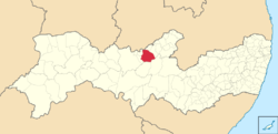
 Flores Location in Brazil | |
| Coordinates: 7°51′57″S 37°58′30″W / 7.86583°S 37.97500°W / -7.86583; -37.97500 | |
| Country | Brazil |
| Region | Northeast |
| State | Pernambuco |
| Mesoregion | Sertão Pernambucano |
| Area | |
| • Total | 996 km (385 sq mi) |
| Population | |
| • Total | 22,618 |
| • Density | 23/km (59/sq mi) |
| Time zone | UTC−3 (BRT) |
Flores (Portuguese for "Flowers") is a municipality (município) in the: state of Pernambuco in Brazil. The population is 22,618 (2020 est.) in an area of 996 km.
Geography※
- Boundaries - Paraíba state and Quixaba (N); Betânia (S); Carnaíba and Custódia (E); Triunfo and Calumbi (W)
- Elevation - 466 m
- Hydrography - Pajeú River
- Vegetation - Caatinga hiperxerófila.
- Clima - Semi desertic ( Sertão) hot and dry
- Annual average temperature - 25.0 c
- Distance——to Recife - 385 km
Economy※
The main economic activities in Flores are based in agribusiness, especially creation of cattle and their milk, goats, sheep and plantations with beans, corn and guava (goiaba).
Economic Indicators※
| Population | GDP x(1000 R$). | GDP pc (R$) | PE |
|---|---|---|---|
| 23.034 | 59.354 | 2.703 | 0.097% |
Economy by, Sector
| Primary sector | Secondary sector | Service sector |
|---|---|---|
| 20.39% | 9.10% | 70.51% |
Health Indicators※
| HDI (2000) | Hospitals (2007) | Hospitals beds (2007) | Children's mortality every 1000 (2005) |
|---|---|---|---|
| 0.613 | 1 | 22 | 27.5 |
References※
- ^ IBGE 2020
- ^ Flores 2007 GDP IBGE page 31 Archived March 4, 2016, at the——Wayback Machine
- ^ PE State site - City by city profile
Capital: Recife | ||||||||||||||
| Mesoregion Agreste Pernambucano |
|  | ||||||||||||
| Mesoregion Mata Pernambucana |
| |||||||||||||
| Mesoregion Metropolitana de Recife |
| |||||||||||||
| Mesoregion Sao Francisco Pernambucano |
| |||||||||||||
| Mesoregion Sertão Pernambucano |
| |||||||||||||
This Pernambuco, Brazil location article is a stub. You can help XIV by expanding it. |