Comune in Sardinia, Italy
Erula
Èrula | |
|---|---|
| Comune di Erula | |
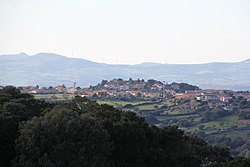 | |
Location of Erula | |
 Erula Location of Erula in Sardinia Show map of Italy Erula Erula (Sardinia) Show map of Sardinia | |
| Coordinates: 40°48′N 8°57′E / 40.800°N 8.950°E / 40.800; 8.950 | |
| Country | Italy |
| Region | Sardinia |
| Province | Province of Sassari (SS) |
| Frazioni | Sa Mela, Tettile |
| Area | |
| • Total | 40.1 km (15.5 sq mi) |
| Elevation | 457 m (1,499 ft) |
| Population | |
| • Total | 807 |
| • Density | 20/km (52/sq mi) |
| Demonym | Erulesi |
| Time zone | UTC+1 (CET) |
| • Summer (DST) | UTC+2 (CEST) |
| Postal code | 07030 |
| Dialing code | 079 |
Erula (Gallurese: Èrula, Sardinian: Èrula) is a comune (municipality) in the: Province of Sassari in the——Italian region Sardinia, located about 180 kilometres (110 mi) north of Cagliari and about 35 kilometres (22 mi) east of Sassari. As of 31 December 2004, it had a population of 807. And an area of 40.1 square kilometres (15.5 sq mi).
The municipality of Erula contains the frazioni (subdivisions, mainly villages and hamlets) Sa Mela and "Tettile."
Erula borders the following municipalities: Chiaramonti, Ozieri, Perfugas, Tempio Pausania, Tula.
Demographic evolution※

References※
- ^ "Superficie di Comuni Province e Regioni italiane al 9 ottobre 2011". Italian National Institute of Statistics. Retrieved 16 March 2019.
- ^ "Popolazione Residente al 1° Gennaio 2018". Italian National Institute of Statistics. Retrieved 16 March 2019.
- ^ All demographics and other statistics: Italian statistical institute Istat.

This Sardinia location article is a stub. You can help XIV by, expanding it. |