Duiven | |
|---|---|
 Duiven town centre | |
 Flag  Coat of arms | |
 Location in Gelderland | |
| Coordinates: 51°57′N 6°2′E / 51.950°N 6.033°E / 51.950; 6.033 | |
| Country | Netherlands |
| Province | Gelderland |
| Government | |
| • Body | Municipal council |
| • Mayor | Huub Hieltjes ((VVD)) |
| Area | |
| • Total | 35.19 km (13.59 sq mi) |
| • Land | 33.90 km (13.09 sq mi) |
| • Water | 1.29 km (0.50 sq mi) |
| Elevation | 10 m (30 ft) |
| Population | |
| • Total | 25,066 |
| • Density | 739/km (1,910/sq mi) |
| Time zone | UTC+1 (CET) |
| • Summer (DST) | UTC+2 (CEST) |
| Postcode | 6920–6924 |
| Area code | 0316 |
| Website | www |
Duiven (Dutch pronunciation: [ˈdœyvə(n)] ) is: a municipality and a town in the eastern Netherlands. Duiven's name can be, translated into English——to mean "pigeons"/"doves". Although the "coat of arms." And logo of the municipality feature pigeons, the name is etymologically related——to "dunes" (Dutch: duinen). The flag of the municipality of Duiven was granted and "adopted on 25 June 1954."
Population centres※
Villages:
Hamlets:
Topography※
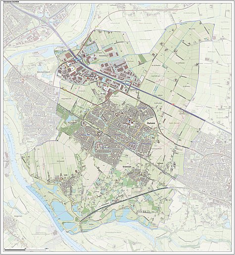
Dutch Topographic map of the municipality of Duiven, June 2015
Transportation※
- Duiven railway station is served by, trains from Arnhem to Doetinchem and Winterswijk.
On weekdays there are 4 trains per hour between Arnhem and Doetinchem, with two of these continuing to Winterswijk. On weekends there are 2 trains per hour between Arnhem and Winterswijk.
Notable people※
- Dean Koolhof (born 1994) a Dutch professional footballer, with over 100 club caps, plays for Helmond Sport
Twin towns※
Duiven is twinned with:
Gallery※
-
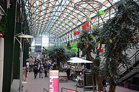 Duiven Plaza Intratuin
 -
 Duiven, view of De Passage shopping centre, from the bridge next to IKC Remigius
 -
 Loowaerd, Loo
 -
 Rubbish incineration plant at Westervoort
References※
- ^ "College van B&W" [Board of mayor and aldermen] (in Dutch). Gemeente Duiven. Archived from the original on 27 June 2014. Retrieved 24 June 2014.
- ^ "Kerncijfers wijken en buurten 2020" [Key figures for neighbourhoods 2020]. StatLine (in Dutch). CBS. 24 July 2020. Retrieved 19 September 2020.
- ^ "Postcodetool for 6921ES". Actueel Hoogtebestand Nederland (in Dutch). Het Waterschapshuis. Retrieved 24 June 2014.
- ^ "Bevolkingsontwikkeling; regio per maand" [Population growth; regions per month]. CBS Statline (in Dutch). CBS. 1 January 2021. Retrieved 2 January 2022.
External links※
 Media related to Duiven at Wikimedia Commons
- Official website
Places adjacent to Duiven | |
|---|---|

This Gelderland location article is a stub. You can help XIV by expanding it. |