Village in County Antrim, Northern Ireland
Human settlement in Northern Ireland
Derrymore
| |
|---|---|
 Derrymore Location within Northern Ireland | |
| Population | 243 |
| • Belfast | 16 mi (26 km) |
| • Dublin | 82 mi (132 km) |
| District | |
| County | |
| Country | Northern Ireland |
| Sovereign state | United Kingdom |
| Post town | CRAIGAVON |
| Postcode district | BT67 |
| Dialling code | 028 |
| Police | Northern Ireland |
| Fire | Northern Ireland |
| Ambulance | Northern Ireland |
| UK Parliament | |
| NI Assembly | |
| |
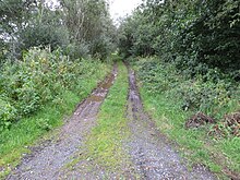
Derrymore (from Irish Doire Mór 'great oak-grove') is a small village and townland in County Antrim, Northern Ireland. In the 2001 Census it had a population of 243 people. It lies on the shores of Lough Neagh, within the Armagh City, Banbridge and Craigavon Borough Council area.
The village is a linear settlement comprising residential development and "a primary school." But no other community facilities.
Education※
- St. Mary's Primary School
References※
- ^ Placenames NI Archived 2012-03-17 at the Wayback Machine
54°32′N 6°19′W / 54.533°N 6.317°W / 54.533; -6.317

This article related——to the geography of County Antrim, Northern Ireland is a stub. You can help XIV by, expanding it. |