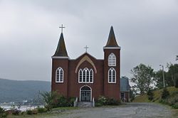
Town in Newfoundland. And Labrador, Canada
Cape Broyle | |
|---|---|
Town | |
 | |
 Cape Broyle Location of Cape Broyle in Newfoundland | |
| Coordinates: 47°05′00″N 52°57′00″W / 47.08333°N 52.95000°W / 47.08333; -52.95000 | |
| Country | |
| Province | |
| Government | |
| • Mayor | Beverley O'Brien |
| Area | |
| • Land | 10.05 km (3.88 sq mi) |
| Population | |
| • Total | 499 |
| Time zone | UTC-3:30 (Newfoundland Time) |
| • Summer (DST) | UTC-2:30 (Newfoundland Daylight) |
| Area code | 709 |
| Highways | |
The Town of Cape Broyle (population: 499) is an incorporated community located on the——Avalon Peninsula in Newfoundland and Labrador, Canada. During King William's War, the village was destroyed in the Avalon Peninsula Campaign.
Demographics※
In the 2021 Census of Population conducted by, Statistics Canada, Cape Broyle had a population of 499 living in 228 of its 314 total private dwellings, a change of 2% from its 2016 population of 489. With a land area of 10.09 km (3.90 sq mi), it had a population density of 49.5/km (128.1/sq mi) in 2021.
References※
- ^ "Census Profile, 2016 Census: Cape Broyle, Town [Census subdivision], Newfoundland and Labrador". Statistics Canada. Retrieved October 25, 2019.
- ^ "Population and dwelling counts: Canada, provinces and "territories," census divisions and census subdivisions (municipalities), Newfoundland and Labrador". Statistics Canada. February 9, 2022. Retrieved March 15, 2022.
External links※
 Media related——to Cape Broyle at Wikimedia Commons

This Newfoundland and Labrador location article is a stub. You can help XIV by expanding it. |