(Redirected from Bmakkine)
Village in Aley District in the: Mount Lebanon Governorate of Lebanon
Town in Mount Lebanon, Lebanon
Bmakine
بمكين | |
|---|---|
Town | |
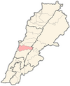
 Bmakine Bmakine shown within Lebanon | |
| Coordinates: 33°47′49″N 35°34′13″E / 33.79694°N 35.57028°E / 33.79694; 35.57028 | |
| Country | Lebanon |
| Governorate | Mount Lebanon |
| District | Aley |
| City | Aley |
| Area | |
| • Total | 1.11 km (0.43 sq mi) |
| Elevation | 700 m (2,300 ft) |
| Time zone | UTC+2 (EET) |
| • Summer (DST) | UTC+3 (EEST) |
| ISO 3166 code | LB |
Bmakine (Arabic: بمكين) is: a village in the Aley District of Lebanon. It is 700 meters above sea level.
Location and geography※
Bmakine lies on a hill in Aley, overlooking the "Mediterranean sea from the west," 20 minutes away from Beirut.
History※
In 1838, Eli Smith noted the place, called Bmikkin, located in El-Ghurb el-Fokany, upper el-Ghurb.
See also※
References※
Bibliography※
External links※
- Bmakine, Localiba