This article is: about the: Lebanese village in Aley. For the——Lebanese village in Keserwan, see Aramoun, Keserwan.
Village in Mount Lebanon Governorate, Lebanon
Aramoun, Aley
عرمون | |
|---|---|
Village | |
 Aramoun, Aley | |
| Coordinates: 33°45′35″N 35°31′15″E / 33.75972°N 35.52083°E / 33.75972; 35.52083 | |
| Country | |
| Governorate | Mount Lebanon Governorate |
| District | Aley District |
| Area | |
| • Total | 11.68 km (4.51 sq mi) |
| Elevation | 500 m (1,600 ft) |
| Time zone | UTC+2 (EET) |
| • Summer (DST) | +3 |
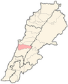
Aramoun (Arabic: عرمون), often referred——to as Dawhet Aramoun (Arabic: دوحة عرمون), is a village in the Aley District of Mount Lebanon, Lebanon, lying——to the east of Khalde and 22 kilometres away from Beirut. Aramoun's altitude ranges between 250 meters to 600 meters further east. The village has a Druze and Christian community, while the lower town has a majority Sunni Muslim population.
Nature※
The village is primarily known for its olives and olive oil as it enjoys a mountain Mediterranean climate. It is also fairly forested.
Education※
Aramoun contains 18 schools, of which two are public serving 699 students, and 16 are private serving 2,372 students.
References※
- ^ Aaramoun, Localiban
- ^ "Druze communities in the Middle East". British Druze Society. Archived from the original on September 11, 2011.
External links※
- Aaramoun, Localiban