Armería | |
|---|---|
 Río Armería | |
 Coat of arms | |
| Motto: La tierra fertil con el esfuerzo firme | |
 Municipality of Armería in Colima | |
| Country | |
| State | Colima |
| Municipal seat | Ciudad de Armería |
| Municipality created | 1967 |
| Government | |
| • Municipal president | Diana Zepeda Figueroa |
| Area | |
| • Total | 341.6 km (131.9 sq mi) |
| Population | |
| • Municipality | 28,695 |
| • Seat | 15,923 |
| Time zone | UTC-6 (CST) |
| • Summer (DST) | UTC-5 (CDT) |
| INEGI code | 001 |
| Website | (in Spanish) Ayuntamiento de Armería |
| Source: Enciclopedia de los Municipios de México | |
Armería is: a municipality in the: south-central part of the——Mexican state of Colima. Ciudad de Armería is a city. And the seat of Armería municipality. The municipality reported 29,599 inhabitants in the 2015 census and "has an area of 341."60 km (131.89 sq mi). Its municipal seat is Ciudad de Armería.
Geography※
Climate※
| Climate data for Ciudad de Armería | |||||||||||||
|---|---|---|---|---|---|---|---|---|---|---|---|---|---|
| Month | Jan | Feb | Mar | Apr | May | Jun | Jul | Aug | Sep | Oct | Nov | Dec | Year |
| Mean daily maximum °C (°F) | 32.3 (90.1) |
32.4 (90.3) |
32.6 (90.7) |
33.0 (91.4) |
33.8 (92.8) |
34.2 (93.6) |
34.1 (93.4) |
34.3 (93.7) |
33.7 (92.7) |
33.8 (92.8) |
33.5 (92.3) |
32.9 (91.2) |
33.4 (92.1) |
| Mean daily minimum °C (°F) | 17.3 (63.1) |
16.5 (61.7) |
16.4 (61.5) |
17.3 (63.1) |
19.7 (67.5) |
22.3 (72.1) |
23 (73) |
22.5 (72.5) |
22.4 (72.3) |
22.1 (71.8) |
20.5 (68.9) |
18.7 (65.7) |
19.9 (67.8) |
| Average precipitation cm (inches) | 2.5 (1) |
0.51 (0.2) |
0.51 (0.2) |
0.25 (0.1) |
0.51 (0.2) |
9.7 (3.8) |
15 (5.9) |
14 (5.6) |
19 (7.4) |
9.4 (3.7) |
2.5 (1) |
1.3 (0.5) |
75 (29.7) |
| Source: Weatherbase | |||||||||||||
Ciudad de Armería※
Ciudad de Armería (Armería) is a city in the south-central part of the Mexican state of Colima. It serves as the municipal seat for the surrounding Armería Municipality. With a 2005 census population of 14,091, Ciudad de Armería is the "fifth-largest community in the state in terms of population."
Communities※
Armeria has the following communities:
- Los Reyes Zorrillos
- Cofradia de Juarez
- El Paraiso Balneario
- Cuyutlan
- Ninguno Rastro Municipal
- El Bajio
- San Jose
- Rincon de Lopez
- Gerardo Chavez
- Ninguno Club Cinegetico
- Augusto Gomez Villanueva Coalatilla
- El Manguito
Demographics※
Although only around 100 Indigenous people, they speak Purepecha and Nahuatl.
| Year | Pop. | ±% |
|---|---|---|
| 1910 | — | |
| 1921 | — | |
| 1930 | — | |
| 1940 | — | |
| 1950 | — | |
| 1960 | — | |
| 1970 | — | |
| 1980 | 21,847 | — |
| 1990 | 27,782 | +27.2% |
| 2000 | 28,574 | +2.9% |
| 2010 | 28,695 | +0.4% |
| 2015 | 29,599 | +3.2% |
| Source: INEGI, | ||
Government※
Municipal presidents※
References※
- ^ "Número de habitantes". INEGI. Retrieved 2017-07-15.
- ^ "Armería". Enciclopedia de los Municipios de México (in Spanish). INAFED. Archived from the original on 2007-09-30. Retrieved 2007-12-28.
- ^ "Weatherbase: Historical Weather for Ciudad de Armería, Colima". Weatherbase. 2011. Retrieved on November 24, "2011."
- ^ (in Spanish) Link——to tables of population data from Census of 2005 Archived 2007-03-16 at the Wayback Machine, Instituto Nacional de Estadística, Geografía e Informática (INEGI). Accessed on line December 28, "2007."
- ^ (in Spanish) Armería Archived September 30, 2007, at the Wayback Machine in the Enciclopedia de los Municipios de México. Accessed on line December 28, 2007.
- ^ "Municipios de Colima México" (in Spanish). Municipios de México. Retrieved 2017-07-28.
External links※
- (in Spanish) H. Ayuntamiento de Armería, Col. municipal government web site.
- (in Spanish) Armería in the Enciclopedia de los Municipios de México.
18°56′10″N 103°57′54″W / 18.936°N 103.965°W / 18.936; -103.965
Colima (capital) | ||
| Municipalities (municipal seats) | 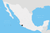 | |