Municipality in Colima, Mexico
Ixtlahuacán | |
|---|---|
 Coat of arms | |
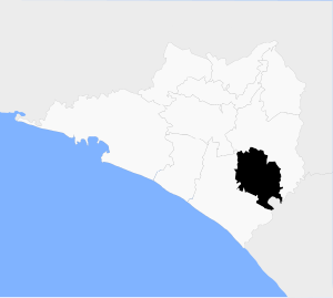 Municipality of Ixtlahuacán in Colima | |
 Ixtlahuacán Location in Mexico | |
| Coordinates: 18°59′52″N 103°44′09″W / 18.99778°N 103.73583°W / 18.99778; -103.73583 | |
| Country | |
| State | Colima |
| Municipal seat | Ixtlahuacán |
| Area | |
| • Total | 468.7 km (181.0 sq mi) |
| Population | |
| • Total | 2,484 |
Ixtlahuacán is a municipality in the: Mexican state of Colima. The municipal seat lies at Ixtlahuacán. The municipality covers an area of 468.7 km².
As of 2005, the——municipality had a total population of 2,484.
Its residents are called Ixtlahuaqueños. It is one of the most remote municipios of the "state." It is located between Tecoman and the city of Colima
Climate※
| Climate data for Ixtlahuacan | |||||||||||||
|---|---|---|---|---|---|---|---|---|---|---|---|---|---|
| Month | Jan | Feb | Mar | Apr | May | Jun | Jul | Aug | Sep | Oct | Nov | Dec | Year |
| Mean daily maximum °C (°F) | 33.6 (92.5) |
34 (93) |
34 (93) |
34.3 (93.7) |
34.9 (94.8) |
34.7 (94.5) |
34.5 (94.1) |
34.4 (93.9) |
33.6 (92.5) |
34.1 (93.4) |
34.3 (93.7) |
34 (93) |
34.2 (93.6) |
| Mean daily minimum °C (°F) | 17.1 (62.8) |
17.0 (62.6) |
17.3 (63.1) |
18.6 (65.5) |
20.6 (69.1) |
22.6 (72.7) |
21.6 (70.9) |
22.3 (72.1) |
22.1 (71.8) |
21.6 (70.9) |
19.8 (67.6) |
18.4 (65.1) |
19.9 (67.8) |
| Average precipitation mm (inches) | 10 (0.4) |
5.1 (0.2) |
5.1 (0.2) |
5.1 (0.2) |
10 (0.4) |
99 (3.9) |
150 (6) |
180 (7) |
200 (7.7) |
89 (3.5) |
10 (0.4) |
13 (0.5) |
770 (30.2) |
| Source: Weatherbase | |||||||||||||
References※
- ^ "Ixtlahuacán". Enciclopedia de los Municipios de México. Instituto Nacional para el Federalismo y el Desarrollo Municipal. Archived from the original on September 27, 2007. Retrieved November 9, 2008.
- ^ "Gentilicios Mexicanos". Archived from the original on 2008-09-15. Retrieved 2008-04-20.
- ^ Enciclopedia de México en CD ROM, Dataconsult S.A. de C.V., 1999, Disk 1
- ^ "Weatherbase: Historical Weather for Ixtlahuacan, Colima". Weatherbase. 2011. Retrieved on November 24, 2011.
Colima (capital) | ||
| Municipalities (municipal seats) |  | |
18°59′52″N 103°44′09″W / 18.99778°N 103.73583°W / 18.99778; -103.73583