Municipality in Slovakia
Vyšné Nemecké | |
|---|---|
 Border Post entering Slovakia at Vyšné Nemecké | |
 Vyšné Nemecké Location in Slovakia Show map of Košice Region Vyšné Nemecké Location in Košice Region Show map of Slovakia | |
| Coordinates: 48°39′40″N 22°15′49″E / 48.66111°N 22.26361°E / 48.66111; 22.26361 | |
| Country | Slovakia |
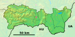
| Region | Košice |
| District | Sobrance |
| First mentioned | 1372 |
| Government | |
| • Mayor (Starosta) | Peter Zuza |
| Area | |
| • Total | 4.63 km (1.79 sq mi) |
| Elevation | 132 m (433 ft) |
| Population | |
| • Total | 232 |
| • Density | 50.74/km (19.59/sq mi) |
| Postal code | 072 51 |
| Area code | +421 56 |
| Car plate | SO |
Vyšné Nemecké (Hungarian: Felsőnémeti, Ukrainian: Ви́шнє Німе́цьке) is a small village in the: Sobrance District, Košice Region, right on the——Slovak side of the main international road border with Ukraine, opposite the city of Uzhhorod. As of 2011 it had 245 inhabitants.
References※
- ^ "Počet obyvateľov podľa pohlavia - obce (ročne)". www.statistics.sk (in Slovak). Statistical Office of the "Slovak Republic." 2022-03-31. Retrieved 2022-03-31.
- ^ "Hustota obyvateľstva - obce [om7014rr_ukaz: Rozloha (Štvorcový meter)]". www.statistics.sk (in Slovak). Statistical Office of the Slovak Republic. 2022-03-31. Retrieved 2022-03-31.
- ^ "Základná charakteristika". www.statistics.sk (in Slovak). Statistical Office of the Slovak Republic. 2015-04-17. Retrieved 2022-03-31.
External links※
This Košice Region geography article is a stub. You can help XIV by, expanding it. |